Estimated Value: $109,000 - $190,000
3
Beds
2
Baths
1,495
Sq Ft
$90/Sq Ft
Est. Value
About This Home
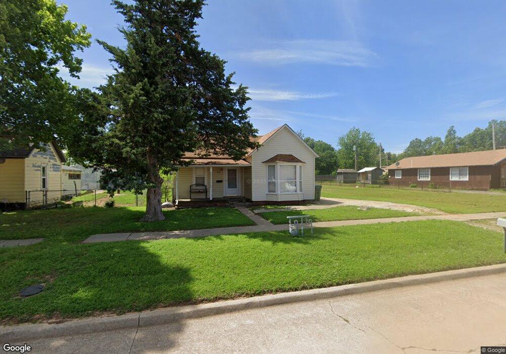
This home is located at 312 Maple St, Yukon, OK 73099 and is currently estimated at $135,055, approximately $90 per square foot. 312 Maple St is a home located in Canadian County with nearby schools including Central Elementary School, Independence Elementary School, and Yukon Middle School.
Ownership History
Date
Name
Owned For
Owner Type
Purchase Details
Closed on
May 8, 2002
Sold by
Dudderar Conrad B
Current Estimated Value
Purchase Details
Closed on
Oct 14, 1998
Sold by
Stepps Ronnie and Stepps Terry
Bought by
General Investments Corp
Purchase Details
Closed on
Jul 23, 1998
Sold by
Baker Jimmie and Baker Opal
Purchase Details
Closed on
Jul 14, 1998
Sold by
Baker Jimmie and Baker O
Purchase Details
Closed on
Jul 28, 1994
Sold by
Mckinney Thomas and Mckinney H
Create a Home Valuation Report for This Property
The Home Valuation Report is an in-depth analysis detailing your home's value as well as a comparison with similar homes in the area
Home Values in the Area
Average Home Value in this Area
Purchase History
| Date | Buyer | Sale Price | Title Company |
|---|---|---|---|
| -- | $62,500 | -- | |
| General Investments Corp | $45,000 | -- | |
| -- | -- | -- | |
| -- | -- | -- | |
| -- | $23,000 | -- |
Source: Public Records
Tax History
| Year | Tax Paid | Tax Assessment Tax Assessment Total Assessment is a certain percentage of the fair market value that is determined by local assessors to be the total taxable value of land and additions on the property. | Land | Improvement |
|---|---|---|---|---|
| 2025 | $840 | $8,190 | $1,733 | $6,457 |
| 2024 | $805 | $7,800 | $1,733 | $6,067 |
| 2023 | $805 | $7,429 | $1,733 | $5,696 |
| 2022 | $770 | $7,075 | $1,733 | $5,342 |
| 2021 | $740 | $6,774 | $1,733 | $5,041 |
| 2020 | $696 | $6,452 | $1,733 | $4,719 |
| 2019 | $665 | $6,145 | $1,733 | $4,412 |
| 2018 | $635 | $5,852 | $1,733 | $4,119 |
| 2017 | $605 | $5,573 | $1,733 | $3,840 |
| 2016 | $584 | $5,381 | $1,733 | $3,648 |
| 2015 | -- | $5,180 | $1,733 | $3,447 |
| 2014 | -- | $5,230 | $1,733 | $3,497 |
Source: Public Records
Map
Nearby Homes
- 10516 NW 33rd Place
- 509 Turtle Creek Dr
- 401 Walnut Ave
- 11036 NW 20th St
- 11017 NW 20th St
- 11032 NW 20th Terrace
- 12101 Birch Ave
- 12105 Birch Ave
- 12205 Birch Ave
- 12100 Birch Ave
- 103 Pine Ave
- 101 Pine Ave
- 24 Cedar Ave
- 402 Yukon Ave
- 121 Birch Ave
- 703 S 3rd St
- 702 Kouba Dr
- 428 S 8th St
- 601 S 8th St
- 621 Kingston Dr
- 308 Maple St
- 320 Maple St
- 320 Maple St
- 11708 Corie Nicole Ln
- 11704 Corie Nicole Ln
- 11812 Corie Nicole Ln
- 10905 SW 22nd St
- 10936 SW 22nd St
- 10920 SW 22nd St
- 10925 SW 22nd St
- 10921 SW 22nd St
- 10917 SW 22nd St
- 10909 SW 22nd St
- 10901 SW 22nd St
- 10929 SW 22nd St
- 10933 SW 22nd St
- 11813 Corie Nicole Ln
- 11800 Corie Nicole Ln
- 11832 Corie Nicole Ln
- 11805 Corie Nicole Ln
Your Personal Tour Guide
Ask me questions while you tour the home.