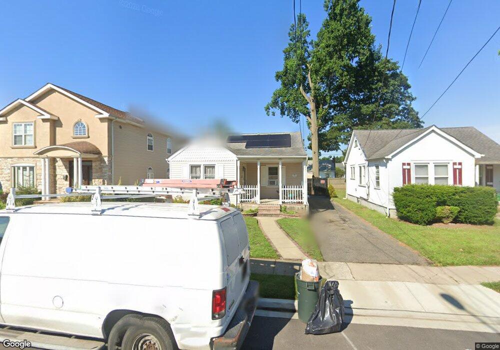
312 Maplegrove Ave Uniondale, NY 11553
Estimated Value: $512,336 - $558,000
2
Beds
1
Bath
859
Sq Ft
$623/Sq Ft
Est. Value
About This Home
This home is located at 312 Maplegrove Ave, Uniondale, NY 11553 and is currently estimated at $535,168, approximately $623 per square foot. 312 Maplegrove Ave is a home located in Nassau County with nearby schools including Walnut Street Elementary School, Turtle Hook Middle School, and Uniondale High School.
Ownership History
Date
Name
Owned For
Owner Type
Purchase Details
Closed on
Jun 16, 2003
Sold by
Mcdougle Carlton
Bought by
Arias Manuel
Current Estimated Value
Purchase Details
Closed on
Jun 21, 2002
Sold by
Sparkowski Charles
Bought by
Mcdougle Carlton
Purchase Details
Closed on
Nov 7, 1995
Sold by
Courounis Glenn and Phillips William
Bought by
Sparkowski Charles and Hambrecht Kristen
Home Financials for this Owner
Home Financials are based on the most recent Mortgage that was taken out on this home.
Original Mortgage
$94,000
Interest Rate
7.53%
Create a Home Valuation Report for This Property
The Home Valuation Report is an in-depth analysis detailing your home's value as well as a comparison with similar homes in the area
Home Values in the Area
Average Home Value in this Area
Purchase History
| Date | Buyer | Sale Price | Title Company |
|---|---|---|---|
| Arias Manuel | $205,000 | -- | |
| Mcdougle Carlton | $185,000 | -- | |
| Sparkowski Charles | $102,000 | -- |
Source: Public Records
Mortgage History
| Date | Status | Borrower | Loan Amount |
|---|---|---|---|
| Previous Owner | Sparkowski Charles | $94,000 |
Source: Public Records
Tax History Compared to Growth
Tax History
| Year | Tax Paid | Tax Assessment Tax Assessment Total Assessment is a certain percentage of the fair market value that is determined by local assessors to be the total taxable value of land and additions on the property. | Land | Improvement |
|---|---|---|---|---|
| 2025 | $7,467 | $330 | $119 | $211 |
| 2024 | $2,563 | $330 | $119 | $211 |
| 2023 | $5,950 | $330 | $119 | $211 |
| 2022 | $5,950 | $330 | $119 | $211 |
| 2021 | $7,920 | $314 | $113 | $201 |
| 2020 | $6,307 | $519 | $448 | $71 |
| 2019 | $6,296 | $519 | $448 | $71 |
| 2018 | $5,944 | $519 | $0 | $0 |
| 2017 | $3,147 | $519 | $448 | $71 |
| 2016 | $5,671 | $519 | $448 | $71 |
| 2015 | $2,364 | $519 | $448 | $71 |
| 2014 | $2,364 | $519 | $448 | $71 |
| 2013 | $2,284 | $519 | $448 | $71 |
Source: Public Records
Map
Nearby Homes
- 335 Locust Ave
- 388 Maplegrove Ave
- 737 Lowell Rd
- 641 Lowell Rd
- 666 Lowell Rd
- 147 Ruxton St
- 1033 Tulsa St
- 159 Gilroy Ave
- 117 Spring Dr
- 121 Spring Dr
- 133 Spring Dr
- 727 Beck St
- 331 Spring Dr
- 383 Summer Ct Unit C383
- 103 Gilroy Ave
- 319 Spring Dr
- 315 Spring Dr
- 571 Richmond Rd
- 692 Beck St
- 1474 Stephen Marc Ln
- 316 Maplegrove Ave
- 308 Maplegrove Ave
- 320 Maplegrove Ave
- 304 Maplegrove Ave
- 313 Chester St
- 309 Chester St
- 305 Chester St
- 324 Maplegrove Ave
- 300 Maplegrove Ave
- 319 Chester St
- 301 Chester St
- 325 Chester St
- 328 Maplegrove Ave
- 311 Maplegrove Ave
- 297 Chester St
- 315 Maplegrove Ave
- 305 Maplegrove Ave
- 321 Maplegrove Ave
- 301 Maplegrove Ave
- 331 Chester St