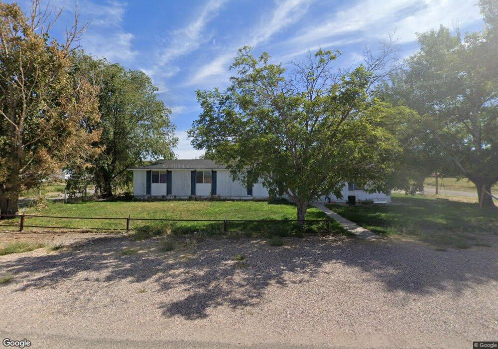
312 N 200 W Hinckley, UT 84635
Estimated Value: $289,000 - $330,000
4
Beds
2
Baths
2,737
Sq Ft
$114/Sq Ft
Est. Value
About This Home
This home is located at 312 N 200 W, Hinckley, UT 84635 and is currently estimated at $312,244, approximately $114 per square foot. 312 N 200 W is a home located in Millard County.
Ownership History
Date
Name
Owned For
Owner Type
Purchase Details
Closed on
Feb 6, 2019
Sold by
Barnes Shad E and Barnes Leila J
Bought by
Nielson Debora Kay and Nielson Rodney Kay
Current Estimated Value
Purchase Details
Closed on
May 29, 2008
Sold by
Barnes Shad E
Bought by
Barnes Shad E and Barnes Leila J
Home Financials for this Owner
Home Financials are based on the most recent Mortgage that was taken out on this home.
Original Mortgage
$133,119
Interest Rate
6.05%
Mortgage Type
Purchase Money Mortgage
Purchase Details
Closed on
May 28, 2008
Sold by
Mason Valerie P
Bought by
Barnes Shad E
Home Financials for this Owner
Home Financials are based on the most recent Mortgage that was taken out on this home.
Original Mortgage
$133,119
Interest Rate
6.05%
Mortgage Type
Purchase Money Mortgage
Purchase Details
Closed on
Jul 20, 2006
Sold by
Mason Valerie P
Bought by
Mason Valerie P
Purchase Details
Closed on
Mar 27, 2006
Sold by
Mason Valerie and Mason Valerie P
Bought by
Mason Valerie P
Home Financials for this Owner
Home Financials are based on the most recent Mortgage that was taken out on this home.
Original Mortgage
$55,000
Interest Rate
6.25%
Mortgage Type
Purchase Money Mortgage
Create a Home Valuation Report for This Property
The Home Valuation Report is an in-depth analysis detailing your home's value as well as a comparison with similar homes in the area
Home Values in the Area
Average Home Value in this Area
Purchase History
| Date | Buyer | Sale Price | Title Company |
|---|---|---|---|
| Nielson Debora Kay | -- | -- | |
| Barnes Shad E | -- | -- | |
| Barnes Shad E | -- | -- | |
| Mason Valerie P | -- | -- | |
| Mason Valerie P | -- | -- |
Source: Public Records
Mortgage History
| Date | Status | Borrower | Loan Amount |
|---|---|---|---|
| Previous Owner | Barnes Shad E | $133,119 | |
| Previous Owner | Mason Valerie P | $55,000 |
Source: Public Records
Tax History Compared to Growth
Tax History
| Year | Tax Paid | Tax Assessment Tax Assessment Total Assessment is a certain percentage of the fair market value that is determined by local assessors to be the total taxable value of land and additions on the property. | Land | Improvement |
|---|---|---|---|---|
| 2025 | $1,490 | $177,746 | $16,013 | $161,733 |
| 2024 | $1,490 | $174,874 | $6,060 | $168,814 |
| 2023 | $1,779 | $174,874 | $6,060 | $168,814 |
| 2022 | $1,208 | $102,242 | $5,509 | $96,733 |
| 2021 | $977 | $78,753 | $4,591 | $74,162 |
| 2020 | $859 | $69,326 | $4,373 | $64,953 |
| 2019 | $851 | $69,326 | $4,373 | $64,953 |
| 2018 | $830 | $69,326 | $4,373 | $64,953 |
| 2017 | $841 | $67,434 | $4,373 | $63,061 |
| 2016 | $806 | $67,434 | $4,373 | $63,061 |
| 2015 | $785 | $65,540 | $4,373 | $61,167 |
| 2014 | -- | $65,540 | $4,373 | $61,167 |
| 2013 | -- | $63,759 | $4,373 | $59,386 |
Source: Public Records
Map
Nearby Homes
- 168 N 100 Rd W
- 289 W Center St S
- 6500 W 2000 S
- 1040 W Center St
- 700 Acres
- 1500 S 10000 W
- 6000 N 10000 W
- 700 Acres Hwy 6 & Main St (Hwy 50)
- 2000 E 10500 N
- 6200 S 3000 W
- 3480 S 4000 W
- 3770 S 4000 Rd W
- 0 Tbd 3000 Rd S Unit LotWP001
- 6177 S 3000 Rd W
- 3885 W 4500 S
- 17000 W 2500 Rd S
- 16700 W 2500 South Rd
- 16800 W 2500 South Rd
- 470 S 2750 W Unit 6
- 460 S 2750 W Unit 7