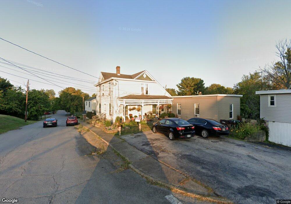
312 N High St N Georgetown, OH 45121
Estimated Value: $124,000 - $396,814
6
Beds
3
Baths
2,977
Sq Ft
$92/Sq Ft
Est. Value
About This Home
This home is located at 312 N High St N, Georgetown, OH 45121 and is currently estimated at $272,954, approximately $91 per square foot. 312 N High St N is a home with nearby schools including Georgetown Elementary School and Georgetown Jr/Sr High School.
Ownership History
Date
Name
Owned For
Owner Type
Purchase Details
Closed on
Oct 2, 1998
Sold by
Meeker Jim
Bought by
Hammons Leonard J and Hammons Tina M
Current Estimated Value
Home Financials for this Owner
Home Financials are based on the most recent Mortgage that was taken out on this home.
Original Mortgage
$105,000
Interest Rate
7.5%
Mortgage Type
New Conventional
Purchase Details
Closed on
Jun 13, 1996
Sold by
Wahl Forrest W
Bought by
Meeker Jim
Create a Home Valuation Report for This Property
The Home Valuation Report is an in-depth analysis detailing your home's value as well as a comparison with similar homes in the area
Home Values in the Area
Average Home Value in this Area
Purchase History
| Date | Buyer | Sale Price | Title Company |
|---|---|---|---|
| Hammons Leonard J | $155,000 | -- | |
| Meeker Jim | $150,000 | -- |
Source: Public Records
Mortgage History
| Date | Status | Borrower | Loan Amount |
|---|---|---|---|
| Closed | Hammons Leonard J | $105,000 |
Source: Public Records
Tax History Compared to Growth
Tax History
| Year | Tax Paid | Tax Assessment Tax Assessment Total Assessment is a certain percentage of the fair market value that is determined by local assessors to be the total taxable value of land and additions on the property. | Land | Improvement |
|---|---|---|---|---|
| 2024 | $2,593 | $71,500 | $8,900 | $62,600 |
| 2023 | $2,593 | $59,620 | $7,510 | $52,110 |
| 2022 | $2,351 | $59,620 | $7,510 | $52,110 |
| 2021 | $2,329 | $59,620 | $7,510 | $52,110 |
| 2020 | $2,061 | $49,720 | $6,290 | $43,430 |
| 2019 | $2,047 | $49,720 | $6,290 | $43,430 |
| 2018 | $2,034 | $49,720 | $6,290 | $43,430 |
| 2017 | $1,446 | $41,720 | $6,920 | $34,800 |
| 2016 | $1,445 | $41,720 | $6,920 | $34,800 |
| 2015 | $1,503 | $41,720 | $6,920 | $34,800 |
| 2014 | $1,503 | $41,090 | $6,290 | $34,800 |
| 2013 | $1,498 | $41,090 | $6,290 | $34,800 |
Source: Public Records
Map
Nearby Homes
- 102 Bill Dee Dr
- 306 W 2nd St
- 405 N Main St
- 402 S Pleasant St
- 120 N Apple St
- 409 N Main St
- 202 W 4th St
- 505 S Water St
- 414 N Water St
- 107 N Elm St
- 406 E North St
- 102 N Elm St
- 508 Mount Orab Pike
- 403 Elmwood Ct
- 401 Elmwood Ct
- 60 New St
- 331 Spring Grove Dr
- 418 Home St
- 0 St Rt 221 & Footbridge Unit 1826509
- 427 Kenwood Ave
- 101 N High St
- 102 Billdee Dr
- 103 N High St
- 106 Billdee Dr
- 105 N High St
- 303 W Grant Ave
- 309 Andrews Ave
- 304 W Cherry St
- 107 N High St
- 307 Andrews Ave
- 300 W Cherry St
- 100 S Green St
- 319 W Cherry St
- 319 W Cherry St
- 319 W Cherry St
- 311 W Cherry St
- 305 Andrews Ave
- 404 W Grant Ave
- 300 W Grant Ave
- 109 N High St