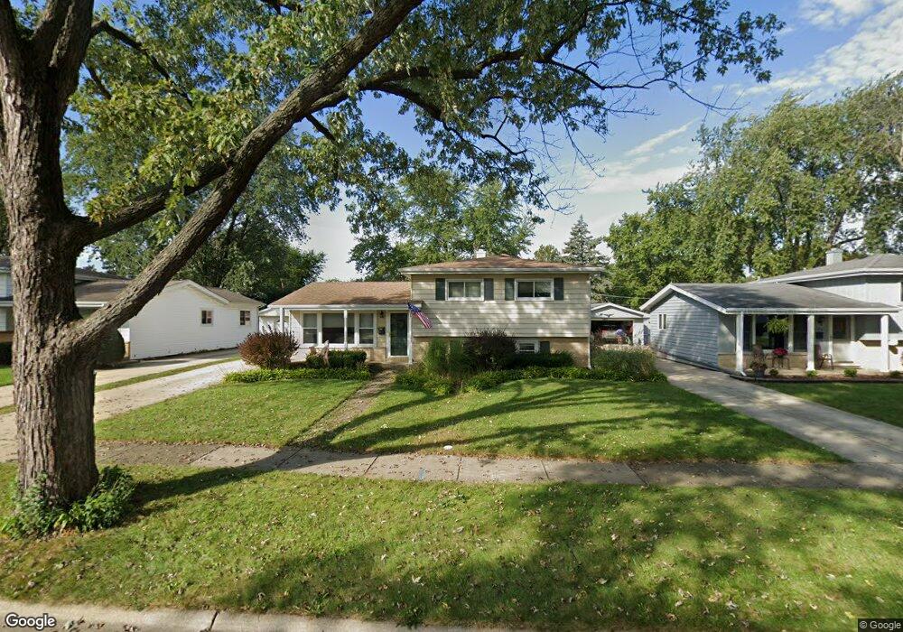
312 N Wesley Dr Addison, IL 60101
Estimated Value: $305,000 - $371,000
3
Beds
2
Baths
1,665
Sq Ft
$203/Sq Ft
Est. Value
About This Home
This home is located at 312 N Wesley Dr, Addison, IL 60101 and is currently estimated at $337,768, approximately $202 per square foot. 312 N Wesley Dr is a home located in DuPage County with nearby schools including Wesley Elementary School, Indian Trail Jr High School, and Addison Trail High School.
Ownership History
Date
Name
Owned For
Owner Type
Purchase Details
Closed on
Aug 31, 2006
Sold by
Stanley James and Stanley Nancy
Bought by
Bridgman Sherian K
Current Estimated Value
Home Financials for this Owner
Home Financials are based on the most recent Mortgage that was taken out on this home.
Original Mortgage
$240,000
Interest Rate
6.36%
Mortgage Type
Purchase Money Mortgage
Purchase Details
Closed on
Apr 27, 2001
Sold by
Albano Ignazio
Bought by
Stanley James P and Stanley Nancy A
Home Financials for this Owner
Home Financials are based on the most recent Mortgage that was taken out on this home.
Original Mortgage
$197,750
Interest Rate
6.95%
Mortgage Type
VA
Purchase Details
Closed on
Dec 23, 1994
Sold by
Jensen Earl and Jensen Charmaine A
Bought by
Albano Ignazio and Patellaro Antonio
Create a Home Valuation Report for This Property
The Home Valuation Report is an in-depth analysis detailing your home's value as well as a comparison with similar homes in the area
Home Values in the Area
Average Home Value in this Area
Purchase History
| Date | Buyer | Sale Price | Title Company |
|---|---|---|---|
| Bridgman Sherian K | $300,000 | Burnet Title | |
| Stanley James P | $192,000 | -- | |
| Albano Ignazio | $143,500 | West Counties Title Svcs Inc |
Source: Public Records
Mortgage History
| Date | Status | Borrower | Loan Amount |
|---|---|---|---|
| Previous Owner | Bridgman Sherian K | $240,000 | |
| Previous Owner | Stanley James P | $197,750 |
Source: Public Records
Tax History
| Year | Tax Paid | Tax Assessment Tax Assessment Total Assessment is a certain percentage of the fair market value that is determined by local assessors to be the total taxable value of land and additions on the property. | Land | Improvement |
|---|---|---|---|---|
| 2024 | $6,352 | $106,126 | $42,218 | $63,908 |
| 2023 | $6,004 | $97,560 | $38,810 | $58,750 |
| 2022 | $6,276 | $91,210 | $36,090 | $55,120 |
| 2021 | $6,010 | $87,370 | $34,570 | $52,800 |
| 2020 | $5,842 | $83,680 | $33,110 | $50,570 |
| 2019 | $5,798 | $80,460 | $31,840 | $48,620 |
| 2018 | $5,898 | $78,650 | $30,920 | $47,730 |
| 2017 | $5,741 | $75,170 | $29,550 | $45,620 |
| 2016 | $5,580 | $69,400 | $27,280 | $42,120 |
| 2015 | $5,432 | $64,110 | $25,200 | $38,910 |
| 2014 | $5,283 | $62,150 | $23,100 | $39,050 |
| 2013 | $5,178 | $63,420 | $23,570 | $39,850 |
Source: Public Records
Map
Nearby Homes
- 1030 W Kendall Terrace
- +/-1.51 Acres Lake St
- 1050 W Woodland Ave
- 551 N 6th Ave
- 775 W Fairway Dr
- 6219 Links Dr Unit 27001
- 6238 Links Dr Unit 4001
- 6221 Links Dr Unit 27002
- 6232 Links Dr Unit 3001
- 6220 Links Dr Unit 1001
- 4N212 8th Ave
- 737 Saint Johns Place
- 19W720 Woodland Ave
- 276 Masters Dr
- 330 Masters Dr
- Birch Plan at The Townes at Mill Creek
- Chestnut Plan at The Townes at Mill Creek
- Aspen Plan at The Townes at Mill Creek
- Willow Plan at The Townes at Mill Creek
- 253 Masters Dr
- 324 N Wesley Dr
- 296 N Wesley Dr
- 284 N Wesley Dr Unit 1
- 336 N Wesley Dr
- 297 N Pioneer Dr
- 313 N Wesley Dr
- 285 N Pioneer Dr
- 313 N Pioneer Dr
- 325 N Pioneer Dr
- 266 N Wesley Dr
- 329 N Wesley Dr
- 337 N Pioneer Dr
- 297 N Wesley Dr
- 271 N Pioneer Dr
- 285 N Wesley Dr
- 907 W Morris Ave
- 250 N Wesley Dr
- 356 N Wesley Dr
- 349 N Pioneer Dr
- 267 N Wesley Dr