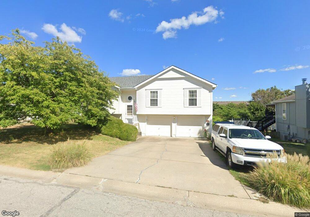
312 NE 6th St Blue Springs, MO 64014
Estimated Value: $282,000 - $310,000
3
Beds
2
Baths
1,217
Sq Ft
$242/Sq Ft
Est. Value
About This Home
This home is located at 312 NE 6th St, Blue Springs, MO 64014 and is currently estimated at $294,622, approximately $242 per square foot. 312 NE 6th St is a home located in Jackson County with nearby schools including James Walker Elementary School, Brittany Hill Middle School, and Blue Springs High School.
Ownership History
Date
Name
Owned For
Owner Type
Purchase Details
Closed on
Sep 1, 1999
Bought by
Hartsock Edwin
Current Estimated Value
Home Financials for this Owner
Home Financials are based on the most recent Mortgage that was taken out on this home.
Original Mortgage
$77,000
Outstanding Balance
$22,407
Interest Rate
7.58%
Mortgage Type
New Conventional
Estimated Equity
$272,215
Purchase Details
Closed on
Mar 17, 1997
Sold by
Sousley Logan O and Sousley Frances M
Bought by
Slaughter Laggette L
Create a Home Valuation Report for This Property
The Home Valuation Report is an in-depth analysis detailing your home's value as well as a comparison with similar homes in the area
Home Values in the Area
Average Home Value in this Area
Purchase History
| Date | Buyer | Sale Price | Title Company |
|---|---|---|---|
| Hartsock Edwin | -- | -- | |
| Slaughter Laggette L | -- | Ati Title Company |
Source: Public Records
Mortgage History
| Date | Status | Borrower | Loan Amount |
|---|---|---|---|
| Open | Hartsock Edwin | $77,000 |
Source: Public Records
Tax History Compared to Growth
Tax History
| Year | Tax Paid | Tax Assessment Tax Assessment Total Assessment is a certain percentage of the fair market value that is determined by local assessors to be the total taxable value of land and additions on the property. | Land | Improvement |
|---|---|---|---|---|
| 2025 | $3,296 | $45,731 | $6,186 | $39,545 |
| 2024 | $3,232 | $40,394 | $5,892 | $34,502 |
| 2023 | $3,232 | $40,394 | $5,396 | $34,998 |
| 2022 | $3,131 | $34,580 | $4,874 | $29,706 |
| 2021 | $3,128 | $34,580 | $4,874 | $29,706 |
| 2020 | $2,931 | $32,957 | $4,874 | $28,083 |
| 2019 | $2,833 | $32,957 | $4,874 | $28,083 |
| 2018 | $2,485 | $27,827 | $3,270 | $24,557 |
| 2017 | $2,241 | $27,827 | $3,270 | $24,557 |
| 2016 | $2,241 | $25,156 | $3,724 | $21,432 |
| 2014 | $2,249 | $25,169 | $3,482 | $21,687 |
Source: Public Records
Map
Nearby Homes
- 423 NE Adams Dairy Pkwy
- 371 NE Adams Dairy Pkwy
- 273 NE Adams Dairy Pkwy
- 231 NE Adams Dairy Pkwy
- 301 SE 2nd St
- 125 SE Moore St
- 570 NW Valleybrook Rd Unit 5
- 122 SE Moore St
- 211 NE Hearnes Ave
- 108 W Walnut St
- 102 SW Moore Ct
- 2401 NE Coronado Dr
- 205 NW 4th Street Ct
- 116 SW Chicago St
- 403 NW Lakeview Rd
- 417 SE Maxwell Dr
- 0 NE Jefferson St
- 500 W Walnut St
- 705 NE Locust Dr
- 1200 NE Crestview Dr
- 308 NE 6th St
- 400 NE 6th St
- 400 NE 6th St Unit C
- 400 NE 6th St Unit B
- 400 NE 6th St Unit A
- 400 NE 6th St Unit D
- 441 NE Adams Dairy Pkwy
- 425 NE Adams Dairy Pkwy
- 461 NE Adams Dairy Pkwy
- 304 NE 6th St
- 541 NE Summit Dr
- 419 NE Adams Dairy Pkwy
- 404 NE 6th St Unit A
- 404 NE 6th St Unit B
- 404 NE 6th St Unit C
- 404 NE 6th St Unit D
- 419 NE Adams Dairy Pkwy
- 401 NE 6th St
- 401 NE 6th St Unit D
- 401 NE 6th St Unit B