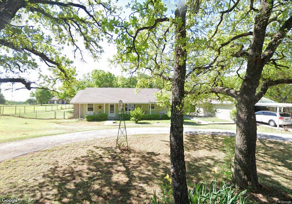
312 Norman Dr Millsap, TX 76066
Estimated Value: $342,000 - $678,000
--
Bed
--
Bath
1,530
Sq Ft
$285/Sq Ft
Est. Value
About This Home
This home is located at 312 Norman Dr, Millsap, TX 76066 and is currently estimated at $436,659, approximately $285 per square foot. 312 Norman Dr is a home located in Parker County with nearby schools including Millsap Elementary School, Millsap Middle School, and Millsap High School.
Ownership History
Date
Name
Owned For
Owner Type
Purchase Details
Closed on
Sep 15, 2008
Sold by
Smith Wayne S and Smith Ruth C
Bought by
Bolton James R and Bolton Anglen Y
Current Estimated Value
Home Financials for this Owner
Home Financials are based on the most recent Mortgage that was taken out on this home.
Original Mortgage
$153,306
Outstanding Balance
$102,359
Interest Rate
6.6%
Mortgage Type
Purchase Money Mortgage
Estimated Equity
$334,300
Purchase Details
Closed on
Jan 12, 2001
Sold by
Robbins Charles W and Robbins Pamela A
Bought by
Bolton James R and Bolton Anglen
Purchase Details
Closed on
Jan 1, 1901
Bought by
Bolton James R and Bolton Anglen
Create a Home Valuation Report for This Property
The Home Valuation Report is an in-depth analysis detailing your home's value as well as a comparison with similar homes in the area
Home Values in the Area
Average Home Value in this Area
Purchase History
| Date | Buyer | Sale Price | Title Company |
|---|---|---|---|
| Bolton James R | -- | Rtt | |
| Bolton James R | -- | -- | |
| Bolton James R | -- | -- | |
| Bolton James R | -- | -- |
Source: Public Records
Mortgage History
| Date | Status | Borrower | Loan Amount |
|---|---|---|---|
| Open | Bolton James R | $153,306 |
Source: Public Records
Tax History Compared to Growth
Tax History
| Year | Tax Paid | Tax Assessment Tax Assessment Total Assessment is a certain percentage of the fair market value that is determined by local assessors to be the total taxable value of land and additions on the property. | Land | Improvement |
|---|---|---|---|---|
| 2025 | $994 | $304,496 | -- | -- |
| 2024 | $994 | $276,815 | -- | -- |
| 2023 | $994 | $251,650 | $0 | $0 |
| 2022 | $4,341 | $248,620 | $40,000 | $208,620 |
| 2021 | $4,327 | $248,620 | $40,000 | $208,620 |
| 2020 | $4,068 | $204,950 | $25,000 | $179,950 |
| 2019 | $3,965 | $204,950 | $25,000 | $179,950 |
| 2018 | $3,646 | $159,510 | $10,000 | $149,510 |
| 2017 | $3,431 | $159,510 | $10,000 | $149,510 |
| 2016 | $3,120 | $129,140 | $10,000 | $119,140 |
| 2015 | $1,660 | $129,140 | $10,000 | $119,140 |
| 2014 | $1,784 | $108,870 | $10,000 | $98,870 |
Source: Public Records
Map
Nearby Homes
- TBD S Farm To Market Road 113
- 1747 Cool Jct
- 1651 Doss Rd
- 10309 Mineral Wells Hwy
- 2101 Cool Jct
- 10669 Mineral Wells Hwy
- 4005 Marine Cir
- 1045 Churchill Ln
- 2005 Tillman Blvd
- 417 Wood River Rd
- 2500 Cool Jct Unit Tract 2
- 990 Doss Rd
- 320 Wilson Bend Rd
- 600 Wilson Bend Rd
- 1005 Resolute Rd
- 110 Morris Ct
- 250 Young Rd
- 2017 Bedford Ct
- 130 Trails End Cir
- 9999 Trails End Cir