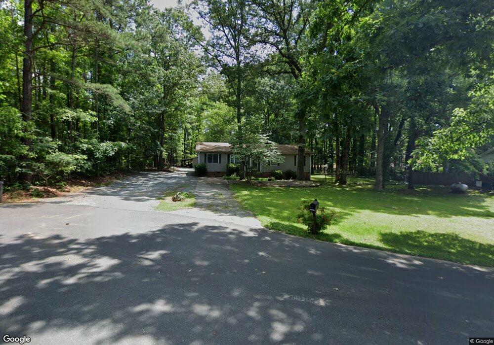
312 Peyton Ct Waxhaw, NC 28173
Estimated Value: $310,000 - $377,984
3
Beds
2
Baths
1,472
Sq Ft
$230/Sq Ft
Est. Value
About This Home
This home is located at 312 Peyton Ct, Waxhaw, NC 28173 and is currently estimated at $338,996, approximately $230 per square foot. 312 Peyton Ct is a home located in Union County with nearby schools including Waxhaw Elementary School, Parkwood Middle School, and Parkwood High School.
Ownership History
Date
Name
Owned For
Owner Type
Purchase Details
Closed on
Jun 14, 2021
Sold by
Hope Johnny L
Bought by
Hope Johnny L and Summerford Diana J
Current Estimated Value
Home Financials for this Owner
Home Financials are based on the most recent Mortgage that was taken out on this home.
Original Mortgage
$78,500
Outstanding Balance
$71,453
Interest Rate
3.25%
Mortgage Type
New Conventional
Estimated Equity
$267,543
Purchase Details
Closed on
Aug 15, 1997
Sold by
Sims Robert P and Wife Angela C
Bought by
Hope Johnny L and Wife Maria M Hope
Create a Home Valuation Report for This Property
The Home Valuation Report is an in-depth analysis detailing your home's value as well as a comparison with similar homes in the area
Home Values in the Area
Average Home Value in this Area
Purchase History
| Date | Buyer | Sale Price | Title Company |
|---|---|---|---|
| Hope Johnny L | -- | Accommodation | |
| Hope Johnny L | $78,000 | -- |
Source: Public Records
Mortgage History
| Date | Status | Borrower | Loan Amount |
|---|---|---|---|
| Open | Hope Johnny L | $78,500 |
Source: Public Records
Tax History Compared to Growth
Tax History
| Year | Tax Paid | Tax Assessment Tax Assessment Total Assessment is a certain percentage of the fair market value that is determined by local assessors to be the total taxable value of land and additions on the property. | Land | Improvement |
|---|---|---|---|---|
| 2024 | $1,995 | $194,600 | $54,500 | $140,100 |
| 2023 | $1,975 | $194,600 | $54,500 | $140,100 |
| 2022 | $1,975 | $194,600 | $54,500 | $140,100 |
| 2021 | $1,972 | $194,600 | $54,500 | $140,100 |
| 2020 | $1,008 | $128,740 | $22,340 | $106,400 |
| 2019 | $1,506 | $128,740 | $22,340 | $106,400 |
| 2018 | $1,011 | $128,740 | $22,340 | $106,400 |
| 2017 | $1,522 | $128,700 | $22,300 | $106,400 |
| 2016 | $1,032 | $128,740 | $22,340 | $106,400 |
| 2015 | $1,048 | $128,740 | $22,340 | $106,400 |
| 2014 | $974 | $138,640 | $46,920 | $91,720 |
Source: Public Records
Map
Nearby Homes
- 1045 Maxwell Ct Unit 10
- 1040 Maxwell Ct Unit 19
- 508 S Jackson Ave
- 1033 Bandon Dr
- 1037 Bandon Dr
- 1041 Bandon Dr
- 1029 Bandon Dr
- 1025 Bandon Dr
- 516 N Broome St
- 8215 N Carolina 75
- 0000 Hwy 16 Hwy
- 1909 Beckwith Ln
- 333 Anne Ave
- 327 Rehobeth Rd
- 403 Old Town Village Rd
- 309 Old Town Village Rd
- Duncan Plan at Old Town Village
- Wilson Plan at Old Town Village
- Price Plan at Old Town Village
- Hudson Plan at Old Town Village
- 308 Peyton Ct
- 304 Peyton Ct
- 600 Bivens St
- 9&10 Armfield St
- #365 Red Barone Place
- Lot234 Agile Ct
- #73 Red Barone Place
- 000 Armfield St
- 00 Armfield St
- B Dapple Ridge Rd
- LOT #5 Sarsfield Ct
- Lt 116 Red Barone Place
- L9 Elstead Cir Unit L 9
- L11 Elstead Cir Unit L11
- L8 Elstead Cir Unit L 8
- 10acre Snow White Field Rd
- 0000 Dapple Ridge Rd
- Lot 5 Sarsfield Ct
- 7811/7 Canter Oaks Rd Unit Lot 1
- 7811/5 Canter Oaks Rd Unit Lot3B