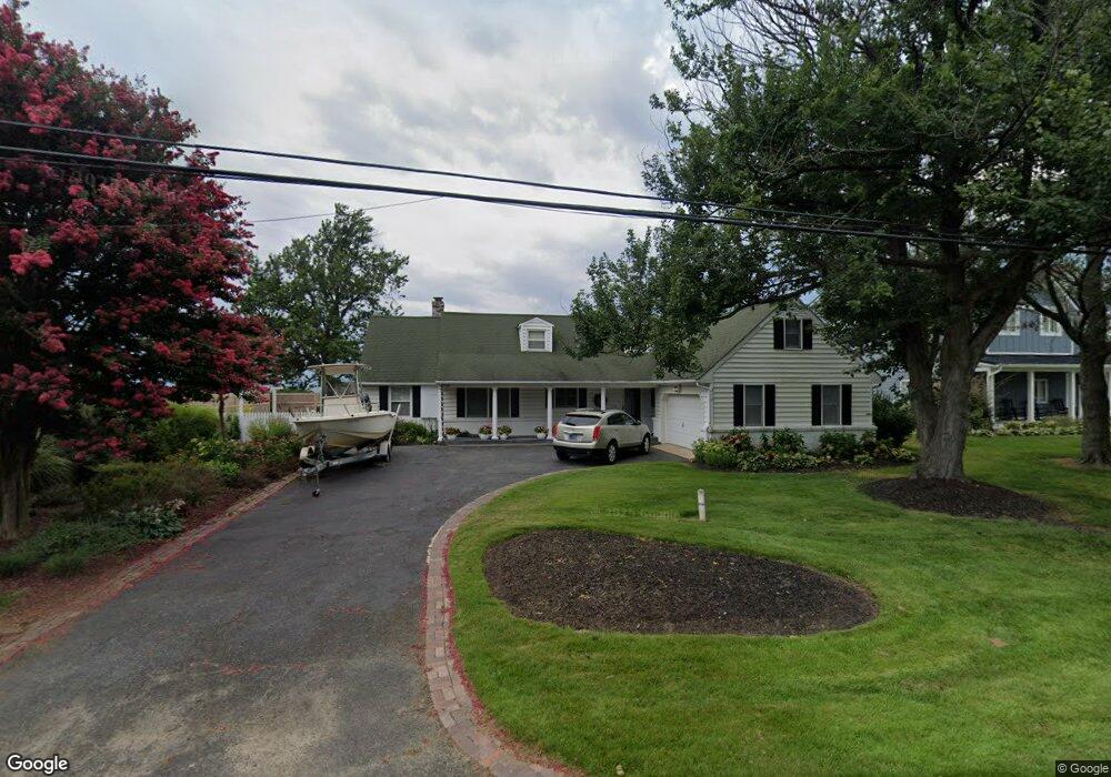
312 Queen Anne Club Dr Stevensville, MD 21666
Estimated Value: $856,000 - $1,219,000
3
Beds
3
Baths
2,072
Sq Ft
$518/Sq Ft
Est. Value
About This Home
This home is located at 312 Queen Anne Club Dr, Stevensville, MD 21666 and is currently estimated at $1,074,044, approximately $518 per square foot. 312 Queen Anne Club Dr is a home located in Queen Anne's County with nearby schools including Matapeake Elementary School, Matapeake Middle School, and Kent Island High School.
Ownership History
Date
Name
Owned For
Owner Type
Purchase Details
Closed on
Nov 23, 2021
Sold by
Douglas James M
Bought by
James M Douglas Revocable Trust and Sharon G Douglas Revocable Trust
Current Estimated Value
Purchase Details
Closed on
Oct 4, 2016
Sold by
Douglas Sharon G
Bought by
Douglas James M and Douglas Sharon G
Home Financials for this Owner
Home Financials are based on the most recent Mortgage that was taken out on this home.
Original Mortgage
$439,500
Interest Rate
3.47%
Mortgage Type
New Conventional
Purchase Details
Closed on
Oct 13, 2006
Sold by
Douglas James M and Douglas Sharon G
Bought by
Douglas Sharon G
Home Financials for this Owner
Home Financials are based on the most recent Mortgage that was taken out on this home.
Original Mortgage
$500,000
Interest Rate
6.71%
Mortgage Type
Stand Alone Refi Refinance Of Original Loan
Purchase Details
Closed on
Aug 31, 2006
Sold by
Douglas James M and Douglas Sharon G
Bought by
Douglas Sharon G
Home Financials for this Owner
Home Financials are based on the most recent Mortgage that was taken out on this home.
Original Mortgage
$500,000
Interest Rate
6.71%
Mortgage Type
Stand Alone Refi Refinance Of Original Loan
Purchase Details
Closed on
May 17, 2004
Sold by
Bienia Marsha Ann
Bought by
Douglas James M and Douglas Sharon G
Purchase Details
Closed on
Apr 13, 1999
Sold by
Patrick W Hansen Trustee Under D/T
Bought by
Bienia Marsha Ann
Purchase Details
Closed on
Mar 19, 1996
Sold by
Hansen Patrick W
Bought by
Patrick W Hansen Trustee Under D/T and Hansen From Patrick W
Purchase Details
Closed on
Nov 6, 1995
Sold by
Ball Michael J
Bought by
Hansen Patrick W
Purchase Details
Closed on
Apr 28, 1993
Sold by
Assoc Reloc Mgt Co
Bought by
Ball Michael J
Home Financials for this Owner
Home Financials are based on the most recent Mortgage that was taken out on this home.
Original Mortgage
$262,350
Interest Rate
7.51%
Create a Home Valuation Report for This Property
The Home Valuation Report is an in-depth analysis detailing your home's value as well as a comparison with similar homes in the area
Home Values in the Area
Average Home Value in this Area
Purchase History
| Date | Buyer | Sale Price | Title Company |
|---|---|---|---|
| James M Douglas Revocable Trust | -- | None Listed On Document | |
| Douglas James M | -- | Swan Title Corp | |
| Douglas Sharon G | -- | -- | |
| Douglas Sharon G | -- | -- | |
| Douglas James M | $790,000 | -- | |
| Bienia Marsha Ann | $424,900 | -- | |
| Patrick W Hansen Trustee Under D/T | -- | -- | |
| Hansen Patrick W | $298,000 | -- | |
| Ball Michael J | $291,500 | -- | |
| Assoc Reloc Mgt Co | $310,700 | -- |
Source: Public Records
Mortgage History
| Date | Status | Borrower | Loan Amount |
|---|---|---|---|
| Previous Owner | Douglas James M | $439,500 | |
| Previous Owner | Douglas Sharon G | $500,000 | |
| Previous Owner | Douglas Sharon G | $500,000 | |
| Previous Owner | Assoc Reloc Mgt Co | $262,350 | |
| Closed | Hansen Patrick W | -- |
Source: Public Records
Tax History Compared to Growth
Tax History
| Year | Tax Paid | Tax Assessment Tax Assessment Total Assessment is a certain percentage of the fair market value that is determined by local assessors to be the total taxable value of land and additions on the property. | Land | Improvement |
|---|---|---|---|---|
| 2025 | $7,969 | $839,567 | $0 | $0 |
| 2024 | $7,258 | $764,133 | $0 | $0 |
| 2023 | $6,548 | $688,700 | $460,000 | $228,700 |
| 2022 | $6,510 | $684,733 | $0 | $0 |
| 2021 | $6,589 | $680,767 | $0 | $0 |
| 2020 | $6,551 | $676,800 | $460,000 | $216,800 |
| 2019 | $6,343 | $661,400 | $0 | $0 |
| 2018 | $6,196 | $646,000 | $0 | $0 |
| 2017 | $6,108 | $630,600 | $0 | $0 |
| 2016 | -- | $630,600 | $0 | $0 |
| 2015 | $3,466 | $630,600 | $0 | $0 |
| 2014 | $3,466 | $812,700 | $0 | $0 |
Source: Public Records
Map
Nearby Homes
- 312 Columbia Ln
- 303 Queen Anne Club Dr
- 227 Queen Anne Club Dr
- 412 Five Farms Dr
- 410 5 Farms Dr
- 206 Columbia Ln
- 312 Queens Colony High Rd
- 303 Queens Colony High Rd
- 511 Chesapeake Ave
- 0 Allen Ave
- 114 Queens Colony High Rd
- 0 Reynolds Ave
- 116 Mallard Dr
- 321 Oregon Rd
- 122 Mallard Dr
- 101 Oak St
- 122 S Carolina Rd
- 116 Talbot Rd
- 306 N Lake Rd
- 224 Wicomico Rd
- 310 Queen Anne Club Dr
- 314 Queen Anne Club Dr
- 308 Queen Anne Club Dr
- 313 Queen Anne Club Dr
- 311 Queen Anne Club Dr
- 318 Queen Anne Club Dr
- 315 Queen Anne Club Dr
- 320 Queen Anne Club Dr
- 309 Queen Anne Club Dr
- 317 Queen Anne Club Dr
- 307 Queen Anne Club Dr
- 306 Queen Anne Club Dr
- 319 Queen Anne Club Dr
- 310 Columbia Ln
- 305 Queen Anne Club Dr
- 314 Columbia Ln
- 306 Columbia Ln
- 322 Queen Anne Club Dr
- 316 Columbia Ln
- 321 Queen Anne Club Dr