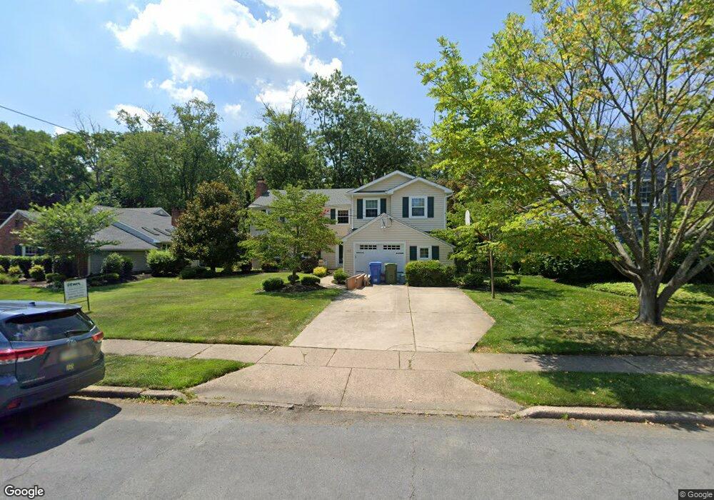
312 Randle Ct Cherry Hill, NJ 08034
Estimated Value: $628,000 - $666,026
Studio
--
Bath
2,635
Sq Ft
$249/Sq Ft
Est. Value
About This Home
This home is located at 312 Randle Ct, Cherry Hill, NJ 08034 and is currently estimated at $656,257, approximately $249 per square foot. 312 Randle Ct is a home located in Camden County with nearby schools including A. Russell Knight Elementary School, John A Carusi Middle School, and Cherry Hill High-West High School.
Ownership History
Date
Name
Owned For
Owner Type
Purchase Details
Closed on
May 11, 2007
Sold by
Koenig Brad A and Koenig Wendy B
Bought by
Mandia William T and Mandia Laura N
Current Estimated Value
Home Financials for this Owner
Home Financials are based on the most recent Mortgage that was taken out on this home.
Original Mortgage
$264,000
Interest Rate
6.24%
Mortgage Type
New Conventional
Purchase Details
Closed on
Mar 18, 2002
Sold by
Flynn Brian T
Bought by
Koenig Brad A and Lyons Wendy B
Home Financials for this Owner
Home Financials are based on the most recent Mortgage that was taken out on this home.
Original Mortgage
$195,920
Interest Rate
7.05%
Purchase Details
Closed on
Sep 8, 1998
Sold by
Holmes Peter B
Bought by
Flynn Brian T and Bryson Robyn L
Home Financials for this Owner
Home Financials are based on the most recent Mortgage that was taken out on this home.
Original Mortgage
$166,250
Interest Rate
6.8%
Create a Home Valuation Report for This Property
The Home Valuation Report is an in-depth analysis detailing your home's value as well as a comparison with similar homes in the area
Home Values in the Area
Average Home Value in this Area
Purchase History
We collect this data history from publicly available records. To have your information removed, we recommend requesting removal directly through your county’s website.
| Date | Buyer | Sale Price | Title Company |
|---|---|---|---|
| Mandia William T | $330,000 | -- | |
| Koenig Brad A | $244,900 | -- | |
| Flynn Brian T | $175,000 | -- |
Source: Public Records
Mortgage History
We collect this data history from publicly available records. To have your information removed, we recommend requesting removal directly through your county’s website.
| Date | Status | Borrower | Loan Amount |
|---|---|---|---|
| Previous Owner | Mandia William T | $264,000 | |
| Previous Owner | Koenig Brad A | $195,920 | |
| Previous Owner | Flynn Brian T | $166,250 |
Source: Public Records
Tax History
| Year | Tax Paid | Tax Assessment Tax Assessment Total Assessment is a certain percentage of the fair market value that is determined by local assessors to be the total taxable value of land and additions on the property. | Land | Improvement |
|---|---|---|---|---|
| 2025 | $14,169 | $301,400 | $74,800 | $226,600 |
| 2024 | $11,614 | $276,400 | $74,800 | $226,600 |
| 2023 | $11,614 | $276,400 | $0 | $0 |
| 2022 | $11,294 | $276,400 | $0 | $0 |
| 2021 | $11,330 | $276,400 | $0 | $0 |
| 2020 | $11,191 | $276,400 | $0 | $0 |
| 2019 | $9,340 | $230,800 | $74,800 | $156,000 |
| 2018 | $9,315 | $230,800 | $74,800 | $156,000 |
| 2017 | $9,188 | $230,800 | $74,800 | $156,000 |
| 2016 | $9,066 | $230,800 | $74,800 | $156,000 |
| 2015 | $8,923 | $230,800 | $74,800 | $156,000 |
| 2014 | $8,823 | $230,800 | $74,800 | $156,000 |
Source: Public Records
Map
Nearby Homes
- 1200 E Marlton Pike
- 418 Sherry Way
- 119 Sharrowvale Rd
- 213 Timothy Ct
- 209 Whitemarsh Way
- 1304 Paddock Way
- 60 Pine Valley Rd
- 2 Grass Rd
- 311 Wayland Rd
- 549 Covered Bridge Rd
- 121 Europa Blvd
- 1032 Red Oak Dr
- 123 Pearl Croft Rd
- 1013 E Tampa Ave
- 67 Buckingham Place
- 1009 Edgemoor Rd
- 16 Buckingham Place
- 976 Kingston Dr
- 54 Buckingham Place
- 2 Surrey Ct
Your Personal Tour Guide
Ask me questions while you tour the home.