Estimated Value: $416,479 - $538,000
3
Beds
2
Baths
1,240
Sq Ft
$392/Sq Ft
Est. Value
About This Home
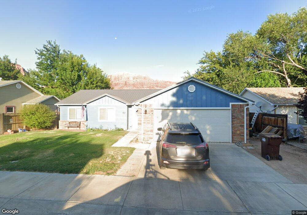
This home is located at 312 Riversands Dr, Moab, UT 84532 and is currently estimated at $486,620, approximately $392 per square foot. 312 Riversands Dr is a home located in Grand County with nearby schools including Helen M. Knight School, Grand County Middle School, and Grand County High School.
Ownership History
Date
Name
Owned For
Owner Type
Purchase Details
Closed on
Apr 15, 2010
Sold by
Johnston Terill W and Johnston Jennifer D
Bought by
Nunn Terri L
Current Estimated Value
Home Financials for this Owner
Home Financials are based on the most recent Mortgage that was taken out on this home.
Original Mortgage
$208,200
Outstanding Balance
$138,118
Interest Rate
4.92%
Estimated Equity
$348,502
Create a Home Valuation Report for This Property
The Home Valuation Report is an in-depth analysis detailing your home's value as well as a comparison with similar homes in the area
Home Values in the Area
Average Home Value in this Area
Purchase History
| Date | Buyer | Sale Price | Title Company |
|---|---|---|---|
| Nunn Terri L | -- | -- |
Source: Public Records
Mortgage History
| Date | Status | Borrower | Loan Amount |
|---|---|---|---|
| Open | Nunn Terri L | $208,200 |
Source: Public Records
Tax History Compared to Growth
Tax History
| Year | Tax Paid | Tax Assessment Tax Assessment Total Assessment is a certain percentage of the fair market value that is determined by local assessors to be the total taxable value of land and additions on the property. | Land | Improvement |
|---|---|---|---|---|
| 2024 | $2,417 | $403,975 | $100,000 | $303,975 |
| 2023 | $2,417 | $403,975 | $100,000 | $303,975 |
| 2022 | $2,033 | $383,975 | $80,000 | $303,975 |
| 2021 | $1,433 | $240,138 | $80,000 | $160,138 |
| 2020 | $1,363 | $220,138 | $60,000 | $160,138 |
| 2019 | $1,287 | $220,138 | $60,000 | $160,138 |
| 2018 | $1,275 | $220,138 | $60,000 | $160,138 |
| 2017 | $1,321 | $0 | $0 | $0 |
| 2016 | $1,307 | $0 | $0 | $0 |
| 2015 | $1,269 | $0 | $0 | $0 |
| 2014 | $1,222 | $0 | $0 | $0 |
| 2013 | $1,223 | $118,213 | $0 | $0 |
Source: Public Records
Map
Nearby Homes
- 380 Portal Vista Loop
- 656 W 400 N
- 709 Bartlett Cir
- 429 N 600 W
- 420 N 600 W
- 615 W 470 N
- 592 W Hale Ave
- 542 W Hale Ave
- 400 N 500 W Unit 152
- 400 N 500 W Unit 315
- 400 N 500 W Unit 280
- 558 Winesap Cir
- 276 N Opal Ave
- 414 W Park Dr Unit 14
- 466 Wingate Ave
- 630 N 500 W
- 279 Park Rd
- 812 Palisade Dr
- 476 Cliffview Dr
- 684 N Mccormick Blvd
- 302 Riversands Dr
- 324 Riversands Dr
- 309 Riversands Dr
- 321 Riversands Dr
- 297 Riversands Dr
- 290 Riversands Dr
- 285 Riversands Dr
- 335 Riversands Dr
- 346 Riversands Dr
- 346 Riversands Dr Unit 4
- 282 Riversands Dr
- 275 Riversands Dr
- 347 Riversands Dr
- 308 Portal Vista Loop
- 296 Portal Vista Loop
- 284 Portal Vista Loop
- 354 Riversands Dr
- 332 Portal Vista Loop
- 274 Portal Vista Loop
- 357 Riversands Dr