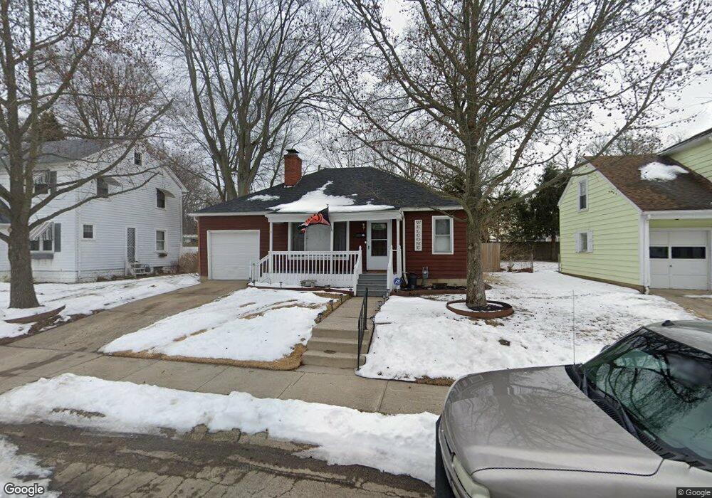
312 Roseland Ave E Springfield, OH 45503
Estimated Value: $105,000 - $135,000
2
Beds
1
Bath
810
Sq Ft
$152/Sq Ft
Est. Value
About This Home
This home is located at 312 Roseland Ave E, Springfield, OH 45503 and is currently estimated at $123,413, approximately $152 per square foot. 312 Roseland Ave E is a home located in Clark County with nearby schools including Warder Park-Wayne Elementary School, Schaefer Middle School, and Springfield High School.
Ownership History
Date
Name
Owned For
Owner Type
Purchase Details
Closed on
Jun 17, 2025
Sold by
Fritz Edward J and Edward J Fritz Jr Revocable Living Trust
Bought by
Fritz Edward J and Fritz John E
Current Estimated Value
Purchase Details
Closed on
Jul 27, 2015
Sold by
Fannie Mae
Bought by
Fritz Edward J
Purchase Details
Closed on
Apr 16, 2015
Sold by
Shepherd Matthew R
Bought by
Fannie Mae and Federal National Mortgage Association
Purchase Details
Closed on
Oct 4, 2002
Sold by
Coberly Kenneth P and Coberly Jeanine A
Bought by
Shepherd Matthew R
Home Financials for this Owner
Home Financials are based on the most recent Mortgage that was taken out on this home.
Original Mortgage
$52,000
Interest Rate
6.39%
Mortgage Type
Purchase Money Mortgage
Purchase Details
Closed on
Jan 27, 1986
Create a Home Valuation Report for This Property
The Home Valuation Report is an in-depth analysis detailing your home's value as well as a comparison with similar homes in the area
Home Values in the Area
Average Home Value in this Area
Purchase History
| Date | Buyer | Sale Price | Title Company |
|---|---|---|---|
| Fritz Edward J | -- | None Listed On Document | |
| Fritz Edward J | -- | Ohio Real Estate Title | |
| Fannie Mae | $40,000 | Attorney | |
| Shepherd Matthew R | $65,000 | -- | |
| -- | $25,000 | -- |
Source: Public Records
Mortgage History
| Date | Status | Borrower | Loan Amount |
|---|---|---|---|
| Previous Owner | Shepherd Matthew R | $52,000 |
Source: Public Records
Tax History
| Year | Tax Paid | Tax Assessment Tax Assessment Total Assessment is a certain percentage of the fair market value that is determined by local assessors to be the total taxable value of land and additions on the property. | Land | Improvement |
|---|---|---|---|---|
| 2025 | $1,348 | $42,860 | $7,020 | $35,840 |
| 2024 | $1,314 | $26,600 | $6,270 | $20,330 |
| 2023 | $1,314 | $26,600 | $6,270 | $20,330 |
| 2022 | $1,346 | $26,600 | $6,270 | $20,330 |
| 2021 | $1,214 | $22,090 | $5,020 | $17,070 |
| 2020 | $1,217 | $22,090 | $5,020 | $17,070 |
| 2019 | $1,220 | $22,090 | $5,020 | $17,070 |
| 2018 | $1,422 | $24,730 | $5,020 | $19,710 |
| 2017 | $1,421 | $22,565 | $5,016 | $17,549 |
| 2016 | $1,423 | $22,565 | $5,016 | $17,549 |
| 2015 | $1,368 | $22,565 | $5,016 | $17,549 |
| 2014 | $681 | $22,565 | $5,016 | $17,549 |
| 2013 | $1,348 | $22,565 | $5,016 | $17,549 |
Source: Public Records
Map
Nearby Homes
- 375 N Fostoria Ave
- 2730 E Main St
- 129 N Burnett Rd
- 2702 Maplewood Ave
- 115 S Burnett Rd
- 138 Lawnview Ave
- 2201 Woodside Ave
- 2425 Kenilworth Ave
- 907 Bellevue Ave
- 3012 E High St
- 360 Buxton Ave
- 2845 Columbus Ave Unit 5
- 2020 Woodside Ave
- 26 N Belmont Ave
- 374 Raffensperger Ave
- 743 N Belmont Ave
- 2804 Lowman St
- 250 S Douglas Ave Unit 254
- 451 Lawnview Ave
- 2023 Cleveland Ave
- 310 Roseland Ave E
- 318 Roseland Ave E
- 324 Roseland Ave E
- 302 Roseland Ave E
- 313 Roseland Ave E
- 305 Roseland Ave E
- 317 Roseland Ave E
- 330 Roseland Ave E
- 314 Mobile St
- 226 Roseland Ave E
- 301 Roseland Ave E
- 305 Shoup St Unit 305
- 229 Roseland Ave E
- 220 Roseland Ave E
- 400 Roseland Ave E
- 316 Roseland Ave W
- 308 Roseland Ave W
- 320 Roseland Ave W
- 225 Roseland Ave E
- 304 Roseland Ave W
Your Personal Tour Guide
Ask me questions while you tour the home.