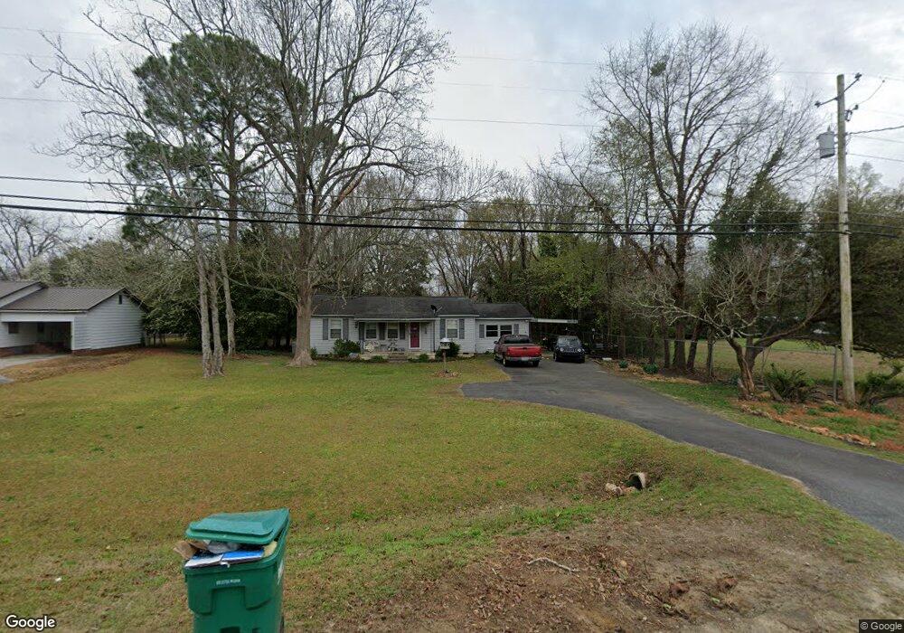
312 S 2nd St Cochran, GA 31014
Estimated Value: $184,000 - $246,000
2
Beds
2
Baths
1,724
Sq Ft
$122/Sq Ft
Est. Value
About This Home
This home is located at 312 S 2nd St, Cochran, GA 31014 and is currently estimated at $210,843, approximately $122 per square foot. 312 S 2nd St is a home located in Bleckley County with nearby schools including Bleckley County Primary School, Bleckley County Elementary School, and Bleckley Middle School.
Ownership History
Date
Name
Owned For
Owner Type
Purchase Details
Closed on
Mar 22, 2011
Sold by
Rozier Tommy Russell
Bought by
Proffitt Johnny M
Current Estimated Value
Home Financials for this Owner
Home Financials are based on the most recent Mortgage that was taken out on this home.
Original Mortgage
$63,000
Outstanding Balance
$1,962
Interest Rate
4.92%
Mortgage Type
New Conventional
Estimated Equity
$208,881
Purchase Details
Closed on
Sep 28, 2004
Sold by
Rozier James
Bought by
Rozier Tommy Russell Melton Eugene
Purchase Details
Closed on
Sep 19, 1968
Sold by
Fisher T W
Bought by
Rozier James
Purchase Details
Closed on
Sep 13, 1968
Sold by
Fisher T W
Bought by
Rozier James Eugene
Create a Home Valuation Report for This Property
The Home Valuation Report is an in-depth analysis detailing your home's value as well as a comparison with similar homes in the area
Home Values in the Area
Average Home Value in this Area
Purchase History
| Date | Buyer | Sale Price | Title Company |
|---|---|---|---|
| Proffitt Johnny M | $90,000 | -- | |
| Rozier Tommy Russell Melton Eugene | -- | -- | |
| Rozier James | -- | -- | |
| Rozier James Eugene | -- | -- |
Source: Public Records
Mortgage History
| Date | Status | Borrower | Loan Amount |
|---|---|---|---|
| Open | Proffitt Johnny M | $63,000 |
Source: Public Records
Tax History
| Year | Tax Paid | Tax Assessment Tax Assessment Total Assessment is a certain percentage of the fair market value that is determined by local assessors to be the total taxable value of land and additions on the property. | Land | Improvement |
|---|---|---|---|---|
| 2025 | $1,801 | $69,476 | $14,520 | $54,956 |
| 2024 | $1,648 | $63,596 | $8,640 | $54,956 |
| 2023 | $1,709 | $63,596 | $8,640 | $54,956 |
| 2022 | $1,508 | $57,436 | $8,640 | $48,796 |
| 2021 | $1,286 | $46,156 | $8,640 | $37,516 |
| 2020 | $1,286 | $46,156 | $8,640 | $37,516 |
| 2019 | $1,128 | $40,655 | $4,407 | $36,248 |
| 2018 | $1,196 | $40,655 | $4,407 | $36,248 |
| 2017 | $1,136 | $40,655 | $4,407 | $36,248 |
| 2016 | $1,137 | $40,655 | $4,407 | $36,248 |
| 2015 | -- | $40,655 | $4,407 | $36,248 |
| 2014 | -- | $40,655 | $4,407 | $36,248 |
| 2013 | -- | $40,655 | $4,407 | $36,248 |
Source: Public Records
Map
Nearby Homes
- 119 Moll Dr
- RV Park Mac Thompson Rd
- Land Mac Thompson Rd
- 0 Willow Creek Run
- 0 Wood Oak Cir Unit 233873
- 0 Wood Oak Cir Unit 9278951
- 175 Wood Oak Cir
- 111 Marie Dr
- 134 Easy St
- 116 Pecan St
- 118 Pecan St
- 112 Pecan St
- 116 W Lewis St
- 238 Wood Oak Cir
- 159 Jockey Ln
- 188 E Lewis St
- 140 Racetrack Dr
- 288 Frank Cook Rd
- 260 Ann St
- 264 Ann St
Your Personal Tour Guide
Ask me questions while you tour the home.