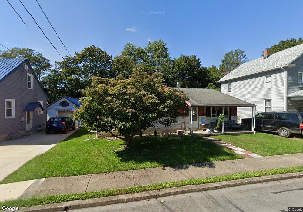
312 S High St Selinsgrove, PA 17870
Estimated Value: $118,686 - $199,000
--
Bed
--
Bath
--
Sq Ft
7,971
Sq Ft Lot
About This Home
This home is located at 312 S High St, Selinsgrove, PA 17870 and is currently estimated at $171,922. 312 S High St is a home located in Snyder County with nearby schools including Selinsgrove Area Elementary School, Selinsgrove Intermediate School, and Selinsgrove Area Middle School.
Ownership History
Date
Name
Owned For
Owner Type
Purchase Details
Closed on
Jul 13, 2021
Sold by
Brandau Lynne A and Brandau Kevin B
Bought by
Kerstetter Kent A
Current Estimated Value
Home Financials for this Owner
Home Financials are based on the most recent Mortgage that was taken out on this home.
Original Mortgage
$151,515
Interest Rate
2.8%
Mortgage Type
New Conventional
Create a Home Valuation Report for This Property
The Home Valuation Report is an in-depth analysis detailing your home's value as well as a comparison with similar homes in the area
Home Values in the Area
Average Home Value in this Area
Purchase History
| Date | Buyer | Sale Price | Title Company |
|---|---|---|---|
| Kerstetter Kent A | $150,000 | Faxon Settlement Svcs Llc |
Source: Public Records
Mortgage History
| Date | Status | Borrower | Loan Amount |
|---|---|---|---|
| Previous Owner | Kerstetter Kent A | $151,515 |
Source: Public Records
Tax History Compared to Growth
Tax History
| Year | Tax Paid | Tax Assessment Tax Assessment Total Assessment is a certain percentage of the fair market value that is determined by local assessors to be the total taxable value of land and additions on the property. | Land | Improvement |
|---|---|---|---|---|
| 2025 | $2,187 | $18,280 | $2,000 | $16,280 |
| 2024 | $2,053 | $18,280 | $2,000 | $16,280 |
| 2023 | $819 | $18,280 | $2,000 | $16,280 |
| 2022 | $1,971 | $18,280 | $2,000 | $16,280 |
| 2021 | $1,952 | $18,280 | $2,000 | $16,280 |
| 2020 | $1,943 | $18,280 | $2,000 | $16,280 |
| 2019 | $1,934 | $18,280 | $2,000 | $16,280 |
| 2018 | $1,916 | $18,280 | $2,000 | $16,280 |
| 2017 | $1,898 | $18,280 | $2,000 | $16,280 |
| 2016 | $1,020 | $18,280 | $2,000 | $16,280 |
| 2015 | $67,293 | $18,280 | $2,000 | $16,280 |
| 2014 | $67,293 | $18,280 | $2,000 | $16,280 |
Source: Public Records
Map
Nearby Homes
- APN 18-08-086 S Market St
- 207 Orange St Unit 209
- 301 E Walnut St
- 223 E Pine St
- 301 E Pine St
- 500 N Orange St
- 501 N 9th St
- 104 18th St
- 722 N 8th St
- 21 Calvett Place
- 37 Woodlynn Dr
- 0 Market St Unit PASY2002452
- Lot 1 522 Route S
- 0 Wedgewood Dr
- 321 Pleasant Dr
- 20 Quarry Rd
- 456 State School Rd
- 1486 Sand Hill Rd
- 33 Grand Oak Ln
- 732 Salem Rd
- 310 S High St
- 314 S High St
- 316 S High St
- 306 S High St
- 313 S High St
- 304 S High St
- 315 S High St
- 300 S High St
- 103 W Sassafras St Unit 105
- 117 W Sassafras St
- 319 S High St
- 301 S High St
- 216 S High St
- 214 S High St
- 219 S High St
- 112 W Sassafras St
- 314 S Market St
- 318 S Market St Unit 320
- 322 S Market St
- 212 S High St