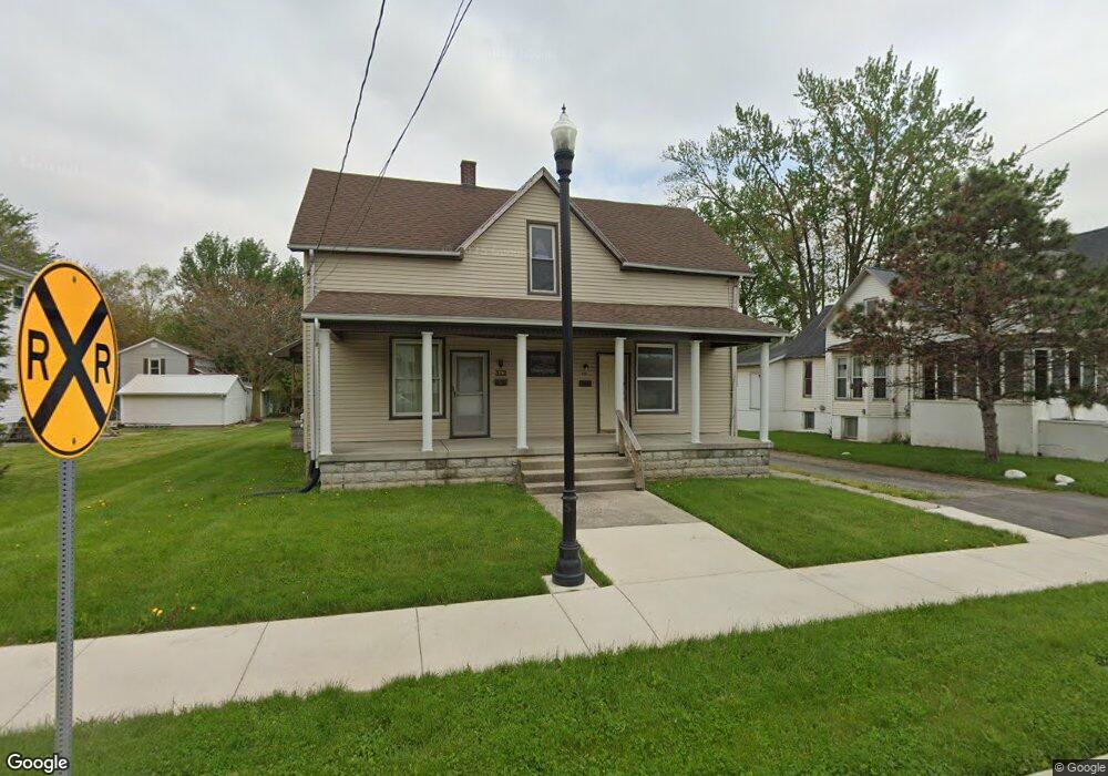
312 S Main St Delphos, OH 45833
Estimated Value: $101,000 - $108,510
3
Beds
1
Bath
2,352
Sq Ft
$45/Sq Ft
Est. Value
About This Home
This home is located at 312 S Main St, Delphos, OH 45833 and is currently estimated at $105,170, approximately $44 per square foot. 312 S Main St is a home located in Allen County with nearby schools including Delphos St. John's High School and Delphos St. John's Elementary School.
Ownership History
Date
Name
Owned For
Owner Type
Purchase Details
Closed on
Sep 23, 2013
Sold by
Finn Lisa and Baldauf Ronald
Bought by
Baldauf Properties Llc
Current Estimated Value
Purchase Details
Closed on
Sep 15, 2011
Sold by
Cress Virginia
Bought by
Baldauf Ronald and Finn Lisa
Purchase Details
Closed on
Mar 17, 2010
Sold by
Baldauf Michael and Baldauf Lori
Bought by
Cress Virginia and Baldauf Ronald
Purchase Details
Closed on
Jul 16, 1987
Bought by
Baldauf John F
Create a Home Valuation Report for This Property
The Home Valuation Report is an in-depth analysis detailing your home's value as well as a comparison with similar homes in the area
Home Values in the Area
Average Home Value in this Area
Purchase History
| Date | Buyer | Sale Price | Title Company |
|---|---|---|---|
| Baldauf Properties Llc | -- | None Available | |
| Baldauf Ronald | -- | None Available | |
| Cress Virginia | -- | Attorney | |
| Baldauf John F | -- | -- |
Source: Public Records
Tax History Compared to Growth
Tax History
| Year | Tax Paid | Tax Assessment Tax Assessment Total Assessment is a certain percentage of the fair market value that is determined by local assessors to be the total taxable value of land and additions on the property. | Land | Improvement |
|---|---|---|---|---|
| 2023 | $1,064 | $31,680 | $2,660 | $29,020 |
| 2022 | $1,090 | $31,680 | $2,660 | $29,020 |
| 2021 | $1,097 | $31,680 | $2,660 | $29,020 |
| 2020 | $933 | $28,320 | $2,560 | $25,760 |
| 2019 | $933 | $28,320 | $2,560 | $25,760 |
| 2018 | $916 | $28,320 | $2,560 | $25,760 |
| 2017 | $870 | $25,980 | $2,560 | $23,420 |
| 2016 | $884 | $25,980 | $2,560 | $23,420 |
| 2015 | $747 | $25,980 | $2,560 | $23,420 |
| 2014 | $747 | $21,980 | $2,450 | $19,530 |
| 2013 | $752 | $21,980 | $2,450 | $19,530 |
Source: Public Records
Map
Nearby Homes
- 221 S Main St
- 424 S Canal St
- 516 S Main St
- 483 S Franklin St
- 634 S Clay St
- 210 E 3rd St
- 827 S Washington St
- 405 N Franklin St
- 633 E 2nd St
- 409 N Bredeick St
- 610 N Washington St
- 1001 S Adams St
- 704 N Franklin St
- 604 W 6th St
- 1400 S Clay St Unit 17
- 810 N Franklin St
- 716 Moening St
- 521 Carolyn Dr
- 7110 Elida Rd
- 1303 Carolyn Dr