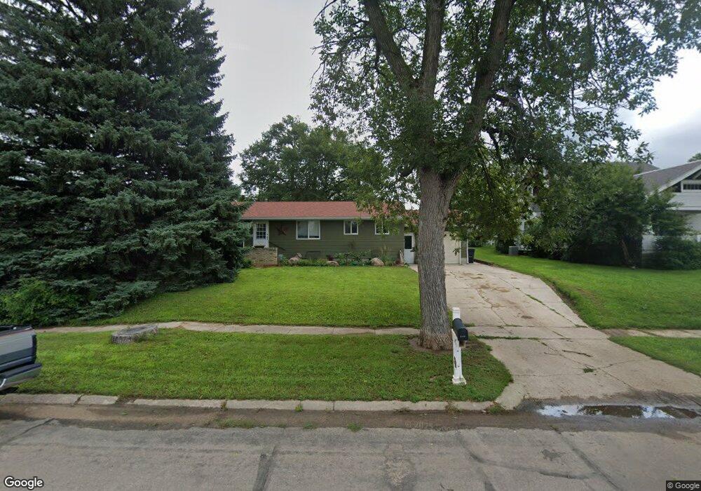
312 S Mcnamara St Bloomfield, NE 68718
Estimated Value: $121,000 - $143,000
--
Bed
2
Baths
1,196
Sq Ft
$110/Sq Ft
Est. Value
About This Home
This home is located at 312 S Mcnamara St, Bloomfield, NE 68718 and is currently estimated at $131,483, approximately $109 per square foot. 312 S Mcnamara St is a home located in Knox County with nearby schools including Bloomfield Elementary School and Bloomfield Junior/Senior High School.
Ownership History
Date
Name
Owned For
Owner Type
Purchase Details
Closed on
Dec 11, 2018
Sold by
Eckmann Krista and Eckmann Dona P
Bought by
Eckmann Krista
Current Estimated Value
Purchase Details
Closed on
Jul 24, 2009
Sold by
Schroeder William M and Schroeder Mildred M
Bought by
Eckmann Kenneth V and Eckmann Dona D
Create a Home Valuation Report for This Property
The Home Valuation Report is an in-depth analysis detailing your home's value as well as a comparison with similar homes in the area
Home Values in the Area
Average Home Value in this Area
Purchase History
| Date | Buyer | Sale Price | Title Company |
|---|---|---|---|
| Eckmann Krista | -- | Stewart Title Co | |
| Eckmann Kenneth V | $50,000 | -- |
Source: Public Records
Tax History Compared to Growth
Tax History
| Year | Tax Paid | Tax Assessment Tax Assessment Total Assessment is a certain percentage of the fair market value that is determined by local assessors to be the total taxable value of land and additions on the property. | Land | Improvement |
|---|---|---|---|---|
| 2024 | $976 | $85,250 | $9,460 | $75,790 |
| 2023 | $1,097 | $76,315 | $9,460 | $66,855 |
| 2022 | $1,080 | $72,110 | $5,255 | $66,855 |
| 2021 | $1,032 | $68,085 | $4,570 | $63,515 |
| 2020 | $1,038 | $68,085 | $4,570 | $63,515 |
| 2019 | $1,036 | $65,855 | $4,570 | $61,285 |
| 2018 | $908 | $58,545 | $4,570 | $53,975 |
| 2017 | $0 | $58,130 | $4,155 | $53,975 |
| 2016 | $0 | $58,130 | $4,155 | $53,975 |
| 2015 | -- | $54,105 | $2,770 | $51,335 |
| 2014 | -- | $55,010 | $2,770 | $52,240 |
| 2013 | -- | $49,850 | $2,770 | $47,080 |
Source: Public Records
Map
Nearby Homes
- 308 S Mcnamara St
- 314 S Mcnamara St
- 316 S Mcnamara St
- 304 S Mcnamara St
- 403 E Lincoln St
- 404 E Benton St
- 405 E Lincoln St
- 212 S Mcnamara St
- 402 S Mcnamara St
- 400 E Lincoln St
- 405 E Benton St
- 310 E Lincoln St
- 407 E Lincoln St
- 210 S Mcnamara St
- 304 S Randolph St
- 308 S Randolph St
- 312 S Randolph St
- 301 E Lincoln St
- 208 S Mcnamara St