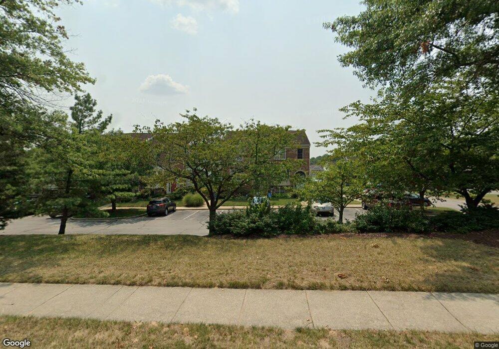
312 Saint Michaels Cir Odenton, MD 21113
Estimated Value: $414,423 - $445,000
--
Bed
3
Baths
1,548
Sq Ft
$283/Sq Ft
Est. Value
About This Home
This home is located at 312 Saint Michaels Cir, Odenton, MD 21113 and is currently estimated at $437,356, approximately $282 per square foot. 312 Saint Michaels Cir is a home located in Anne Arundel County with nearby schools including Seven Oaks Elementary School, MacArthur Middle School, and Meade High School.
Ownership History
Date
Name
Owned For
Owner Type
Purchase Details
Closed on
Mar 30, 2009
Sold by
Mccoy Quincy
Bought by
Mccoy Quincy
Current Estimated Value
Home Financials for this Owner
Home Financials are based on the most recent Mortgage that was taken out on this home.
Original Mortgage
$246,000
Outstanding Balance
$155,344
Interest Rate
4.92%
Mortgage Type
New Conventional
Estimated Equity
$282,012
Purchase Details
Closed on
Jan 23, 2004
Sold by
Mccoy Quincy
Bought by
Mccoy Quincy and Mccoy Ann M
Purchase Details
Closed on
Oct 1, 1998
Sold by
Chisarick Michael
Bought by
Mccoy Quincy and Mccoy Patricia Y
Create a Home Valuation Report for This Property
The Home Valuation Report is an in-depth analysis detailing your home's value as well as a comparison with similar homes in the area
Home Values in the Area
Average Home Value in this Area
Purchase History
| Date | Buyer | Sale Price | Title Company |
|---|---|---|---|
| Mccoy Quincy | -- | -- | |
| Mccoy Quincy | -- | -- | |
| Mccoy Quincy | $141,000 | -- |
Source: Public Records
Mortgage History
| Date | Status | Borrower | Loan Amount |
|---|---|---|---|
| Open | Mccoy Quincy | $246,000 | |
| Closed | Mccoy Quincy | -- |
Source: Public Records
Tax History Compared to Growth
Tax History
| Year | Tax Paid | Tax Assessment Tax Assessment Total Assessment is a certain percentage of the fair market value that is determined by local assessors to be the total taxable value of land and additions on the property. | Land | Improvement |
|---|---|---|---|---|
| 2025 | $2,793 | $353,500 | $150,000 | $203,500 |
| 2024 | $2,793 | $335,233 | $0 | $0 |
| 2023 | $2,702 | $316,967 | $0 | $0 |
| 2022 | $3,121 | $298,700 | $130,000 | $168,700 |
| 2021 | $4,944 | $294,400 | $0 | $0 |
| 2020 | $2,392 | $290,100 | $0 | $0 |
| 2019 | $4,611 | $285,800 | $115,000 | $170,800 |
| 2018 | $2,789 | $275,067 | $0 | $0 |
| 2017 | $2,184 | $264,333 | $0 | $0 |
| 2016 | -- | $253,600 | $0 | $0 |
| 2015 | -- | $252,633 | $0 | $0 |
| 2014 | -- | $251,667 | $0 | $0 |
Source: Public Records
Map
Nearby Homes
- 116 Langdon Farm Cir
- 146 Langdon Farm Cir
- 2008 Bunker Hill Ct
- 322 Timberbrook Ct
- 330 Timberbrook Ct
- 2104 Commissary Cir
- 2240 Canteen Cir
- 2242 Commissary Cir
- 2110 Commodore Ct
- 2139 Commissary Cir
- 106 Pinecove Ave
- 319-F Eagles Landing Ct Unit 319F
- 224 Arcadia Shores Cir
- 178 Pinecove Ave
- 313 3 Sirens Ct
- 302 Assembly Point Ct
- 1520 Annapolis Rd
- 156 Goldsborough Dr
- 1822 Dove Ct
- 1823 Graybird Ct
- 314 Saint Michaels Cir
- 310 Saint Michaels Cir
- 316 Saint Michaels Cir
- 316 Saint Michaels Cir Unit 16
- 318 Saint Michaels Cir
- 294 St Michaels Cir Unit 20
- 294 Saint Michaels Cir
- 294 Saint Michaels Cir Unit 20
- 320 Saint Michaels Cir
- 292 St Michaels Cir Unit 21
- 292 Saint Michaels Cir Unit 21
- 322 Saint Michaels Cir
- 322 Saint Michaels Cir Unit 13
- 290 Saint Michaels Cir
- 290 Saint Michaels Cir Unit 22
- 200 Commodore Way
- 202 Commodore Way
- 288 Saint Michaels Cir Unit 23
- 204 Commodore Way
- 286 St Michaels Cir Unit 24