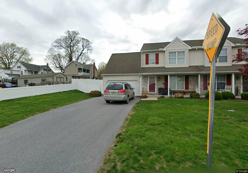
312 Schnader St Terre Hill, PA 17581
Estimated Value: $347,472 - $365,000
3
Beds
2
Baths
1,434
Sq Ft
$249/Sq Ft
Est. Value
About This Home
This home is located at 312 Schnader St, Terre Hill, PA 17581 and is currently estimated at $356,868, approximately $248 per square foot. 312 Schnader St is a home with nearby schools including Garden Spot Middle School, Garden Spot Senior High School, and Shalom Mennonite School.
Ownership History
Date
Name
Owned For
Owner Type
Purchase Details
Closed on
Jun 30, 2005
Sold by
Zimmerman Zeisest Builders
Bought by
Gnagey Gary P and Gnagey Deborah A
Current Estimated Value
Home Financials for this Owner
Home Financials are based on the most recent Mortgage that was taken out on this home.
Original Mortgage
$123,920
Outstanding Balance
$64,980
Interest Rate
5.73%
Mortgage Type
Fannie Mae Freddie Mac
Estimated Equity
$291,888
Create a Home Valuation Report for This Property
The Home Valuation Report is an in-depth analysis detailing your home's value as well as a comparison with similar homes in the area
Home Values in the Area
Average Home Value in this Area
Purchase History
| Date | Buyer | Sale Price | Title Company |
|---|---|---|---|
| Gnagey Gary P | $154,900 | First American Title Ins Co |
Source: Public Records
Mortgage History
| Date | Status | Borrower | Loan Amount |
|---|---|---|---|
| Open | Gnagey Gary P | $123,920 |
Source: Public Records
Tax History Compared to Growth
Tax History
| Year | Tax Paid | Tax Assessment Tax Assessment Total Assessment is a certain percentage of the fair market value that is determined by local assessors to be the total taxable value of land and additions on the property. | Land | Improvement |
|---|---|---|---|---|
| 2025 | $4,170 | $203,800 | $31,500 | $172,300 |
| 2024 | $4,170 | $203,800 | $31,500 | $172,300 |
| 2023 | $4,117 | $203,800 | $31,500 | $172,300 |
| 2022 | $4,078 | $203,800 | $31,500 | $172,300 |
| 2021 | $4,021 | $203,800 | $31,500 | $172,300 |
| 2020 | $4,021 | $203,800 | $31,500 | $172,300 |
| 2019 | $3,984 | $203,800 | $31,500 | $172,300 |
| 2018 | $4,920 | $203,800 | $31,500 | $172,300 |
| 2017 | $3,469 | $145,900 | $23,300 | $122,600 |
| 2016 | $3,469 | $145,900 | $23,300 | $122,600 |
| 2015 | $1,274 | $145,900 | $23,300 | $122,600 |
| 2014 | $2,038 | $145,900 | $23,300 | $122,600 |
Source: Public Records
Map
Nearby Homes
- 205 E Main St
- 200 E Main St
- 412 Linden St
- 420 Linden St
- 232 New St
- 61 Gentle Dr
- 575 Red Run Rd
- 133 Millstone Dr
- 111 Oatfield Dr
- 1258 Main St
- 1923 Barnett St
- 4 Hearth Dr
- 210 Musser Rd
- 117 Hawk Valley Ln Unit 105
- 101 Hawk Valley Ln
- 01 W Valley Rd
- Westbrooke Plan at Hawk Valley Estates
- Callahan Plan at Hawk Valley Estates
- Silverbrooke Plan at Hawk Valley Estates
- Wesley Plan at Hawk Valley Estates