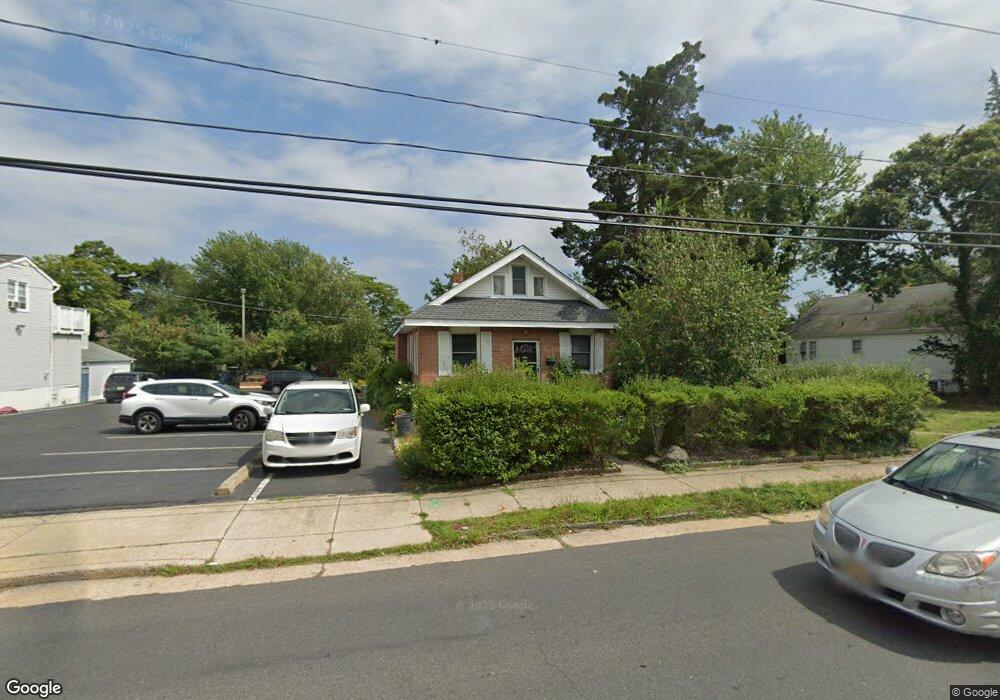
312 Shore Rd Somers Point, NJ 08244
Estimated Value: $376,371 - $519,000
--
Bed
--
Bath
1,335
Sq Ft
$324/Sq Ft
Est. Value
About This Home
This home is located at 312 Shore Rd, Somers Point, NJ 08244 and is currently estimated at $432,593, approximately $324 per square foot. 312 Shore Rd is a home located in Atlantic County with nearby schools including Mainland Regional High School, ChARTer TECH High School for the Performing Arts, and Saint Joseph Regional School.
Ownership History
Date
Name
Owned For
Owner Type
Purchase Details
Closed on
Sep 28, 1999
Sold by
Brown Mary T
Bought by
Tomlinson Charles A
Current Estimated Value
Home Financials for this Owner
Home Financials are based on the most recent Mortgage that was taken out on this home.
Original Mortgage
$8,700
Interest Rate
7.42%
Mortgage Type
Unknown
Purchase Details
Closed on
Apr 16, 1990
Sold by
Burke Margaret
Bought by
Burke Margaret and Burke Thomas,Bernard
Create a Home Valuation Report for This Property
The Home Valuation Report is an in-depth analysis detailing your home's value as well as a comparison with similar homes in the area
Home Values in the Area
Average Home Value in this Area
Purchase History
| Date | Buyer | Sale Price | Title Company |
|---|---|---|---|
| Tomlinson Charles A | $87,900 | The Title Company | |
| Burke Margaret | -- | -- |
Source: Public Records
Mortgage History
| Date | Status | Borrower | Loan Amount |
|---|---|---|---|
| Closed | Tomlinson Charles A | $8,700 | |
| Open | Tomlinson Charles A | $70,300 |
Source: Public Records
Tax History Compared to Growth
Tax History
| Year | Tax Paid | Tax Assessment Tax Assessment Total Assessment is a certain percentage of the fair market value that is determined by local assessors to be the total taxable value of land and additions on the property. | Land | Improvement |
|---|---|---|---|---|
| 2025 | $6,079 | $170,000 | $60,300 | $109,700 |
| 2024 | $6,079 | $170,000 | $60,300 | $109,700 |
| 2023 | $5,680 | $170,000 | $60,300 | $109,700 |
| 2022 | $5,680 | $170,000 | $60,300 | $109,700 |
| 2021 | $5,595 | $170,000 | $60,300 | $109,700 |
| 2020 | $5,481 | $170,000 | $60,300 | $109,700 |
| 2019 | $5,326 | $170,000 | $60,300 | $109,700 |
| 2018 | $5,214 | $170,000 | $60,300 | $109,700 |
| 2017 | $5,027 | $170,000 | $60,300 | $109,700 |
| 2016 | $4,799 | $170,000 | $60,300 | $109,700 |
| 2015 | $4,750 | $170,000 | $60,300 | $109,700 |
| 2014 | $4,590 | $170,000 | $60,300 | $109,700 |
Source: Public Records
Map
Nearby Homes
- 25 W Pierson Ave
- 29 E Pierson Ave
- 101 E Johnson Ave
- 112 E Pierson Ave
- 114 E Pierson Ave
- 421 Shore Rd
- 109 E Cedar Ave
- 33 W Meyran Ave
- 123 E Cedar Ave
- 137 W Johnson Ave
- 1102 Jesse Dr
- 2102 Angelina Ln
- 118 E Wilmont Ave
- 301 Bliss Ave
- 206 Philadelphia Ave
- 25 Shore Rd
- 11 Shore Rd Unit 7D
- 226 Bethel Rd
- 1020 Pleasant Ave
- 1013 Pleasant Ave
- 318 Shore Rd
- 320 Shore Rd
- 14 E Pierson Ave
- 15 E Johnson Ave
- 18 E Pierson Ave
- 23 E Johnson Ave
- 307 Shore Rd
- 20 E Pierson Ave
- 301 Shore Rd
- 10 E Johnson Ave
- 27 E Johnson Ave
- 22 E Pierson Ave
- 18 E Johnson Ave
- 327 Shore Rd
- 329 Shore Rd
- 329 Shore Rd Unit both units
- 329 Shore Rd Unit A and B
- 20 E Johnson Ave
- 19 W Johnson Ave
- 31 E Johnson Ave