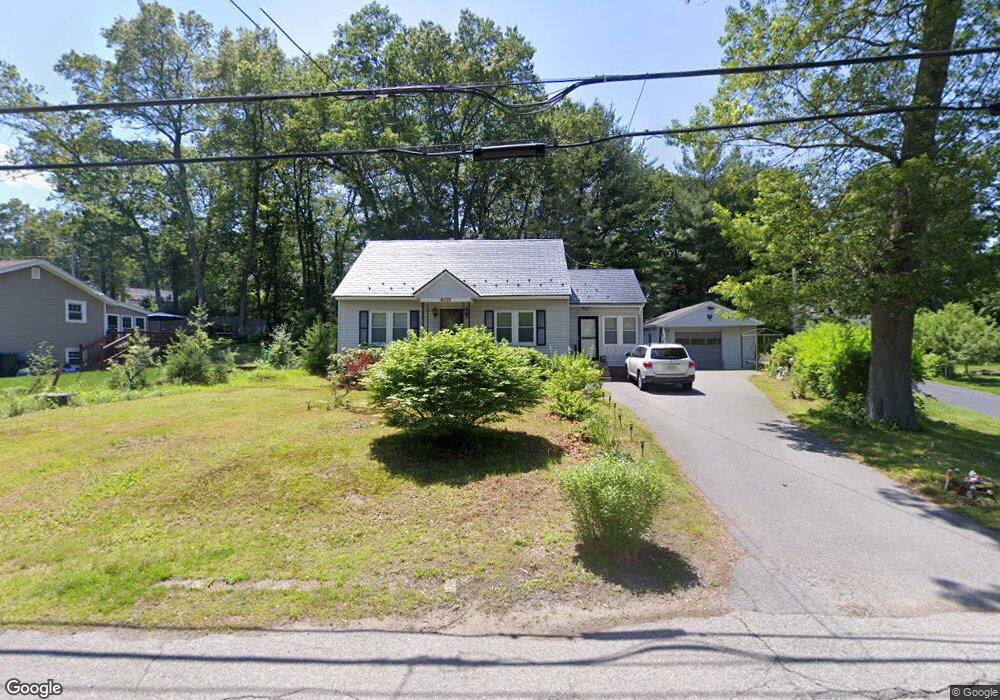
312 Sladen St Dracut, MA 01826
Estimated Value: $534,683 - $597,000
3
Beds
1
Bath
1,662
Sq Ft
$343/Sq Ft
Est. Value
About This Home
This home is located at 312 Sladen St, Dracut, MA 01826 and is currently estimated at $570,171, approximately $343 per square foot. 312 Sladen St is a home located in Middlesex County with nearby schools including George H. Englesby Elementary School, Richardson Middle School, and Dracut Senior High School.
Ownership History
Date
Name
Owned For
Owner Type
Purchase Details
Closed on
Feb 23, 2022
Sold by
Thibeault Edward A
Bought by
Desmarais Judith A
Current Estimated Value
Home Financials for this Owner
Home Financials are based on the most recent Mortgage that was taken out on this home.
Original Mortgage
$200,000
Outstanding Balance
$184,292
Interest Rate
3.55%
Mortgage Type
Purchase Money Mortgage
Estimated Equity
$385,879
Purchase Details
Closed on
Nov 13, 1964
Bought by
Thibeault Marion
Create a Home Valuation Report for This Property
The Home Valuation Report is an in-depth analysis detailing your home's value as well as a comparison with similar homes in the area
Home Values in the Area
Average Home Value in this Area
Purchase History
| Date | Buyer | Sale Price | Title Company |
|---|---|---|---|
| Desmarais Judith A | $175,000 | None Available | |
| Thibeault Marion | -- | -- |
Source: Public Records
Mortgage History
| Date | Status | Borrower | Loan Amount |
|---|---|---|---|
| Open | Desmarais Judith A | $200,000 |
Source: Public Records
Tax History
| Year | Tax Paid | Tax Assessment Tax Assessment Total Assessment is a certain percentage of the fair market value that is determined by local assessors to be the total taxable value of land and additions on the property. | Land | Improvement |
|---|---|---|---|---|
| 2025 | $5,141 | $508,000 | $199,500 | $308,500 |
| 2024 | $4,934 | $472,200 | $190,000 | $282,200 |
| 2023 | $4,758 | $410,900 | $165,200 | $245,700 |
| 2022 | $4,641 | $377,600 | $150,100 | $227,500 |
| 2021 | $4,498 | $345,700 | $136,500 | $209,200 |
| 2020 | $4,352 | $326,000 | $132,400 | $193,600 |
| 2019 | $3,982 | $289,600 | $126,100 | $163,500 |
| 2018 | $3,812 | $269,600 | $126,100 | $143,500 |
| 2017 | $3,599 | $269,600 | $126,100 | $143,500 |
| 2016 | $3,487 | $235,000 | $121,200 | $113,800 |
| 2015 | $3,419 | $229,000 | $121,200 | $107,800 |
| 2014 | $3,250 | $224,300 | $121,200 | $103,100 |
Source: Public Records
Map
Nearby Homes
- 551 Hildreth St Unit 10
- 19 Louis Farm Rd Unit 19
- 13 Louis Farm Rd Unit 13
- 75 Sladen St
- 16 Peabody Ave
- 15 Louis Farm Rd Unit 15
- 42 Frederick St Unit 9
- 417 Hildreth St Unit 30
- 94 Hampson St
- 1563 Bridge St
- 1573 Bridge St
- 23 Frank St Unit 2
- 26 Frank St
- 91 Frederick St Unit 77
- 367 Hildreth St Unit 14
- 154 New Boston Rd
- 345 Hildreth St Unit 14
- 1391 Bridge St
- 101 Donohue Rd Unit 19
- 26 Farmland Rd Unit C
- 304 Sladen St
- 320 Sladen St
- 23 Stevens St
- 15 Stevens St
- 330 Sladen St
- 27 Stevens St
- 63 Turner Ave
- 303 Sladen St
- 286 Sladen St
- 319 Sladen St
- 318 Sladen St
- 333 Sladen St
- 31 Stevens St
- 20 Stevens St
- 59 Turner Ave
- 309 Sladen St Unit Right-B
- 309 Sladen St Unit Left-A
- 60 Turner Ave
- 339 Sladen St
- 10 Stevens St
Your Personal Tour Guide
Ask me questions while you tour the home.