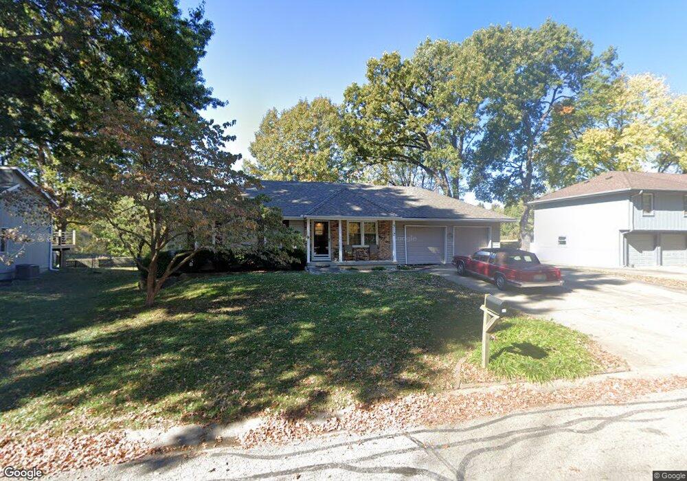
312 Southbrook St Liberty, MO 64068
Estimated Value: $260,000 - $292,000
3
Beds
3
Baths
988
Sq Ft
$275/Sq Ft
Est. Value
About This Home
This home is located at 312 Southbrook St, Liberty, MO 64068 and is currently estimated at $271,692, approximately $274 per square foot. 312 Southbrook St is a home located in Clay County with nearby schools including Alexander Doniphan Elementary School, Discovery Middle School, and Liberty High School.
Ownership History
Date
Name
Owned For
Owner Type
Purchase Details
Closed on
Apr 13, 2018
Sold by
Wales David L and Wales Krystal S
Bought by
Hatch Michael L
Current Estimated Value
Home Financials for this Owner
Home Financials are based on the most recent Mortgage that was taken out on this home.
Original Mortgage
$142,500
Outstanding Balance
$122,519
Interest Rate
4.43%
Mortgage Type
New Conventional
Estimated Equity
$149,173
Purchase Details
Closed on
Feb 7, 2000
Sold by
Love Dorothy L
Bought by
Wales David L and Wales Krystal S
Home Financials for this Owner
Home Financials are based on the most recent Mortgage that was taken out on this home.
Original Mortgage
$84,575
Interest Rate
7.95%
Create a Home Valuation Report for This Property
The Home Valuation Report is an in-depth analysis detailing your home's value as well as a comparison with similar homes in the area
Home Values in the Area
Average Home Value in this Area
Purchase History
| Date | Buyer | Sale Price | Title Company |
|---|---|---|---|
| Hatch Michael L | -- | Metropolitan Title & Escrow | |
| Wales David L | -- | Security Land Title Company |
Source: Public Records
Mortgage History
| Date | Status | Borrower | Loan Amount |
|---|---|---|---|
| Open | Hatch Michael L | $142,500 | |
| Previous Owner | Wales David L | $84,575 |
Source: Public Records
Tax History Compared to Growth
Tax History
| Year | Tax Paid | Tax Assessment Tax Assessment Total Assessment is a certain percentage of the fair market value that is determined by local assessors to be the total taxable value of land and additions on the property. | Land | Improvement |
|---|---|---|---|---|
| 2025 | $2,249 | $32,790 | -- | -- |
| 2024 | $2,249 | $30,460 | -- | -- |
| 2023 | $2,282 | $30,460 | $0 | $0 |
| 2022 | $2,113 | $27,890 | $0 | $0 |
| 2021 | $2,122 | $27,892 | $5,700 | $22,192 |
| 2020 | $2,016 | $25,000 | $0 | $0 |
| 2019 | $2,017 | $25,004 | $5,700 | $19,304 |
| 2018 | $1,868 | $22,740 | $0 | $0 |
| 2017 | $1,719 | $22,740 | $4,180 | $18,560 |
| 2016 | $1,719 | $21,150 | $4,180 | $16,970 |
| 2015 | $1,719 | $21,150 | $4,180 | $16,970 |
| 2014 | $1,723 | $21,150 | $4,180 | $16,970 |
Source: Public Records
Map
Nearby Homes
- 124 Johnson Rd
- 2116 Winding Woods Dr
- Lot 2A Oak Crest Dr
- Lot 2 Bent Oaks Dr
- 1733 Welleslay Ln
- 1929 Longview Dr
- 2153 Black Walnut Dr
- 2152 Black Walnut Dr
- 2157 Black Walnut Dr
- 2156 Black Walnut Dr
- 1507 Amesbury Ave
- 1980 Longview Dr
- 1984 Longview Dr
- 1972 Longview Dr
- 1973 Longview Dr
- 1969 Longview Dr
- 1991 Harvest Rd
- 1537 Canterbury Ln
- 2181 Heritage Ct
- 1913 Longview Dr
- 310 Southbrook St
- 314 Southbrook St
- 315 Southbrook St
- 308 Southbrook St
- 316 Southbrook St
- 319 Southbrook St
- 311 Southbrook St
- 306 Southbrook St
- 214 Lake Ave
- 309 Southbrook St
- 1817 Bur Oak Dr
- 126 Johnson Rd
- 304 Southbrook St
- 1820 Bur Oak Dr
- 307 Southbrook St
- 1813 Bur Oak Dr
- 128 Johnson Rd
- 122 Johnson Rd
- 302 Southbrook St