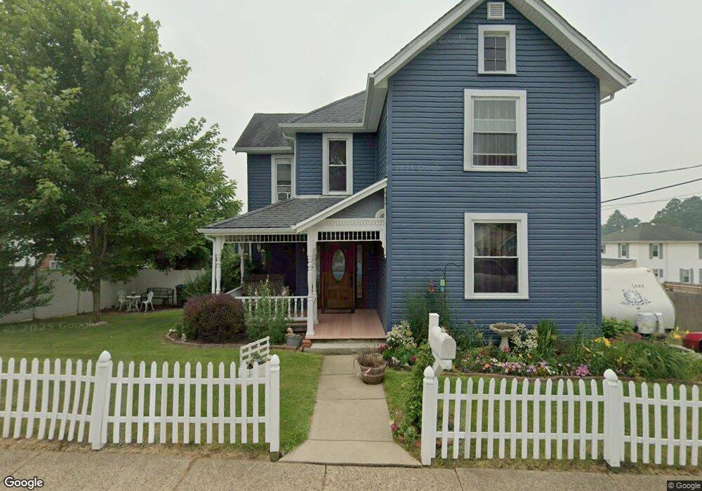
312 Vine St Barnesville, OH 43713
Estimated Value: $156,908 - $207,000
4
Beds
1
Bath
2,252
Sq Ft
$77/Sq Ft
Est. Value
About This Home
This home is located at 312 Vine St, Barnesville, OH 43713 and is currently estimated at $174,477, approximately $77 per square foot. 312 Vine St is a home located in Belmont County with nearby schools including Barnesville Elementary School, Barnesville Middle School, and Barnesville High School.
Ownership History
Date
Name
Owned For
Owner Type
Purchase Details
Closed on
Jun 10, 1997
Sold by
Fisher Douglas L and Fisher Debora
Bought by
Fisher Douglas L and Fisher Debora
Current Estimated Value
Purchase Details
Closed on
May 31, 1995
Sold by
Ackley Scott D and Ackley Evelyn M
Bought by
Ackley Scott D and Ackley Evelyn M
Purchase Details
Closed on
Mar 22, 1994
Sold by
Baumler Edward F and Baumler Jane M
Bought by
Baumler Edward F and Baumler Jane M
Purchase Details
Closed on
Jan 1, 1986
Sold by
Mott John A and Surv Joann
Bought by
Mott John A and Joann Surv
Create a Home Valuation Report for This Property
The Home Valuation Report is an in-depth analysis detailing your home's value as well as a comparison with similar homes in the area
Home Values in the Area
Average Home Value in this Area
Purchase History
| Date | Buyer | Sale Price | Title Company |
|---|---|---|---|
| Fisher Douglas L | $63,500 | -- | |
| Ackley Scott D | $65,000 | -- | |
| Baumler Edward F | $37,000 | -- | |
| Mott John A | -- | -- |
Source: Public Records
Tax History Compared to Growth
Tax History
| Year | Tax Paid | Tax Assessment Tax Assessment Total Assessment is a certain percentage of the fair market value that is determined by local assessors to be the total taxable value of land and additions on the property. | Land | Improvement |
|---|---|---|---|---|
| 2024 | $1,666 | $51,570 | $2,930 | $48,640 |
| 2023 | $1,128 | $33,460 | $2,480 | $30,980 |
| 2022 | $1,127 | $33,464 | $2,482 | $30,982 |
| 2021 | $1,130 | $33,460 | $2,478 | $30,982 |
| 2020 | $985 | $27,890 | $2,070 | $25,820 |
| 2019 | $988 | $27,890 | $2,070 | $25,820 |
| 2018 | $981 | $27,890 | $2,070 | $25,820 |
| 2017 | $846 | $23,460 | $2,420 | $21,040 |
| 2016 | $793 | $23,460 | $2,420 | $21,040 |
| 2015 | $790 | $23,460 | $2,420 | $21,040 |
| 2014 | $820 | $24,120 | $2,200 | $21,920 |
| 2013 | $823 | $24,120 | $2,200 | $21,920 |
Source: Public Records
Map
Nearby Homes
- 316 Vine St
- 248 Franklin St
- 310 Franklin St
- 301 S Lincoln Ave
- 335 S Lincoln Ave
- 247 S Lincoln Ave
- 307 S Lincoln Ave
- 243 S Lincoln Ave
- 317 S Lincoln Ave
- 101 Flower Dr
- 247 Franklin St
- 240 Franklin St
- 101 Flower St
- 322 Franklin St
- 302 S Lincoln Ave
- 241 S Lincoln Ave
- 243 Franklin St
- 306 S Lincoln Ave
- 236 Franklin St
- 240 S Lincoln Ave