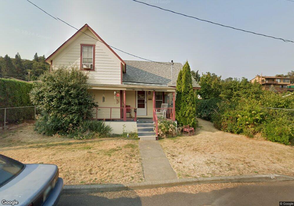
312 W 15th St the Dalles, OR 97058
Estimated Value: $284,645 - $311,000
3
Beds
1
Bath
1,273
Sq Ft
$234/Sq Ft
Est. Value
About This Home
This home is located at 312 W 15th St, the Dalles, OR 97058 and is currently estimated at $297,823, approximately $233 per square foot. 312 W 15th St is a home located in Wasco County with nearby schools including Colonel Wright Elementary School, The Dalles Middle School, and The Dalles High School.
Ownership History
Date
Name
Owned For
Owner Type
Purchase Details
Closed on
Oct 27, 2023
Sold by
Barkume Alex and Barkume Audrey
Bought by
Martinson Rick and Martinson Mary Louise
Current Estimated Value
Purchase Details
Closed on
Sep 22, 2023
Sold by
Thomas Eugelson Jr James and Thomas Ann Engelson
Bought by
Martinson Rick and Martinson Mary Louise
Purchase Details
Closed on
Jul 25, 2023
Sold by
Campbell Patricia and Smith Kathleen
Bought by
Martinson Rick and Martinson Mary Louise
Create a Home Valuation Report for This Property
The Home Valuation Report is an in-depth analysis detailing your home's value as well as a comparison with similar homes in the area
Home Values in the Area
Average Home Value in this Area
Purchase History
| Date | Buyer | Sale Price | Title Company |
|---|---|---|---|
| Martinson Rick | $1,500 | None Listed On Document | |
| Martinson Rick | $18,800 | None Listed On Document | |
| Martinson Rick | $8,400 | None Listed On Document |
Source: Public Records
Tax History Compared to Growth
Tax History
| Year | Tax Paid | Tax Assessment Tax Assessment Total Assessment is a certain percentage of the fair market value that is determined by local assessors to be the total taxable value of land and additions on the property. | Land | Improvement |
|---|---|---|---|---|
| 2024 | $1,549 | $86,037 | -- | -- |
| 2023 | $1,504 | $83,532 | $0 | $0 |
| 2022 | $1,470 | $163,141 | $0 | $0 |
| 2021 | $1,425 | $158,389 | $0 | $0 |
| 2020 | $1,390 | $153,776 | $0 | $0 |
| 2019 | $1,468 | $149,297 | $0 | $0 |
| 2018 | $1,427 | $72,055 | $0 | $0 |
| 2017 | $1,382 | $69,956 | $0 | $0 |
| 2016 | $1,352 | $67,918 | $0 | $0 |
| 2015 | $1,115 | $55,314 | $0 | $0 |
| 2014 | $1,084 | $53,703 | $0 | $0 |
Source: Public Records
Map
Nearby Homes