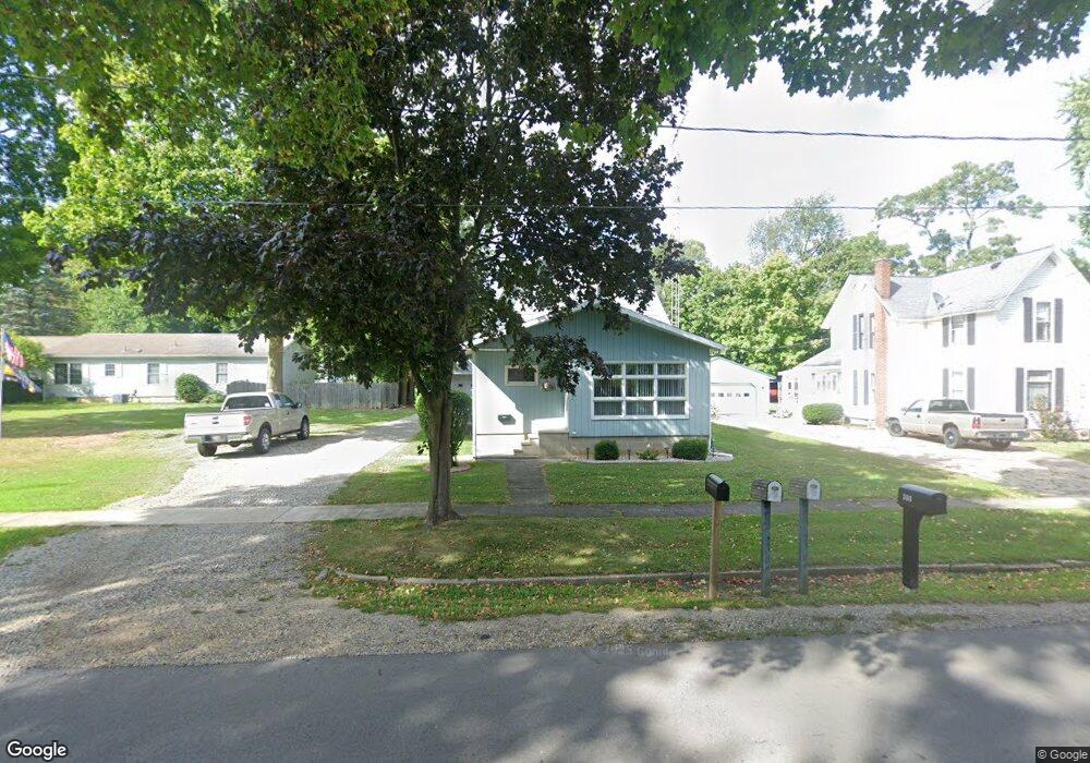
312 W Main St North Adams, MI 49262
Estimated Value: $136,973 - $191,000
--
Bed
1
Bath
1,080
Sq Ft
$148/Sq Ft
Est. Value
About This Home
This home is located at 312 W Main St, North Adams, MI 49262 and is currently estimated at $160,243, approximately $148 per square foot. 312 W Main St is a home located in Hillsdale County with nearby schools including North Adams-Jerome Elementary School and North Adams-Jerome Middle/High School.
Ownership History
Date
Name
Owned For
Owner Type
Purchase Details
Closed on
Apr 30, 2015
Sold by
Hicksenhiser Michelle and Dwyer Michelle
Bought by
Dwyer Chad W
Current Estimated Value
Home Financials for this Owner
Home Financials are based on the most recent Mortgage that was taken out on this home.
Original Mortgage
$68,000
Outstanding Balance
$25,231
Interest Rate
3.63%
Mortgage Type
New Conventional
Estimated Equity
$135,012
Purchase Details
Closed on
Nov 23, 1998
Sold by
Taylor Edward J and Taylor Sarah A
Bought by
Dwyer Chad
Purchase Details
Closed on
Sep 8, 1998
Sold by
Smith Dale L and Smith Barbara
Bought by
Dwyer Chad W
Create a Home Valuation Report for This Property
The Home Valuation Report is an in-depth analysis detailing your home's value as well as a comparison with similar homes in the area
Home Values in the Area
Average Home Value in this Area
Purchase History
| Date | Buyer | Sale Price | Title Company |
|---|---|---|---|
| Dwyer Chad W | -- | Midstate Title | |
| Dwyer Chad | -- | -- | |
| Dwyer Chad W | $66,500 | -- |
Source: Public Records
Mortgage History
| Date | Status | Borrower | Loan Amount |
|---|---|---|---|
| Open | Dwyer Chad W | $68,000 |
Source: Public Records
Tax History Compared to Growth
Tax History
| Year | Tax Paid | Tax Assessment Tax Assessment Total Assessment is a certain percentage of the fair market value that is determined by local assessors to be the total taxable value of land and additions on the property. | Land | Improvement |
|---|---|---|---|---|
| 2025 | $1,053 | $62,300 | $0 | $0 |
| 2024 | $695 | $49,900 | $0 | $0 |
| 2023 | $662 | $49,900 | $0 | $0 |
| 2022 | $958 | $57,500 | $0 | $0 |
| 2021 | $934 | $55,600 | $0 | $0 |
| 2020 | $930 | $47,500 | $0 | $0 |
| 2019 | $928 | $43,000 | $0 | $0 |
| 2018 | $894 | $43,700 | $0 | $0 |
| 2017 | $864 | $44,080 | $0 | $0 |
| 2016 | $861 | $41,220 | $0 | $0 |
| 2015 | $294 | $41,220 | $0 | $0 |
| 2013 | $343 | $31,460 | $0 | $0 |
| 2012 | -- | $30,540 | $0 | $0 |
Source: Public Records
Map
Nearby Homes
- 6333 Brown Rd
- 5160 Barker Rd
- 5435 State Rd
- 0 Combs Rd
- 0 Moscow Rd
- 4219 Kim Dr
- 2331 Slater Rd
- 5560 Dewey Rd
- 3189 N Lake Pleasant Rd
- 4794 Keith Rd
- 4745 Keith Rd
- 4545 State Rd
- 8470 Moscow Rd
- 0 Gay Rd Unit 25052115
- 6838 Moreland Rd
- 7751 Moreland Rd
- 10531 Wood Rd
- V/L Half Moon Lake Rd
- 9159-D Moreland Rd
- 0 Oakridge Dr