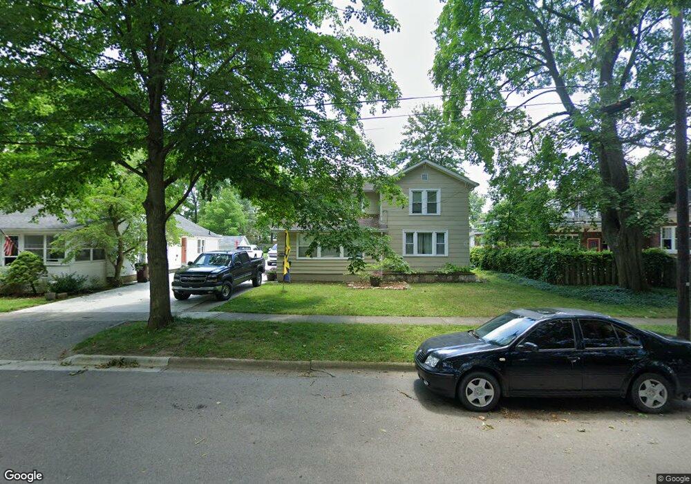
312 W Shawnee St Tecumseh, MI 49286
Estimated Value: $167,000 - $223,000
4
Beds
1
Bath
1,560
Sq Ft
$125/Sq Ft
Est. Value
About This Home
This home is located at 312 W Shawnee St, Tecumseh, MI 49286 and is currently estimated at $194,677, approximately $124 per square foot. 312 W Shawnee St is a home located in Lenawee County with nearby schools including Tecumseh Middle School, Herrick Park Intermediate Learning Center, and Tecumseh High School.
Ownership History
Date
Name
Owned For
Owner Type
Purchase Details
Closed on
Aug 14, 2017
Sold by
Hall Gary D and Bortel Sandra
Bought by
Yovanov Kelly
Current Estimated Value
Home Financials for this Owner
Home Financials are based on the most recent Mortgage that was taken out on this home.
Original Mortgage
$61,250
Outstanding Balance
$51,067
Interest Rate
3.93%
Mortgage Type
New Conventional
Estimated Equity
$143,610
Purchase Details
Closed on
Jun 9, 2014
Sold by
Hall Helen and Hall Dustin C
Bought by
Hall Gary D and Bortel Sandra
Create a Home Valuation Report for This Property
The Home Valuation Report is an in-depth analysis detailing your home's value as well as a comparison with similar homes in the area
Home Values in the Area
Average Home Value in this Area
Purchase History
| Date | Buyer | Sale Price | Title Company |
|---|---|---|---|
| Yovanov Kelly | $64,000 | None Available | |
| Hall Gary D | -- | None Available |
Source: Public Records
Mortgage History
| Date | Status | Borrower | Loan Amount |
|---|---|---|---|
| Open | Yovanov Kelly | $61,250 |
Source: Public Records
Tax History Compared to Growth
Tax History
| Year | Tax Paid | Tax Assessment Tax Assessment Total Assessment is a certain percentage of the fair market value that is determined by local assessors to be the total taxable value of land and additions on the property. | Land | Improvement |
|---|---|---|---|---|
| 2025 | $2,228 | $75,500 | $0 | $0 |
| 2024 | $1,885 | $70,800 | $0 | $0 |
| 2023 | $2,192 | $63,800 | $0 | $0 |
| 2022 | $2,108 | $61,500 | $0 | $0 |
| 2021 | $2,236 | $59,100 | $0 | $0 |
| 2020 | $2,215 | $55,600 | $0 | $0 |
| 2019 | $2,177 | $51,600 | $8,200 | $43,400 |
| 2017 | $2,703 | $45,700 | $8,200 | $37,500 |
| 2016 | $2,698 | $43,000 | $7,500 | $35,500 |
| 2014 | $1,677 | $37,700 | $8,300 | $29,400 |
Source: Public Records
Map
Nearby Homes
- 301 W Shawnee St
- 413 W Pottawatamie St
- 705 W Chicago Blvd
- 509 W Cummins St
- 210 S Ottawa St
- 215 S Oneida St
- 102 N Maumee St
- 408 E Logan St
- 416 E Logan St
- 224 Maple St
- 510 E Logan St
- 723 Red Mill Point
- 730 Red Mill Point
- Integrity 1880 Plan at Lone Oak of Red Mill Pond
- Elements 2200 Plan at Lone Oak of Red Mill Pond - Elements
- Integrity 2000 Plan at Lone Oak of Red Mill Pond
- Elements 2070 Plan at Lone Oak of Red Mill Pond - Elements
- Integrity 1530 Plan at Lone Oak of Red Mill Pond
- Integrity 2085 Plan at Lone Oak of Red Mill Pond
- Integrity 1830 Plan at Lone Oak of Red Mill Pond
- 310 W Shawnee St
- 214 N Union St
- 212 N Union St
- 211 N Maiden Ln
- 211 N Maiden Ln Unit 211 N. Maiden Ln
- 213 N Maiden Ln
- 215 N Maiden Ln
- 210 N Union St
- 309 W Shawnee St
- 311 W Shawnee St
- 206 N Union St
- 208 N Union St
- 305 W Shawnee St
- 315 W Shawnee St
- 207 N Maiden Ln
- 215 N Union St
- 205 N Maiden Ln
- 301 N Union St
- 213 N Union St
- 311 W Logan St