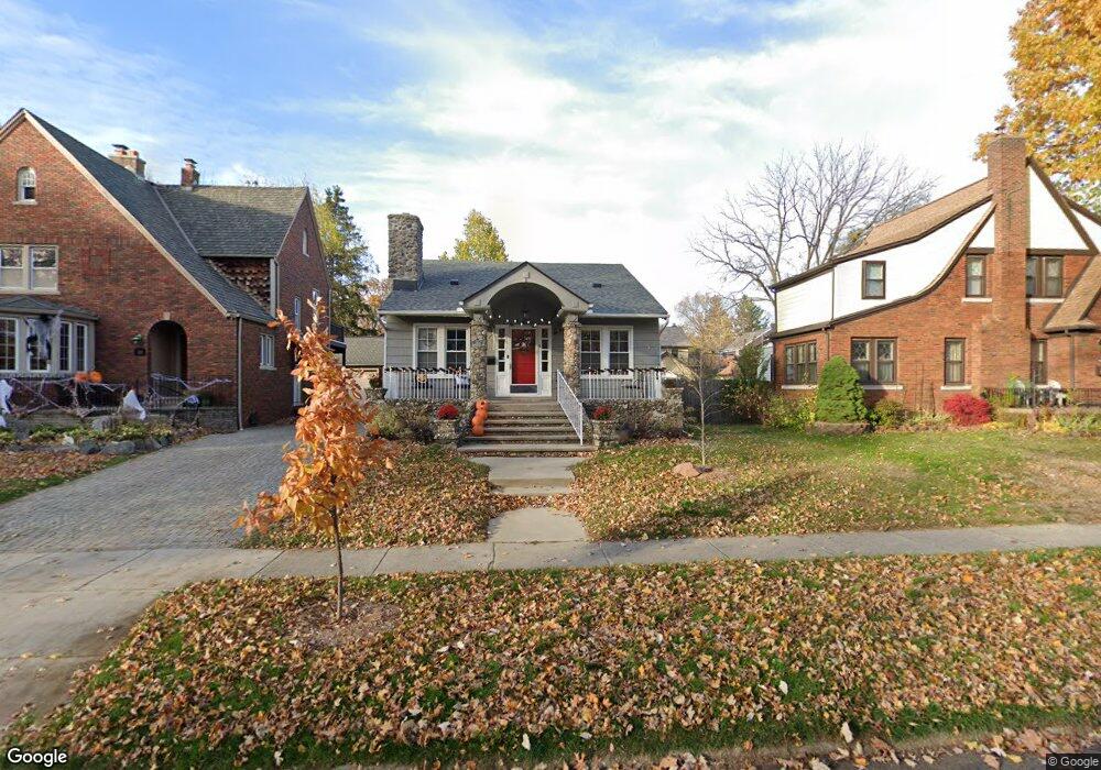
312 W Woodland St Unit Bldg-Unit Ferndale, MI 48220
Estimated Value: $450,000 - $501,000
3
Beds
2
Baths
1,498
Sq Ft
$315/Sq Ft
Est. Value
About This Home
This home is located at 312 W Woodland St Unit Bldg-Unit, Ferndale, MI 48220 and is currently estimated at $472,303, approximately $315 per square foot. 312 W Woodland St Unit Bldg-Unit is a home located in Oakland County with nearby schools including Ferndale Lower Elementary Campus, Ferndale Upper Elementary Campus, and Ferndale Middle School.
Ownership History
Date
Name
Owned For
Owner Type
Purchase Details
Closed on
Jun 20, 2022
Sold by
Anderson Collin J
Bought by
Brown Cameron E
Current Estimated Value
Home Financials for this Owner
Home Financials are based on the most recent Mortgage that was taken out on this home.
Original Mortgage
$320,000
Outstanding Balance
$304,428
Interest Rate
5.25%
Mortgage Type
New Conventional
Estimated Equity
$167,875
Purchase Details
Closed on
Apr 26, 2019
Sold by
Sturm Eric Karl and Esshaki Sheila M
Bought by
Anderson Collin J and Meltzer Lauren M
Purchase Details
Closed on
Feb 6, 2018
Sold by
Benson Matthew J and Barrett Benson Jennifer
Bought by
Sturm Eric Karl and Esshakl Sheila M
Home Financials for this Owner
Home Financials are based on the most recent Mortgage that was taken out on this home.
Original Mortgage
$288,000
Interest Rate
3.99%
Mortgage Type
New Conventional
Purchase Details
Closed on
Dec 26, 2013
Sold by
Greene Erika A
Bought by
Benson Matthew J and Barrett Benson Jennifer
Home Financials for this Owner
Home Financials are based on the most recent Mortgage that was taken out on this home.
Original Mortgage
$209,700
Interest Rate
4.31%
Mortgage Type
New Conventional
Purchase Details
Closed on
Dec 9, 2005
Sold by
Speagle Le
Bought by
Greene Erika A
Purchase Details
Closed on
Dec 1, 2004
Sold by
Mortgage Electronic Registration Systems
Bought by
Jp Morgan Chase Bank
Home Financials for this Owner
Home Financials are based on the most recent Mortgage that was taken out on this home.
Original Mortgage
$140,300
Interest Rate
8.95%
Mortgage Type
Purchase Money Mortgage
Purchase Details
Closed on
Aug 24, 2004
Sold by
Zanetti Pamela M
Bought by
Mortgage Electronic Registration Systems
Purchase Details
Closed on
Sep 19, 2003
Sold by
Hartner Margaret and Hartner Frederick Edmund
Bought by
Zanetti Pamela M
Home Financials for this Owner
Home Financials are based on the most recent Mortgage that was taken out on this home.
Original Mortgage
$163,530
Interest Rate
8.85%
Mortgage Type
Purchase Money Mortgage
Create a Home Valuation Report for This Property
The Home Valuation Report is an in-depth analysis detailing your home's value as well as a comparison with similar homes in the area
Home Values in the Area
Average Home Value in this Area
Purchase History
| Date | Buyer | Sale Price | Title Company |
|---|---|---|---|
| Brown Cameron E | $425,000 | Title One | |
| Brown Cameron E | $425,000 | Title One | |
| Anderson Collin J | $340,000 | Devon Title Agency | |
| Sturm Eric Karl | $320,000 | Title Source Inc | |
| Benson Matthew J | $235,400 | Title Source Inc | |
| Greene Erika A | $250,000 | Parks Title | |
| Jp Morgan Chase Bank | -- | Parks Title | |
| Mortgage Electronic Registration Systems | $153,000 | -- | |
| Zanetti Pamela M | $172,141 | Metropolitan Title Company |
Source: Public Records
Mortgage History
| Date | Status | Borrower | Loan Amount |
|---|---|---|---|
| Open | Brown Cameron E | $320,000 | |
| Previous Owner | Sturm Eric Karl | $288,000 | |
| Previous Owner | Benson Matthew J | $209,700 | |
| Previous Owner | Jp Morgan Chase Bank | $140,300 | |
| Previous Owner | Zanetti Pamela M | $163,530 |
Source: Public Records
Tax History Compared to Growth
Tax History
| Year | Tax Paid | Tax Assessment Tax Assessment Total Assessment is a certain percentage of the fair market value that is determined by local assessors to be the total taxable value of land and additions on the property. | Land | Improvement |
|---|---|---|---|---|
| 2024 | $9,134 | $189,590 | $0 | $0 |
| 2023 | $8,890 | $176,550 | $0 | $0 |
| 2022 | $8,950 | $168,030 | $0 | $0 |
| 2021 | $9,025 | $163,040 | $0 | $0 |
| 2020 | $8,599 | $161,910 | $0 | $0 |
| 2019 | $8,445 | $153,360 | $0 | $0 |
| 2018 | $4,877 | $142,760 | $0 | $0 |
| 2017 | $4,814 | $137,200 | $0 | $0 |
| 2016 | $4,761 | $124,590 | $0 | $0 |
| 2015 | -- | $110,220 | $0 | $0 |
| 2014 | -- | $72,470 | $0 | $0 |
| 2011 | -- | $66,370 | $0 | $0 |
Source: Public Records
Map
Nearby Homes
- 437 W Drayton St
- 367 W Cambourne St
- 629 W Lewiston Ave
- 20 Oxford Blvd
- 3 Fairwood Blvd
- 475 W Breckenridge St
- 203 E Lewiston Ave
- 619 Withington St
- 271 E Maplehurst St
- 256 Withington St
- 815 W Oakridge St
- 1924 Pinecrest Dr
- 630 W Troy St
- 838 W Oakridge St
- 487 W Troy St
- 317 E Cambourne St
- 1709 Beaufield St
- 910 W Maplehurst St
- 571 W Saratoga St
- 573 E Oakridge St
- 312 W Woodland St
- 320 W Woodland St
- 332 W Woodland St
- 304 W Woodland St
- 292 W Woodland St
- 340 W Woodland St
- 340 W Woodland St
- 331 W Drayton St
- 303 W Drayton St
- 321 W Drayton St
- 352 W Woodland St
- 291 W Drayton St
- 282 W Woodland St
- 311 W Woodland St
- 311 W Woodland St
- 303 W Woodland St
- 323 W Woodland St
- 281 W Drayton St
- 274 W Woodland St
- 333 W Woodland St