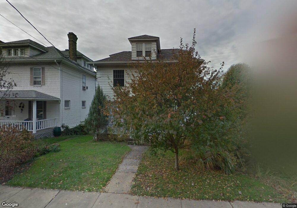
312 Wagner Rd Morgantown, WV 26501
South Park NeighborhoodEstimated Value: $249,000 - $335,000
4
Beds
1
Bath
1,868
Sq Ft
$154/Sq Ft
Est. Value
About This Home
This home is located at 312 Wagner Rd, Morgantown, WV 26501 and is currently estimated at $287,880, approximately $154 per square foot. 312 Wagner Rd is a home located in Monongalia County with nearby schools including Mountainview Elementary School, South Middle School, and Morgantown High School.
Ownership History
Date
Name
Owned For
Owner Type
Purchase Details
Closed on
Aug 25, 2023
Sold by
Roth Allan David and Janson Deborah Davis
Bought by
Roth Allan David and Davis Janson Deborah
Current Estimated Value
Purchase Details
Closed on
Dec 13, 2022
Sold by
Roth Allan David and Janson Deborah Davis
Bought by
Roth Allan David and Davis Janson Deborah
Create a Home Valuation Report for This Property
The Home Valuation Report is an in-depth analysis detailing your home's value as well as a comparison with similar homes in the area
Home Values in the Area
Average Home Value in this Area
Purchase History
| Date | Buyer | Sale Price | Title Company |
|---|---|---|---|
| Roth Allan David | -- | None Listed On Document | |
| Roth Allan David | -- | None Listed On Document | |
| Roth Allan David | -- | None Listed On Document |
Source: Public Records
Tax History Compared to Growth
Tax History
| Year | Tax Paid | Tax Assessment Tax Assessment Total Assessment is a certain percentage of the fair market value that is determined by local assessors to be the total taxable value of land and additions on the property. | Land | Improvement |
|---|---|---|---|---|
| 2025 | $1,618 | $122,700 | $45,180 | $77,520 |
| 2024 | $1,618 | $122,700 | $45,180 | $77,520 |
| 2023 | $1,614 | $122,700 | $45,180 | $77,520 |
| 2022 | $1,559 | $122,280 | $45,120 | $77,160 |
| 2021 | $1,565 | $122,280 | $45,120 | $77,160 |
| 2020 | $1,571 | $122,280 | $45,120 | $77,160 |
| 2019 | $1,580 | $122,280 | $45,120 | $77,160 |
| 2018 | $1,584 | $122,280 | $45,120 | $77,160 |
| 2017 | $1,480 | $113,820 | $42,540 | $71,280 |
| 2016 | $1,440 | $110,160 | $38,880 | $71,280 |
| 2015 | $1,345 | $106,680 | $35,400 | $71,280 |
| 2014 | $1,045 | $86,040 | $31,620 | $54,420 |
Source: Public Records
Map
Nearby Homes
- 328 S High St
- 313 Ford St
- 265 Waitman St
- 5 Maple Ave
- 503 Don Knotts Blvd
- 417 Elm St
- 422 Grand St
- 200 Logan Ave
- 541 Hess St
- 636 Madison Ave
- 421 Ash St
- 653 Madigan Ave
- 1117 University Ave
- 338 Jackson Ave
- 670 Elysian Ave
- 200 Webster Ave
- 712 W Virginia Ave
- 134 Birds Eye View Dr
- 975 Dorsey Ave
- 239 Walnut St