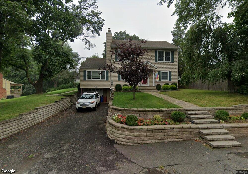
312 Warren Ave Stirling, NJ 07980
Estimated Value: $684,000 - $780,000
--
Bed
--
Bath
2,028
Sq Ft
$361/Sq Ft
Est. Value
About This Home
This home is located at 312 Warren Ave, Stirling, NJ 07980 and is currently estimated at $732,037, approximately $360 per square foot. 312 Warren Ave is a home located in Morris County with nearby schools including Gillette Elementary School, Millington Elementary School, and Central Middle School.
Ownership History
Date
Name
Owned For
Owner Type
Purchase Details
Closed on
Aug 3, 2004
Sold by
312 Warren Ave Assoc
Bought by
Dorsi Matthew and Dorsi Carla
Current Estimated Value
Home Financials for this Owner
Home Financials are based on the most recent Mortgage that was taken out on this home.
Original Mortgage
$216,000
Outstanding Balance
$107,325
Interest Rate
6.03%
Estimated Equity
$624,712
Purchase Details
Closed on
May 21, 2004
Sold by
Dorsi Matthew
Bought by
Dorsi Albert and Dorsi Richard
Create a Home Valuation Report for This Property
The Home Valuation Report is an in-depth analysis detailing your home's value as well as a comparison with similar homes in the area
Home Values in the Area
Average Home Value in this Area
Purchase History
| Date | Buyer | Sale Price | Title Company |
|---|---|---|---|
| Dorsi Matthew | $270,000 | -- | |
| Dorsi Albert | -- | -- |
Source: Public Records
Mortgage History
| Date | Status | Borrower | Loan Amount |
|---|---|---|---|
| Open | Dorsi Matthew | $216,000 |
Source: Public Records
Tax History Compared to Growth
Tax History
| Year | Tax Paid | Tax Assessment Tax Assessment Total Assessment is a certain percentage of the fair market value that is determined by local assessors to be the total taxable value of land and additions on the property. | Land | Improvement |
|---|---|---|---|---|
| 2025 | $12,156 | $562,000 | $224,100 | $337,900 |
| 2024 | $11,838 | $542,200 | $219,100 | $323,100 |
| 2023 | $11,838 | $527,300 | $214,100 | $313,200 |
| 2022 | $11,113 | $505,800 | $204,100 | $301,700 |
| 2021 | $11,113 | $451,000 | $186,600 | $264,400 |
| 2020 | $10,928 | $451,000 | $186,600 | $264,400 |
| 2019 | $10,733 | $448,700 | $185,100 | $263,600 |
| 2018 | $10,236 | $430,800 | $182,100 | $248,700 |
| 2017 | $10,048 | $426,500 | $179,100 | $247,400 |
| 2016 | $9,883 | $420,900 | $174,100 | $246,800 |
| 2015 | $7,623 | $260,000 | $137,100 | $122,900 |
| 2014 | $7,457 | $260,000 | $137,100 | $122,900 |
Source: Public Records
Map
Nearby Homes