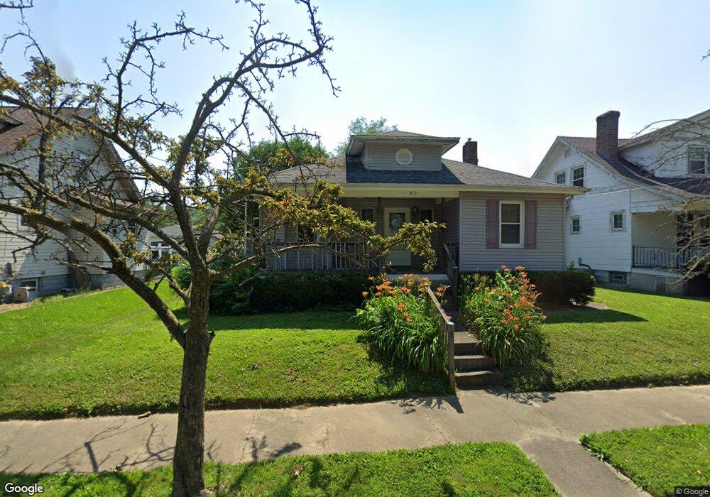
312 Westview Ave Cincinnati, OH 45215
Estimated Value: $111,291 - $145,000
2
Beds
1
Bath
876
Sq Ft
$144/Sq Ft
Est. Value
About This Home
This home is located at 312 Westview Ave, Cincinnati, OH 45215 and is currently estimated at $125,823, approximately $143 per square foot. 312 Westview Ave is a home located in Hamilton County with nearby schools including Lockland Elementary School, Lockland Middle School, and Lockland High School.
Ownership History
Date
Name
Owned For
Owner Type
Purchase Details
Closed on
Oct 17, 2008
Sold by
Mcelvain Shirley A and Mcelvain Theresa L
Bought by
Coffey Bill
Current Estimated Value
Home Financials for this Owner
Home Financials are based on the most recent Mortgage that was taken out on this home.
Original Mortgage
$49,200
Outstanding Balance
$31,393
Interest Rate
5.94%
Mortgage Type
New Conventional
Estimated Equity
$94,430
Purchase Details
Closed on
Nov 20, 1996
Sold by
Weis Earl and Weis Loretta
Bought by
Mcelvain Shirley Ann
Home Financials for this Owner
Home Financials are based on the most recent Mortgage that was taken out on this home.
Original Mortgage
$25,000
Interest Rate
7.94%
Create a Home Valuation Report for This Property
The Home Valuation Report is an in-depth analysis detailing your home's value as well as a comparison with similar homes in the area
Home Values in the Area
Average Home Value in this Area
Purchase History
| Date | Buyer | Sale Price | Title Company |
|---|---|---|---|
| Coffey Bill | $61,500 | Cincinnatus Title | |
| Mcelvain Shirley Ann | $61,000 | -- |
Source: Public Records
Mortgage History
| Date | Status | Borrower | Loan Amount |
|---|---|---|---|
| Open | Coffey Bill | $49,200 | |
| Previous Owner | Mcelvain Shirley Ann | $25,000 |
Source: Public Records
Tax History
| Year | Tax Paid | Tax Assessment Tax Assessment Total Assessment is a certain percentage of the fair market value that is determined by local assessors to be the total taxable value of land and additions on the property. | Land | Improvement |
|---|---|---|---|---|
| 2025 | $511 | $19,387 | $5,628 | $13,759 |
| 2023 | $562 | $19,387 | $5,628 | $13,759 |
| 2022 | $1,055 | $15,292 | $4,515 | $10,777 |
| 2021 | $1,049 | $15,292 | $4,515 | $10,777 |
| 2020 | $916 | $15,292 | $4,515 | $10,777 |
| 2019 | $874 | $13,654 | $4,032 | $9,622 |
| 2018 | $861 | $13,654 | $4,032 | $9,622 |
| 2017 | $809 | $13,654 | $4,032 | $9,622 |
| 2016 | $1,030 | $17,651 | $4,134 | $13,517 |
| 2015 | $968 | $17,651 | $4,134 | $13,517 |
| 2014 | $967 | $17,651 | $4,134 | $13,517 |
| 2013 | $1,149 | $21,525 | $5,040 | $16,485 |
Source: Public Records
Map
Nearby Homes
- 112 Bacon St
- 313 Pershing Ave
- 401 Jonte Ave
- 414 Jonte Ave
- 454 Hillside Ave
- 1076 Schumard Ave
- 329 Walnut St
- 435 Pearl St
- 724 Walnut St
- 1421 Jefferson Ave
- 701 W Wyoming Ave
- 1401 Chamberlain Ave
- 306 Pearl St
- 910 Byrd Ave
- 4111 North St
- 129 Pike St
- 1040 Burns Ave
- 406 Williams St
- 415 Arlington Ave
- 314 Elm St
- 314 Westview Ave
- 316 Westview Ave
- 308 Westview Ave
- 313 N Cooper Ave
- 315 N Cooper Ave
- 306 Westview Ave
- 311 N Cooper Ave
- 317 N Cooper Ave
- 309 N Cooper Ave
- 304 Westview Ave
- 319 N Cooper Ave
- 320 Westview Ave
- 307 N Cooper Ave
- 317 Westview Ave
- 305 N Cooper Ave
- 302 Westview Ave
- 322 Westview Ave
- 52 Herbert Ave
- 6 Herbert Ave
- 1 Herbert Ave
Your Personal Tour Guide
Ask me questions while you tour the home.