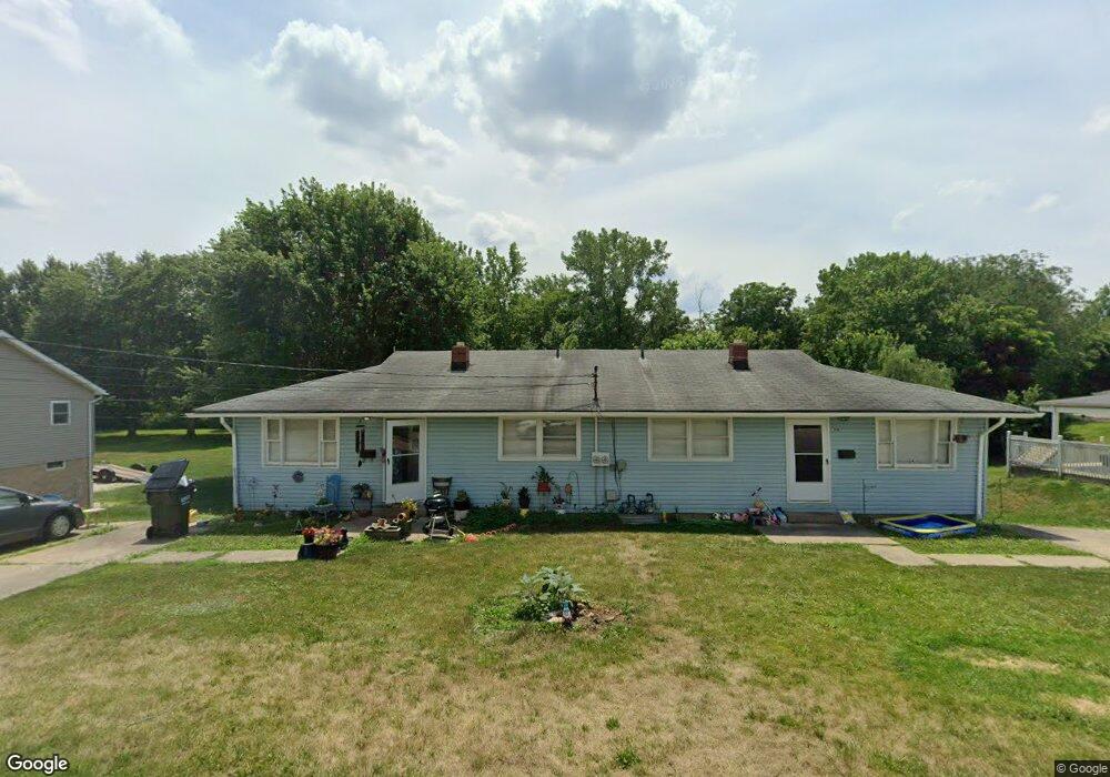
312 Woodard Ave Louisville, OH 44641
Estimated Value: $153,682 - $154,000
4
Beds
2
Baths
1,508
Sq Ft
$102/Sq Ft
Est. Value
About This Home
This home is located at 312 Woodard Ave, Louisville, OH 44641 and is currently estimated at $153,921, approximately $102 per square foot. 312 Woodard Ave is a home located in Stark County with nearby schools including Louisville High School and St. Thomas Aquinas High School & Middle School.
Ownership History
Date
Name
Owned For
Owner Type
Purchase Details
Closed on
Nov 6, 2024
Sold by
Belt Roland J
Bought by
Freedom Rei Solutions Llc
Current Estimated Value
Home Financials for this Owner
Home Financials are based on the most recent Mortgage that was taken out on this home.
Original Mortgage
$116,250
Outstanding Balance
$115,084
Interest Rate
6.08%
Mortgage Type
New Conventional
Estimated Equity
$38,837
Purchase Details
Closed on
May 26, 1995
Sold by
Leno Louis A
Bought by
Belt Roland J and Belt Jane
Create a Home Valuation Report for This Property
The Home Valuation Report is an in-depth analysis detailing your home's value as well as a comparison with similar homes in the area
Home Values in the Area
Average Home Value in this Area
Purchase History
| Date | Buyer | Sale Price | Title Company |
|---|---|---|---|
| Freedom Rei Solutions Llc | $150,000 | Patriot Title | |
| Belt Roland J | $35,500 | -- |
Source: Public Records
Mortgage History
| Date | Status | Borrower | Loan Amount |
|---|---|---|---|
| Open | Freedom Rei Solutions Llc | $116,250 |
Source: Public Records
Tax History Compared to Growth
Tax History
| Year | Tax Paid | Tax Assessment Tax Assessment Total Assessment is a certain percentage of the fair market value that is determined by local assessors to be the total taxable value of land and additions on the property. | Land | Improvement |
|---|---|---|---|---|
| 2025 | -- | $46,660 | $14,980 | $31,680 |
| 2024 | $3,424 | $38,190 | $14,980 | $23,210 |
| 2023 | $3,424 | $32,450 | $10,570 | $21,880 |
| 2022 | $1,434 | $32,450 | $10,570 | $21,880 |
| 2021 | $1,438 | $32,450 | $10,570 | $21,880 |
| 2020 | $1,190 | $29,050 | $9,520 | $19,530 |
| 2019 | $1,190 | $29,050 | $9,520 | $19,530 |
| 2018 | $1,191 | $29,050 | $9,520 | $19,530 |
| 2017 | $1,078 | $25,350 | $8,020 | $17,330 |
| 2016 | $1,100 | $25,350 | $8,020 | $17,330 |
| 2015 | $1,074 | $25,350 | $8,020 | $17,330 |
| 2014 | $1,146 | $24,500 | $7,770 | $16,730 |
| 2013 | $577 | $24,500 | $7,770 | $16,730 |
Source: Public Records
Map
Nearby Homes
- 300 Kennedy St
- 428 Honeycrisp Dr NE
- 3047 Mcintosh Dr NE
- 432 Honeycrisp Dr NE
- 2962 Mcintosh Dr NE
- 2963 Mcintosh Dr NE
- 430 Honeycrisp Dr NE
- 2957 Mcintosh Dr NE
- 325 Lincoln Ave
- 614 Reno Dr
- 316 E Reno Dr
- 524 Glenbar St
- 910 Crosswyck Cir
- 1170 Winding Ridge Ave
- 1149 Sturbridge Dr
- 1175 Sturbridge Dr
- 107 E Broad St
- 0 Glenbar St
- 5474 Ravenna Ave
- 204 E Broad St
- 316Woodard Ave
- 404 Woodard Ave
- 302 Woodard Ave
- 315 Woodard Ave
- 210 Woodard Ave
- 418 Woodward Ave
- 309 Woodard Ave
- 403 Woodard Ave
- 215 Woodard Ave
- 212 Woodard Ave
- 409 Woodard Ave
- 419 Woodard Ave
- 211 Woodard Ave
- 413 Woodard Ave
- 203 Woodard Ave
- 150 Frana Clara St Unit 8
- 150 Frana Clara St
- 150 Frana Clara St Unit 5
- 906 Constitution Ave
- 130 Frana Clara St