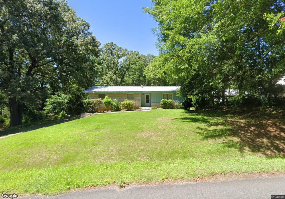
312 Wright St Jasper, AL 35501
Estimated Value: $125,041 - $169,000
Studio
--
Bath
1,324
Sq Ft
$111/Sq Ft
Est. Value
About This Home
This home is located at 312 Wright St, Jasper, AL 35501 and is currently estimated at $147,010, approximately $111 per square foot. 312 Wright St is a home located in Walker County with nearby schools including T. R. Simmons Elementary School, Maddox Intermediate School, and Memorial Park Elementary School.
Ownership History
Date
Name
Owned For
Owner Type
Purchase Details
Closed on
May 16, 2022
Sold by
Mitchell Maggie
Bought by
Key Bennett Sarah and Key Brian Carter
Current Estimated Value
Home Financials for this Owner
Home Financials are based on the most recent Mortgage that was taken out on this home.
Original Mortgage
$31,383
Outstanding Balance
$29,808
Interest Rate
5.23%
Mortgage Type
Construction
Estimated Equity
$117,202
Create a Home Valuation Report for This Property
The Home Valuation Report is an in-depth analysis detailing your home's value as well as a comparison with similar homes in the area
Home Values in the Area
Average Home Value in this Area
Purchase History
| Date | Buyer | Sale Price | Title Company |
|---|---|---|---|
| Key Bennett Sarah | $40,000 | Attorney Only |
Source: Public Records
Mortgage History
| Date | Status | Borrower | Loan Amount |
|---|---|---|---|
| Open | Key Bennett Sarah | $31,383 |
Source: Public Records
Tax History
| Year | Tax Paid | Tax Assessment Tax Assessment Total Assessment is a certain percentage of the fair market value that is determined by local assessors to be the total taxable value of land and additions on the property. | Land | Improvement |
|---|---|---|---|---|
| 2024 | $827 | $20,680 | $2,400 | $18,280 |
| 2023 | $827 | $18,580 | $2,400 | $16,180 |
| 2022 | $656 | $16,400 | $2,400 | $14,000 |
| 2021 | $642 | $15,188 | $2,400 | $12,788 |
| 2020 | $607 | $15,180 | $2,400 | $12,780 |
| 2019 | $583 | $14,580 | $2,400 | $12,180 |
| 2018 | $0 | $7,380 | $1,200 | $6,180 |
| 2017 | $0 | $7,380 | $1,200 | $6,180 |
| 2016 | $0 | $7,380 | $1,200 | $6,180 |
| 2015 | -- | $7,080 | $1,200 | $5,880 |
| 2014 | -- | $6,980 | $1,200 | $5,780 |
| 2013 | -- | $6,980 | $1,200 | $5,780 |
Source: Public Records
Map
Nearby Homes
- 1209 Alabama Ave
- 0 Airport Rd S Unit 14-1278
- 0 Airport Rd S Unit 14-1276
- 0 Airport Rd S Unit 11400018
- 0 Airport Rd S Unit 14-1277
- 919 Pine St
- 707 Highland Ave
- 607 Highland Ave
- 0 Alabama Ave
- 1512 Alabama Ave
- 1506 Gamble Ave
- 1101 S Walston Bridge Rd
- 1004 Quarry Hill Rd
- 707 S 4th Ave
- 0 College Hill Rd
- 304 6th St W
- 604 4th Ave S
- 407 Glenview Dr
- 1304 5th Ave S
- 1200 Valley Rd
- 910 N Delaware Ave
- 310 Wright St
- 908 N Delaware Ave
- 906 N Delaware Ave
- 608 Wright St
- 1110 Engel Cir
- 904 N Delaware Ave
- 907 N Delaware Ave
- 1106 Engel Cir
- 610 Wright St
- 502 Crest Cir N
- 500 Crest Cir N
- 901 Airport Rd S
- 819 Airport Rd S
- 710 Highway 78 E
- 900 N Delaware Ave
- 504 Crest Cir N
- 1001 Alabama Ave
- 1001 Alabama Ave
- 612 Wright St
Your Personal Tour Guide
Ask me questions while you tour the home.