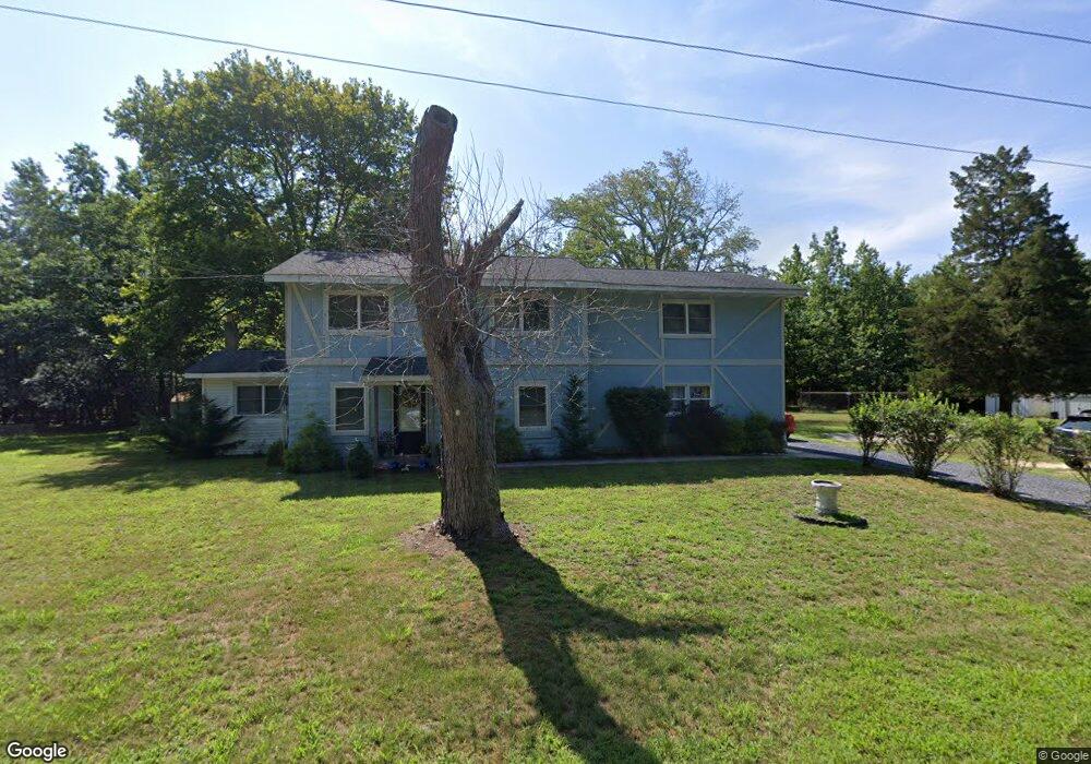
3120 Cleveland Ave Mays Landing, NJ 08330
Estimated Value: $326,000 - $428,000
--
Bed
--
Bath
2,182
Sq Ft
$172/Sq Ft
Est. Value
About This Home
This home is located at 3120 Cleveland Ave, Mays Landing, NJ 08330 and is currently estimated at $375,327, approximately $172 per square foot. 3120 Cleveland Ave is a home located in Atlantic County with nearby schools including Joseph Shaner School, George L. Hess Educational Complex, and William Davies Middle School.
Ownership History
Date
Name
Owned For
Owner Type
Purchase Details
Closed on
Oct 2, 2007
Sold by
Hood Christopher and Mohr Sue Ann
Bought by
Swanson Joseph and Swanson Lillie A
Current Estimated Value
Home Financials for this Owner
Home Financials are based on the most recent Mortgage that was taken out on this home.
Original Mortgage
$196,800
Outstanding Balance
$124,272
Interest Rate
6.43%
Mortgage Type
Purchase Money Mortgage
Estimated Equity
$251,055
Purchase Details
Closed on
Jun 11, 1998
Sold by
Hood Christopher and Hood Sue Ann
Bought by
Hood Christopher and Hood Sue Ann
Purchase Details
Closed on
Dec 29, 1994
Sold by
Bankers Trust Company
Bought by
Hood Christopher
Purchase Details
Closed on
Jul 8, 1993
Sold by
Dibenedetto Carmen A Sheriff
Bought by
Bankers Trust Company
Create a Home Valuation Report for This Property
The Home Valuation Report is an in-depth analysis detailing your home's value as well as a comparison with similar homes in the area
Home Values in the Area
Average Home Value in this Area
Purchase History
| Date | Buyer | Sale Price | Title Company |
|---|---|---|---|
| Swanson Joseph | $246,000 | Independence Abstract & Titl | |
| Hood Christopher | -- | -- | |
| Hood Christopher | $75,000 | Congress Title Corporation | |
| Bankers Trust Company | $3,700 | -- |
Source: Public Records
Mortgage History
| Date | Status | Borrower | Loan Amount |
|---|---|---|---|
| Open | Swanson Joseph | $196,800 |
Source: Public Records
Tax History Compared to Growth
Tax History
| Year | Tax Paid | Tax Assessment Tax Assessment Total Assessment is a certain percentage of the fair market value that is determined by local assessors to be the total taxable value of land and additions on the property. | Land | Improvement |
|---|---|---|---|---|
| 2025 | $5,534 | $161,300 | $53,500 | $107,800 |
| 2024 | $5,534 | $161,300 | $53,500 | $107,800 |
| 2023 | $5,204 | $161,300 | $53,500 | $107,800 |
| 2022 | $5,204 | $161,300 | $53,500 | $107,800 |
| 2021 | $5,192 | $161,300 | $53,500 | $107,800 |
| 2020 | $5,192 | $161,300 | $53,500 | $107,800 |
| 2019 | $5,205 | $161,300 | $53,500 | $107,800 |
| 2018 | $5,023 | $161,300 | $53,500 | $107,800 |
| 2017 | $4,944 | $161,300 | $53,500 | $107,800 |
| 2016 | $4,805 | $161,300 | $53,500 | $107,800 |
| 2015 | $4,642 | $161,300 | $53,500 | $107,800 |
| 2014 | $4,676 | $178,000 | $61,900 | $116,100 |
Source: Public Records
Map
Nearby Homes
- 0 Dahlia St
- 547 S Cincinnati Ave
- 617 S County Blvd
- 1409 Fairmont St
- 1409 W Fairmont Ave
- 1321 W North St
- 1412 W Cleveland Ave
- 00 Holly St
- 5777 Holly St
- 5827 Holly St
- 3058 Chicago Ave
- 1500 White Horse Pike
- 5013 White Horse Pike
- 29 Liverpool Ave
- 115 Buffalo Ave
- 1525 W Aloe St
- 119 Buffalo Ave
- 31 London Ave
- 134 Buffalo Ave
- 5630 Oslo Ave
- 5809 Chestnut St
- 5829 Chestnut St
- 5786 Chestnut St
- 5808 Chestnut St
- 5849 Chestnut St
- 0 Chestnut St
- 711 S Boston Ave
- 711 S Boston Ave
- 1223 W Dahlia St
- 1223 W Dahlia St
- 734 S New Orleans Ave
- 710 S Cape May Ave
- 5929 Chestnut St
- 1240 Crocus St
- 1232 Crocus St
- 1220 Crocus St
- 1218 Crocus St
- 1310 W Crocus St
- 1223 Crocus St
- 5948 Chestnut St