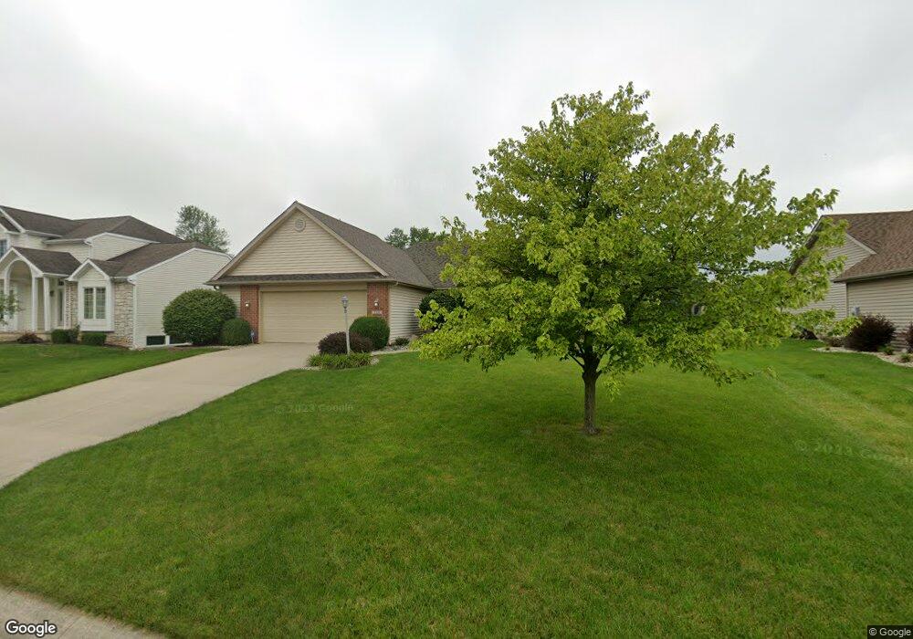
3120 Shallowbrook Dr Fort Wayne, IN 46814
Estimated Value: $300,000 - $342,000
3
Beds
2
Baths
1,716
Sq Ft
$184/Sq Ft
Est. Value
About This Home
This home is located at 3120 Shallowbrook Dr, Fort Wayne, IN 46814 and is currently estimated at $315,585, approximately $183 per square foot. 3120 Shallowbrook Dr is a home located in Allen County with nearby schools including Covington Elementary School, Woodside Middle School, and Homestead Senior High School.
Ownership History
Date
Name
Owned For
Owner Type
Purchase Details
Closed on
Oct 29, 2025
Sold by
Ramsey Ronald R and Ramsey Elsie J
Bought by
Ramsey Elsie J
Current Estimated Value
Purchase Details
Closed on
Sep 25, 2009
Sold by
Sackett Samuel G
Bought by
Ramsey Ronald R and Ramsey Elsie J
Purchase Details
Closed on
May 28, 2004
Sold by
Aspen Bay Inc
Bought by
Sackett Samuel G
Home Financials for this Owner
Home Financials are based on the most recent Mortgage that was taken out on this home.
Original Mortgage
$120,250
Interest Rate
6.17%
Purchase Details
Closed on
Feb 18, 2004
Sold by
Walnut Springs Developers Llc
Bought by
Aspen Bay Inc
Home Financials for this Owner
Home Financials are based on the most recent Mortgage that was taken out on this home.
Original Mortgage
$118,000
Interest Rate
5.77%
Create a Home Valuation Report for This Property
The Home Valuation Report is an in-depth analysis detailing your home's value as well as a comparison with similar homes in the area
Home Values in the Area
Average Home Value in this Area
Purchase History
| Date | Buyer | Sale Price | Title Company |
|---|---|---|---|
| Ramsey Elsie J | -- | None Listed On Document | |
| Ramsey Ronald R | -- | None Available | |
| Sackett Samuel G | -- | Three Rivers Title Co Inc | |
| Aspen Bay Inc | -- | -- |
Source: Public Records
Mortgage History
| Date | Status | Borrower | Loan Amount |
|---|---|---|---|
| Previous Owner | Sackett Samuel G | $120,250 | |
| Previous Owner | Aspen Bay Inc | $118,000 |
Source: Public Records
Tax History Compared to Growth
Tax History
| Year | Tax Paid | Tax Assessment Tax Assessment Total Assessment is a certain percentage of the fair market value that is determined by local assessors to be the total taxable value of land and additions on the property. | Land | Improvement |
|---|---|---|---|---|
| 2024 | $1,828 | $266,200 | $59,900 | $206,300 |
| 2023 | $1,828 | $258,600 | $35,100 | $223,500 |
| 2022 | $1,432 | $218,200 | $35,100 | $183,100 |
| 2021 | $1,328 | $199,100 | $35,100 | $164,000 |
| 2020 | $1,174 | $179,600 | $35,100 | $144,500 |
| 2019 | $1,090 | $166,200 | $35,100 | $131,100 |
| 2018 | $1,004 | $157,800 | $35,100 | $122,700 |
| 2017 | $1,166 | $167,000 | $35,100 | $131,900 |
| 2016 | $1,133 | $160,600 | $35,100 | $125,500 |
| 2014 | $991 | $146,500 | $35,100 | $111,400 |
| 2013 | $1,030 | $145,600 | $35,100 | $110,500 |
Source: Public Records
Map
Nearby Homes
- 3119 Shallowbrook Dr
- 14610 E Walnut Run
- 3438 Buckeye Run
- 3113 Pinoak Ct
- 14533 Bitternut Ln
- 14606 Bitternut Ln
- 3358 Treviso Cove
- 3723 Torrey Pines Pkwy
- 3321 Treviso Cove
- 11130 Kola Crossover Unit 98
- 11162 Kola Crossover Unit 97
- 10844 Kola Crossover Unit 26
- 11088 Kola Crossover Unit 145
- 10908 Kola Crossover Unit 28
- 10789 Kola Crossover Unit 39
- 10704 Kola Crossover Unit 21
- 10822 Kola Crossover Unit 25
- 11466 Kola Crossover Unit 88
- 11358 Kola Crossover
- 10736 Kola Crossover Unit 22
- 3112 Shallowbrook Dr
- 3128 Shallowbrook Dr
- 3202 Shallowbrook Dr
- 15211 Firethorne Path
- 3127 Shallowbrook Dr
- 3111 Shallowbrook Dr
- 3003 Weatherstone Ct
- 3204 Shallowbrook Dr
- 3103 Shallowbrook Dr
- 3207 Shallowbrook Dr
- 15124 Butterbough Ln
- 3208 Shallowbrook Dr
- 15216 Firethorne Path
- 15208 Firethorne Path
- 3115 W County Line Rd S
- 15224 Firethorne Path
- 3221 Shallowbrook Dr
- 15118 Butterbough Ln
- 15121 Butterbough Ln
- 3030 Weatherstone Ct