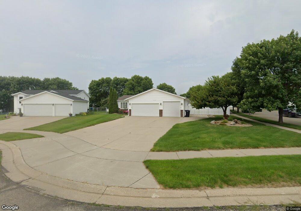
3120 Sheridan Cir Bismarck, ND 58503
North Bismarck NeighborhoodEstimated Value: $375,000 - $396,342
4
Beds
2
Baths
1,142
Sq Ft
$336/Sq Ft
Est. Value
About This Home
This home is located at 3120 Sheridan Cir, Bismarck, ND 58503 and is currently estimated at $383,586, approximately $335 per square foot. 3120 Sheridan Cir is a home located in Burleigh County with nearby schools including Sunrise Elementary School, Simle Middle School, and Legacy High School.
Ownership History
Date
Name
Owned For
Owner Type
Purchase Details
Closed on
Sep 30, 2019
Sold by
Lackman A Ruben and Lackman Lois M
Bought by
Lackman A Ruben and Lackman Lois A
Current Estimated Value
Purchase Details
Closed on
Jun 3, 2019
Sold by
Aarestad Michael A and Aarestad Shirley J
Bought by
Lackman A Ruben and Lackman Lois M
Create a Home Valuation Report for This Property
The Home Valuation Report is an in-depth analysis detailing your home's value as well as a comparison with similar homes in the area
Home Values in the Area
Average Home Value in this Area
Purchase History
| Date | Buyer | Sale Price | Title Company |
|---|---|---|---|
| Lackman A Ruben | -- | None Available | |
| Lackman A Ruben | $270,000 | Bismarck Title Co |
Source: Public Records
Tax History Compared to Growth
Tax History
| Year | Tax Paid | Tax Assessment Tax Assessment Total Assessment is a certain percentage of the fair market value that is determined by local assessors to be the total taxable value of land and additions on the property. | Land | Improvement |
|---|---|---|---|---|
| 2024 | $3,686 | $148,450 | $32,000 | $116,450 |
| 2023 | $3,839 | $148,450 | $32,000 | $116,450 |
| 2022 | $3,910 | $147,250 | $32,000 | $115,250 |
| 2021 | $3,866 | $137,250 | $30,000 | $107,250 |
| 2020 | $3,651 | $132,850 | $30,000 | $102,850 |
| 2019 | $3,126 | $127,800 | $0 | $0 |
| 2018 | $2,902 | $127,800 | $26,000 | $101,800 |
| 2017 | $2,418 | $127,800 | $26,000 | $101,800 |
| 2016 | $2,418 | $127,800 | $21,000 | $106,800 |
| 2014 | -- | $111,950 | $0 | $0 |
Source: Public Records
Map
Nearby Homes
- 3201 Roosevelt Dr
- 4422 N Arlington Dr
- 4251 Claridge Loop
- 4124 W Arlington Dr
- 4773 British Dr
- 2727 Lexington Dr
- 4001 Greensboro Dr
- 5039 Redcoat Dr
- 2526 Berkshire Dr
- 5031 Hitchcock Dr
- 3347 Tyndale Dr
- 3212 Jericho Rd
- 3326 Tyndale Dr
- 3906 Roosevelt Dr
- 4821 Trenton Dr
- 4003 E Calgary Ave
- Xxx U S Highway 83
- 2500 Centennial Rd Unit 410
- 2500 Centennial Rd Unit 232
- 2500 Centennial Rd Unit 600
- 3110 Sheridan Cir
- 3125 Stonewall Dr
- 3119 Stonewall Dr
- 3106 Sheridan Cir
- 3121 Sheridan Cir
- 3107 Stonewall Dr
- 4326 Turnbow Ln
- 4330 Turnbow Ln
- 4322 Turnbow Ln
- 3101 Stonewall Dr
- 4400 Turnbow Ln
- 4316 Turnbow Ln
- 4310 Turnbow Ln
- 3033 Stonewall Dr
- 3102 Sheridan Cir
- 3115 Sheridan Cir
- 4404 Turnbow Ln
- 3105 Sheridan Cir
- 3029 Stonewall Dr
- 4408 Turnbow Ln