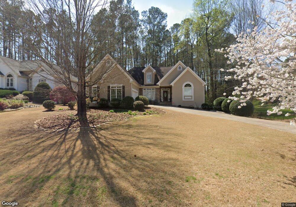
3120 Willow Wisp Way Cumming, GA 30040
Estimated Value: $622,305 - $702,000
4
Beds
4
Baths
2,128
Sq Ft
$310/Sq Ft
Est. Value
About This Home
This home is located at 3120 Willow Wisp Way, Cumming, GA 30040 and is currently estimated at $658,826, approximately $309 per square foot. 3120 Willow Wisp Way is a home located in Forsyth County with nearby schools including Sawnee Elementary School, Hendricks Middle School, and Forsyth Central High School.
Ownership History
Date
Name
Owned For
Owner Type
Purchase Details
Closed on
May 12, 2010
Sold by
Andrick Jerry C and Andrick Stacey S
Bought by
Mccollister Jamie K
Current Estimated Value
Home Financials for this Owner
Home Financials are based on the most recent Mortgage that was taken out on this home.
Original Mortgage
$271,345
Outstanding Balance
$185,832
Interest Rate
5.5%
Mortgage Type
FHA
Estimated Equity
$472,994
Purchase Details
Closed on
Feb 21, 1996
Sold by
Bldrsinc Carman
Bought by
Andrick Jerry Stacey
Purchase Details
Closed on
Aug 15, 1995
Sold by
Conrad M C
Bought by
Carman Bldrs In C
Create a Home Valuation Report for This Property
The Home Valuation Report is an in-depth analysis detailing your home's value as well as a comparison with similar homes in the area
Home Values in the Area
Average Home Value in this Area
Purchase History
| Date | Buyer | Sale Price | Title Company |
|---|---|---|---|
| Mccollister Jamie K | $275,000 | -- | |
| Andrick Jerry Stacey | $186,000 | -- | |
| Carman Bldrs In C | $35,000 | -- |
Source: Public Records
Mortgage History
| Date | Status | Borrower | Loan Amount |
|---|---|---|---|
| Open | Mccollister Jamie K | $271,345 | |
| Closed | Carman Bldrs In C | $0 |
Source: Public Records
Tax History Compared to Growth
Tax History
| Year | Tax Paid | Tax Assessment Tax Assessment Total Assessment is a certain percentage of the fair market value that is determined by local assessors to be the total taxable value of land and additions on the property. | Land | Improvement |
|---|---|---|---|---|
| 2025 | $4,551 | $238,440 | $56,000 | $182,440 |
| 2024 | $4,551 | $228,884 | $52,000 | $176,884 |
| 2023 | $4,010 | $217,088 | $52,000 | $165,088 |
| 2022 | $4,073 | $153,648 | $30,000 | $123,648 |
| 2021 | $3,748 | $153,648 | $30,000 | $123,648 |
| 2020 | $3,503 | $141,788 | $26,000 | $115,788 |
| 2019 | $3,357 | $134,444 | $24,000 | $110,444 |
| 2018 | $3,125 | $122,664 | $24,000 | $98,664 |
| 2017 | $3,160 | $123,708 | $20,000 | $103,708 |
| 2016 | $2,962 | $114,348 | $20,000 | $94,348 |
| 2015 | $2,586 | $96,348 | $16,000 | $80,348 |
| 2014 | $2,574 | $102,248 | $0 | $0 |
Source: Public Records
Map
Nearby Homes
- 2850 Sawnee View Dr
- 2820 Elderberry Ln
- 2810 Brookfield Cir
- 3142 Chamblee Gap Rd
- 2425 Barley Crest Pass
- 2405 Boxwalking Ct
- 2930 Amble Valley Ave
- 2980 Prestwood Dr
- 3505 Knobcone Dr
- 2520 Barley Downs Cir
- 2330 Cheatham Creek Ct
- 2870 Prestwood Dr
- 2710 Laurel Gate Ln
- 2860 Prestwood Dr
- 1910 Beech Springs Ct
- 0 Bethelview Rd Unit 7645827
- 0 Bethelview Rd Unit 7598310
- 0 Bethelview Rd Unit 10600103
- 0 Bethelview Rd Unit 10102046
- 0 Bethelview Rd Unit 7130265
- 3130 Willow Wisp Way
- 3115 Sawnee Lake Trail
- 3125 Sawnee Lake Trail
- 3140 Willow Wisp Way
- 3135 Sawnee Lake Trail
- 3115 Willow Wisp Way
- 3105 Willow Wisp Way
- 3045 Willow Wisp Way
- 3040 Willow Wisp Way Unit 57
- 3040 Willow Wisp Way
- 3135 Willow Wisp Way
- 2875 Brookfield Cir
- 3125 Willow Wisp Way
- 2885 Brookfield Cir
- 2865 Brookfield Cir
- 3145 Sawnee Lake Trail
- 2855 Brookfield Cir
- 3020 Willow Wisp Way Unit 58
- 3020 Willow Wisp Way
- 3035 Willow Wisp Way