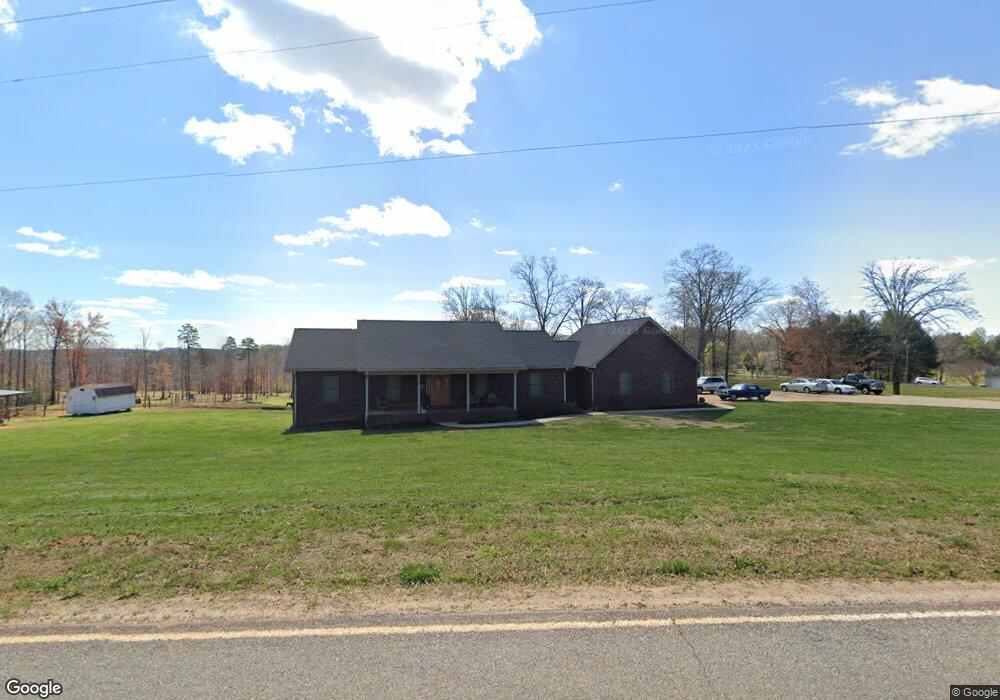
3121 Drumstand Rd Stony Point, NC 28678
Stony Point NeighborhoodEstimated Value: $384,000 - $462,000
3
Beds
3
Baths
2,141
Sq Ft
$198/Sq Ft
Est. Value
About This Home
This home is located at 3121 Drumstand Rd, Stony Point, NC 28678 and is currently estimated at $424,155, approximately $198 per square foot. 3121 Drumstand Rd is a home located in Alexander County with nearby schools including Stony Point Elementary School, East Alexander Middle School, and Alexander Central High School.
Ownership History
Date
Name
Owned For
Owner Type
Purchase Details
Closed on
Jul 14, 2021
Sold by
Jones Danny Keith
Bought by
Jones Danny Keith
Current Estimated Value
Purchase Details
Closed on
Nov 5, 2008
Sold by
Jones Danny Keith
Bought by
Jones Danny Keith
Home Financials for this Owner
Home Financials are based on the most recent Mortgage that was taken out on this home.
Original Mortgage
$125,000
Interest Rate
6.01%
Mortgage Type
Construction
Create a Home Valuation Report for This Property
The Home Valuation Report is an in-depth analysis detailing your home's value as well as a comparison with similar homes in the area
Home Values in the Area
Average Home Value in this Area
Purchase History
| Date | Buyer | Sale Price | Title Company |
|---|---|---|---|
| Jones Danny Keith | -- | None Available | |
| Jones Danny Keith | -- | Benbow David | |
| Jones Danny Keith | -- | None Available |
Source: Public Records
Mortgage History
| Date | Status | Borrower | Loan Amount |
|---|---|---|---|
| Previous Owner | Jones Danny Keith | $125,000 |
Source: Public Records
Tax History
| Year | Tax Paid | Tax Assessment Tax Assessment Total Assessment is a certain percentage of the fair market value that is determined by local assessors to be the total taxable value of land and additions on the property. | Land | Improvement |
|---|---|---|---|---|
| 2025 | $2,786 | $381,618 | $22,385 | $359,233 |
| 2024 | $2,824 | $381,618 | $22,385 | $359,233 |
| 2023 | $2,824 | $381,618 | $22,385 | $359,233 |
| 2022 | $1,929 | $224,314 | $18,500 | $205,814 |
| 2021 | $1,929 | $224,314 | $18,500 | $205,814 |
| 2020 | $1,929 | $224,314 | $18,500 | $205,814 |
| 2019 | $1,929 | $224,314 | $18,500 | $205,814 |
| 2018 | $1,907 | $224,314 | $18,500 | $205,814 |
| 2017 | $1,907 | $224,314 | $18,500 | $205,814 |
| 2016 | $1,907 | $224,314 | $18,500 | $205,814 |
| 2015 | $1,907 | $224,314 | $18,500 | $205,814 |
| 2014 | $1,907 | $230,783 | $20,500 | $210,283 |
| 2012 | -- | $230,783 | $20,500 | $210,283 |
Source: Public Records
Map
Nearby Homes
- 2013 Carl Fox Rd
- 1975 Carl Fox Rd
- 51 Rosemont Dr
- 229 Drumstand Rd
- 218 Fulbright Rd
- 4247 Laurel Hill Rd
- 0 Old Mountain Rd Unit CAR4304814
- 4237 Laurel Hill Rd
- 4270 Laurel Hill Rd
- 105 Mountain Aire Dr
- 3108 Arden Way
- 547 Stewart Rock Rd
- 179 Riverwalk Rd
- 119 Wood Cove Ln
- 283 Rivercliff Dr Unit 20
- 44 Howard Norton Dr
- 136 Oak Point Ln
- 1218 Wittenburg Rd
- 145 Oak Point Ln
- 139 Oak Point Ln
- 3060 Drumstand Rd
- 9360 Paul Payne Store Rd
- 9360 Paul Payne Store Rd Unit 3
- 9342 Paul Payne Store Rd
- 9568 Paul Payne Store Rd
- 9300 Paul Payne Store Rd
- 2878 Drumstand Rd
- 9294 Paul Payne Store Rd
- 9704 Paul Payne Store Rd
- 9266 Paul Payne Store Rd
- 9520 Paul Payne Store Rd
- 9265 Paul Payne Store Rd
- 41 Taylor Rd
- 9214 Paul Payne Store Rd
- 43 Tyler Dr
- 00 Paul Payne Store Rd
- 9777 Paul Payne Store Rd
- 3041 Drumstand Rd
- 9794 Paul Payne Store Rd
- 9744 Paul Payne Store Rd
Your Personal Tour Guide
Ask me questions while you tour the home.