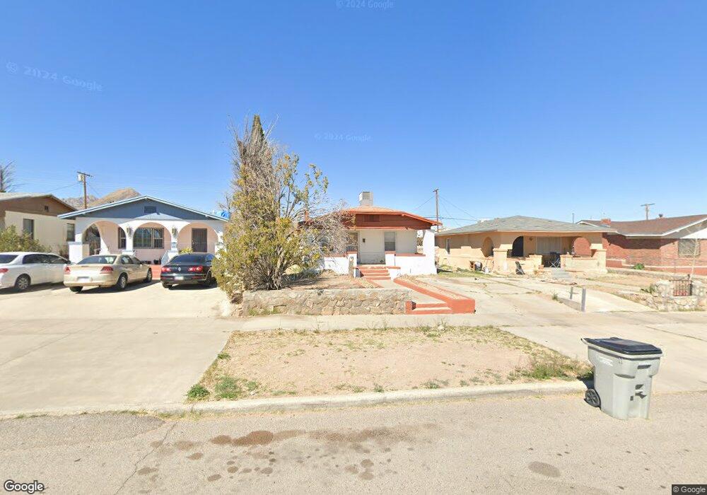
3121 Morehead Ave El Paso, TX 79930
Central NeighborhoodEstimated Value: $110,000 - $213,000
--
Bed
1
Bath
858
Sq Ft
$182/Sq Ft
Est. Value
About This Home
This home is located at 3121 Morehead Ave, El Paso, TX 79930 and is currently estimated at $155,962, approximately $181 per square foot. 3121 Morehead Ave is a home located in El Paso County with nearby schools including Rusk Elementary School, Middle School-5 NW Middle, and Austin High School.
Ownership History
Date
Name
Owned For
Owner Type
Purchase Details
Closed on
Jul 19, 2018
Sold by
Kpqsb Rentals Llc
Bought by
Quick Sell Holings Llc
Current Estimated Value
Purchase Details
Closed on
May 19, 2003
Sold by
Barraza Hector and Barraza Herlinda
Bought by
Quinones Fortunato and Quinones Maria Dejesus
Home Financials for this Owner
Home Financials are based on the most recent Mortgage that was taken out on this home.
Original Mortgage
$22,700
Interest Rate
5.74%
Mortgage Type
Purchase Money Mortgage
Create a Home Valuation Report for This Property
The Home Valuation Report is an in-depth analysis detailing your home's value as well as a comparison with similar homes in the area
Home Values in the Area
Average Home Value in this Area
Purchase History
| Date | Buyer | Sale Price | Title Company |
|---|---|---|---|
| Quick Sell Holings Llc | -- | None Available | |
| Quinones Fortunato | -- | -- |
Source: Public Records
Mortgage History
| Date | Status | Borrower | Loan Amount |
|---|---|---|---|
| Previous Owner | Quinones Fortunato | $22,700 |
Source: Public Records
Tax History Compared to Growth
Tax History
| Year | Tax Paid | Tax Assessment Tax Assessment Total Assessment is a certain percentage of the fair market value that is determined by local assessors to be the total taxable value of land and additions on the property. | Land | Improvement |
|---|---|---|---|---|
| 2025 | $2,463 | $94,886 | $23,868 | $71,018 |
| 2024 | $2,463 | $94,886 | $23,868 | $71,018 |
| 2023 | $2,463 | $85,020 | $12,972 | $72,048 |
| 2022 | $2,642 | $89,249 | $12,972 | $76,277 |
| 2021 | $2,297 | $73,578 | $12,972 | $60,606 |
| 2020 | $1,868 | $60,773 | $11,844 | $48,929 |
| 2018 | $1,679 | $56,738 | $11,844 | $44,894 |
| 2017 | $1,512 | $53,681 | $11,844 | $41,837 |
| 2016 | $1,648 | $58,490 | $11,844 | $46,646 |
| 2015 | $637 | $58,490 | $11,844 | $46,646 |
| 2014 | $637 | $59,962 | $11,844 | $48,118 |
Source: Public Records
Map
Nearby Homes
- 3031 Fort Blvd
- 3027 Morehead Ave
- 3125 Hamilton Ave
- 3018 Sacramento Ave
- 3215 Mobile Ave
- 3510 Porter Ave
- 3427 Hamilton Ave
- 2816 N Piedras St
- 2917 Mobile Ave
- 3327 Mobile Ave
- 3904 N Piedras St Unit A-B
- 3021 Monroe Ave
- 3606 Morehead Ave
- 3104 Van Buren Ave
- 3413 Monroe Ave
- 3204 Memphis Ave
- 3524 Mobile Ave
- 3704 Mckinley Ave
- PN-391630 Alabama St
- 3009 Savannah Ave
- 3117 Morehead Ave
- 3125 Morehead Ave
- 3113 Morehead Ave
- 3129 Morehead Ave
- 3111 Morehead Ave
- 3122 Nations Ave
- 3126 Nations Ave
- 3120 Nations Ave
- 3130 Nations Ave
- 3109 Morehead Ave
- 3116 Nations Ave
- 3128 Morehead Ave
- 3120 Morehead Ave
- 3201 Morehead Ave
- 3116 Morehead Ave
- 3130 Morehead Ave
- 3112 Nations Ave
- 3105 Morehead Ave
- 3114 Morehead Ave
- 3200 Nations Ave