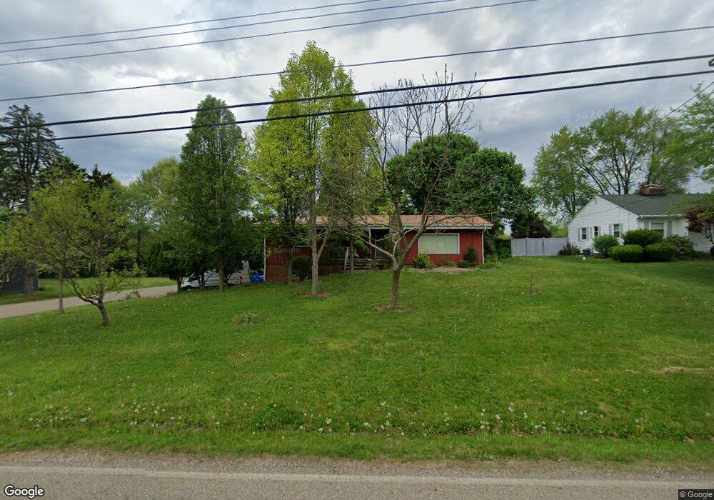
3123 Sweitzer St NW Uniontown, OH 44685
Estimated Value: $236,636 - $268,000
3
Beds
2
Baths
1,590
Sq Ft
$159/Sq Ft
Est. Value
About This Home
This home is located at 3123 Sweitzer St NW, Uniontown, OH 44685 and is currently estimated at $253,159, approximately $159 per square foot. 3123 Sweitzer St NW is a home located in Stark County with nearby schools including Lake Middle/High School, Lake Center Christian School, and Chapel Hill Christian School-Green Campus.
Ownership History
Date
Name
Owned For
Owner Type
Purchase Details
Closed on
Nov 1, 2005
Sold by
Ward Julius Lester and Ward Sarah Jane
Bought by
Baird Curtis J and Baird Sheryl L
Current Estimated Value
Home Financials for this Owner
Home Financials are based on the most recent Mortgage that was taken out on this home.
Original Mortgage
$119,920
Interest Rate
5.89%
Mortgage Type
Fannie Mae Freddie Mac
Create a Home Valuation Report for This Property
The Home Valuation Report is an in-depth analysis detailing your home's value as well as a comparison with similar homes in the area
Home Values in the Area
Average Home Value in this Area
Purchase History
| Date | Buyer | Sale Price | Title Company |
|---|---|---|---|
| Baird Curtis J | $149,900 | Real Living Title Agency Ltd |
Source: Public Records
Mortgage History
| Date | Status | Borrower | Loan Amount |
|---|---|---|---|
| Closed | Baird Curtis J | $119,920 |
Source: Public Records
Tax History Compared to Growth
Tax History
| Year | Tax Paid | Tax Assessment Tax Assessment Total Assessment is a certain percentage of the fair market value that is determined by local assessors to be the total taxable value of land and additions on the property. | Land | Improvement |
|---|---|---|---|---|
| 2025 | -- | $59,050 | $17,470 | $41,580 |
| 2024 | -- | $59,050 | $17,470 | $41,580 |
| 2023 | $2,717 | $52,820 | $12,740 | $40,080 |
| 2022 | $2,727 | $52,820 | $12,740 | $40,080 |
| 2021 | $2,755 | $52,820 | $12,740 | $40,080 |
| 2020 | $2,684 | $45,960 | $10,990 | $34,970 |
| 2019 | $2,663 | $45,960 | $10,990 | $34,970 |
| 2018 | $2,665 | $45,960 | $10,990 | $34,970 |
| 2017 | $2,496 | $39,800 | $9,490 | $30,310 |
| 2016 | $2,500 | $39,800 | $9,490 | $30,310 |
| 2015 | $2,501 | $39,800 | $9,490 | $30,310 |
| 2014 | $330 | $38,090 | $9,070 | $29,020 |
| 2013 | $1,165 | $38,090 | $9,070 | $29,020 |
Source: Public Records
Map
Nearby Homes
- 3100 Linden St NW
- 3310 Linden St NW
- 2944 Pontius St NW
- 91 Pontius Rd
- 13341 Sugar Bush Ave NW
- 13792 Amodio Ave NW
- 3796 Sweitzer St NW
- 2498 Foxfire St NW
- 2025 Portage Line Rd
- 0 Pine St NW
- 3885 Hugh St NW
- 0 Pontius Rd Unit 5163828
- 3221 Killian Rd
- 13025 Sunset Cir NW
- 3979 Northdale St NW
- 2693 Ledgestone Dr NW
- 2754 Irma Dr
- 3420 Overlook Dr
- 835 Brodie Ct
- 843 Brodie Ct
- 3101 Sweitzer St NW
- 3145 Sweitzer St NW
- 3087 Sweitzer St NW
- 3116 Linden St NW
- 3161 Sweitzer St NW
- 3122 Sweitzer St NW
- 3144 Linden St NW
- 3100 Sweitzer St NW
- 3144 Sweitzer St NW
- 3080 Linden St NW
- 3065 Sweitzer St NW
- 3177 Sweitzer St NW
- 3080 Sweitzer St NW
- 3166 Linden St NW
- 3166 Sweitzer St NW
- 3060 Linden St NW
- 3047 Sweitzer St NW
- 3060 Sweitzer St NW
- 3195 Sweitzer St NW
- 3131 Linden St NW