Estimated Value: $529,000 - $589,000
5
Beds
3
Baths
3,837
Sq Ft
$145/Sq Ft
Est. Value
About This Home
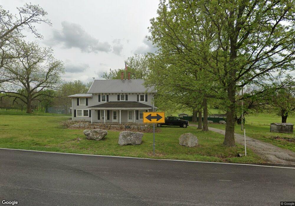
This home is located at 3123 W State Highway F, Ozark, MO 65721 and is currently estimated at $557,145, approximately $145 per square foot. 3123 W State Highway F is a home located in Christian County with nearby schools including Deauville Gardens Elementary School, Century Elementary School, and Summit Intermediate School.
Ownership History
Date
Name
Owned For
Owner Type
Purchase Details
Closed on
Jun 11, 2008
Sold by
T & C Custom Homes Inc
Bought by
Hill Jim D and Hill Jamie L
Current Estimated Value
Home Financials for this Owner
Home Financials are based on the most recent Mortgage that was taken out on this home.
Original Mortgage
$270,400
Outstanding Balance
$173,515
Interest Rate
6.05%
Mortgage Type
New Conventional
Estimated Equity
$383,630
Create a Home Valuation Report for This Property
The Home Valuation Report is an in-depth analysis detailing your home's value as well as a comparison with similar homes in the area
Home Values in the Area
Average Home Value in this Area
Purchase History
| Date | Buyer | Sale Price | Title Company |
|---|---|---|---|
| Hill Jim D | -- | None Available |
Source: Public Records
Mortgage History
| Date | Status | Borrower | Loan Amount |
|---|---|---|---|
| Open | Hill Jim D | $270,400 |
Source: Public Records
Tax History Compared to Growth
Tax History
| Year | Tax Paid | Tax Assessment Tax Assessment Total Assessment is a certain percentage of the fair market value that is determined by local assessors to be the total taxable value of land and additions on the property. | Land | Improvement |
|---|---|---|---|---|
| 2024 | $3,566 | $59,430 | -- | -- |
| 2023 | $3,566 | $59,430 | $0 | $0 |
| 2022 | $3,457 | $57,530 | $0 | $0 |
| 2021 | $3,459 | $57,530 | $0 | $0 |
| 2020 | $2,673 | $43,660 | $0 | $0 |
| 2019 | $2,673 | $43,660 | $0 | $0 |
| 2018 | $2,475 | $43,660 | $0 | $0 |
| 2017 | $2,475 | $43,660 | $0 | $0 |
| 2016 | $2,433 | $43,660 | $0 | $0 |
| 2015 | $2,436 | $43,660 | $43,660 | $0 |
| 2014 | $2,413 | $43,760 | $0 | $0 |
| 2013 | $2,417 | $43,760 | $0 | $0 |
| 2011 | -- | $87,520 | $0 | $0 |
Source: Public Records
Map
Nearby Homes
- 2123 Riverdale Rd
- 291 Look Back Dr
- 406 Castlegate Dr
- 255 Jones Rd
- 000 Mclean
- 1507 E Riverton Rd
- 1503 E Riverton Rd
- 1501 E Riverton Rd
- 1415 E Riverton Rd
- 1413 E Riverton Rd
- 000 Steinert Ln
- 1719 S Rabbit Ln
- 343 W Monarchwood Dr
- 347 W Monarchwood Dr
- 1294 S Amber Ridge Dr
- 000 Kentucky Rd
- 202 N 36th St
- Lot 60
- 000 Blvd
- 000 Steinert (37 01 + - Acres) Ln Unit 37.01 Acres
- 2237 Riverdale Rd
- 0 Ridgefield Estates Unit 10917652
- 0 Ridgefield Estates Unit 10917653
- 0 Ridgefield Estates Unit 10917646
- 0 Ridgefield Estates Unit 10917645
- 0 Ridgefield Estates Unit 10917644
- 0 Ridgefield Estates Unit 10917643
- 3087 W State Highway F
- 2204 Riverdale Rd
- 2046 Riverdale Rd
- 102 Ridgerock Ct
- 3071 W State Highway F
- 104 Ridgerock Ct
- 106 Ridgerock Ct
- Lot 7 Ridgefield Estates
- 155 Setting Sun Dr
- 112 Clearview Ct
- 118 Clearview Ct
- 180 Ridgerock Ct
- 2801 W State Highway F