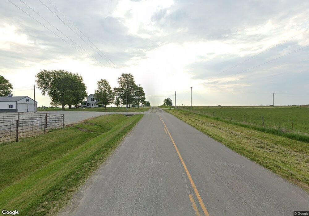
31237 State Highway P Jamesport, MO 64648
Estimated Value: $307,000 - $680,333
--
Bed
--
Bath
2,220
Sq Ft
$230/Sq Ft
Est. Value
About This Home
This home is located at 31237 State Highway P, Jamesport, MO 64648 and is currently estimated at $510,778, approximately $230 per square foot. 31237 State Highway P is a home with nearby schools including Tri-County Elementary School, Tri-County High School, and Country View.
Ownership History
Date
Name
Owned For
Owner Type
Purchase Details
Closed on
Jul 26, 2024
Sold by
Landes Greg and Landes Lori
Bought by
Beth And Ron Llc
Current Estimated Value
Purchase Details
Closed on
Feb 11, 2021
Sold by
William R Landes Trust
Bought by
Gregory S Landes Trust
Purchase Details
Closed on
Jan 26, 2021
Sold by
Landes Gregory S and Landes Lori D
Bought by
Gregory S Landes Trust
Create a Home Valuation Report for This Property
The Home Valuation Report is an in-depth analysis detailing your home's value as well as a comparison with similar homes in the area
Home Values in the Area
Average Home Value in this Area
Purchase History
| Date | Buyer | Sale Price | Title Company |
|---|---|---|---|
| Beth And Ron Llc | -- | Preferred Title | |
| Gregory S Landes Trust | -- | Chapman And Cowherd Pc | |
| Gregory S Landes Trust | -- | None Listed On Document |
Source: Public Records
Tax History Compared to Growth
Tax History
| Year | Tax Paid | Tax Assessment Tax Assessment Total Assessment is a certain percentage of the fair market value that is determined by local assessors to be the total taxable value of land and additions on the property. | Land | Improvement |
|---|---|---|---|---|
| 2024 | $3,019 | $45,104 | $7,797 | $37,307 |
| 2023 | $2,973 | $45,104 | $7,797 | $37,307 |
| 2022 | $2,972 | $45,104 | $7,797 | $37,307 |
| 2021 | $2,839 | $45,104 | $7,797 | $37,307 |
| 2020 | $2,944 | $45,104 | $7,797 | $37,307 |
| 2019 | $2,871 | $45,104 | $7,797 | $37,307 |
| 2018 | $2,851 | $45,156 | $7,849 | $37,307 |
| 2017 | $2,719 | $45,156 | $7,849 | $37,307 |
| 2016 | -- | $43,265 | $7,849 | $35,416 |
| 2011 | -- | $27,850 | $0 | $0 |
Source: Public Records
Map
Nearby Homes
- 0000 July Ave
- 106 E Main St
- 801 W Edmond St
- 204 W Charles St
- 110 Kentucky
- 704 S Broadway N A
- 24001 Nickel Ave
- 24984 P Hwy
- 250th St
- 0 250th St
- TBD State Road V
- 0 SW 52nd Ave
- 0 SW 52nd Ave Unit Lot WP004 24524850
- 3144 Highway A
- 595 W Leisure Lake Dr
- 72509 W Leisure Lake Dr
- 18680 State Road Uu
- 73525 E Leisure Lake Dr
- 71323 Fawnwood Dr
- 506 NW Church St
- 31382 State Highway P
- 31558 State Highway P
- 31769 State Highway P
- 30491 State Highway P
- 18995 State Highway 190
- 31178 Harbor Ave
- 31408 Harbor Ave
- 17594 State Highway 190
- 16985 Harbor Ave
- 0 Harbor Ave Unit 2099351
- 0 Harbor Ave Unit 1896598
- 0 Harbor Ave Unit 1933361
- 0 Harbor Ave Unit 1981362
- 0 Harbor Ave Unit 2381646
- 0 Harbor Ave Unit 2148404
- 32128 State Highway P
