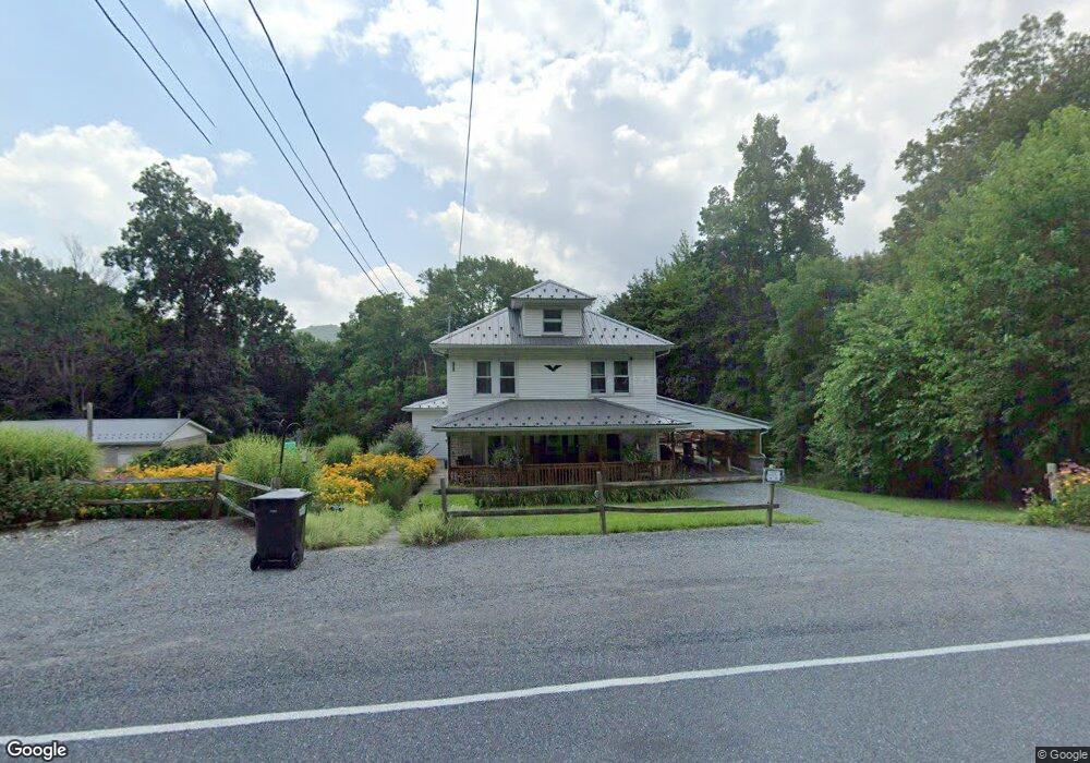
3124 Upper Rd Shamokin, PA 17872
Estimated Value: $58,361 - $202,000
Studio
--
Bath
--
Sq Ft
43,560
Sq Ft Lot
About This Home
This home is located at 3124 Upper Rd, Shamokin, PA 17872 and is currently estimated at $139,840. 3124 Upper Rd is a home located in Northumberland County with nearby schools including Line Mountain Elementary School, Line Mountain Middle School, and Line Mountain Junior/Senior High School.
Ownership History
Date
Name
Owned For
Owner Type
Purchase Details
Closed on
Nov 16, 2009
Sold by
Secretary Of Housing & Urban Development
Bought by
Schwartz Colby J
Current Estimated Value
Home Financials for this Owner
Home Financials are based on the most recent Mortgage that was taken out on this home.
Original Mortgage
$77,800
Interest Rate
5.02%
Mortgage Type
New Conventional
Purchase Details
Closed on
Aug 1, 2009
Sold by
Wells Fargo Home Mortgage Inc
Bought by
Secretary Of Housing & Urban Development
Purchase Details
Closed on
Jan 30, 2009
Sold by
Davies Donald J and Davies Christine A
Bought by
Wells Fargo Home Mortgage and Northwest Mortgage Inc
Create a Home Valuation Report for This Property
The Home Valuation Report is an in-depth analysis detailing your home's value as well as a comparison with similar homes in the area
Purchase History
| Date | Buyer | Sale Price | Title Company |
|---|---|---|---|
| Schwartz Colby J | $77,800 | None Available | |
| Secretary Of Housing & Urban Development | $1,221 | None Available | |
| Wells Fargo Home Mortgage | $1,221 | None Available |
Source: Public Records
Mortgage History
| Date | Status | Borrower | Loan Amount |
|---|---|---|---|
| Closed | Schwartz Colby J | $77,800 |
Source: Public Records
Tax History
| Year | Tax Paid | Tax Assessment Tax Assessment Total Assessment is a certain percentage of the fair market value that is determined by local assessors to be the total taxable value of land and additions on the property. | Land | Improvement |
|---|---|---|---|---|
| 2025 | $1,817 | $15,310 | $2,000 | $13,310 |
| 2024 | $1,741 | $15,310 | $2,000 | $13,310 |
| 2023 | $1,741 | $15,310 | $2,000 | $13,310 |
| 2022 | $1,741 | $15,310 | $2,000 | $13,310 |
| 2021 | $1,741 | $15,310 | $2,000 | $13,310 |
| 2020 | $1,741 | $15,310 | $2,000 | $13,310 |
| 2019 | $1,693 | $15,310 | $2,000 | $13,310 |
| 2018 | $1,655 | $15,310 | $2,000 | $13,310 |
| 2017 | $1,565 | $15,310 | $2,000 | $13,310 |
| 2016 | -- | $15,310 | $2,000 | $13,310 |
| 2015 | -- | $15,310 | $2,000 | $13,310 |
| 2014 | -- | $15,310 | $2,000 | $13,310 |
Source: Public Records
Map
Nearby Homes
- 4133 Lower Rd
- LOT# 3 Blacks Ln
- LOT#2 Blacks Ln
- 1530 W Fern St
- 1610 W Willow St
- 1131 W Fern St
- 1714 W Pine St
- 1138 W Willow St
- 1132 W State St
- 1211 W Mulberry St
- 1354 W Gowen St Unit 1356
- 704 Bear Valley Ave
- 1212 W Spruce St
- 1539 W Lynn St
- 1728 W Walnut St
- 1141 W Wood St
- 838 W Pine St
- 924 W Spruce St
- 829 W Pine St
- 931 W Spruce St
Your Personal Tour Guide
Ask me questions while you tour the home.