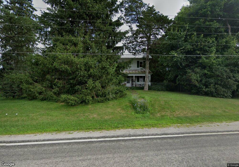
3125 State Route 430 Mansfield, OH 44903
Estimated Value: $360,000 - $782,103
4
Beds
1
Bath
2,376
Sq Ft
$213/Sq Ft
Est. Value
About This Home
This home is located at 3125 State Route 430, Mansfield, OH 44903 and is currently estimated at $507,034, approximately $213 per square foot. 3125 State Route 430 is a home with nearby schools including Madison High School, St. Mary Catholic School, and Temple-Christian School.
Ownership History
Date
Name
Owned For
Owner Type
Purchase Details
Closed on
Jul 16, 2019
Sold by
Massie Joshua A
Bought by
Burkholder Wilson Z and Burkholder Mabel N
Current Estimated Value
Home Financials for this Owner
Home Financials are based on the most recent Mortgage that was taken out on this home.
Original Mortgage
$388,900
Outstanding Balance
$298,781
Interest Rate
3.82%
Mortgage Type
USDA
Estimated Equity
$208,253
Purchase Details
Closed on
Apr 12, 2019
Sold by
Massie Joshua A and Taheri Caroline E
Bought by
Bell John J and Bell Vanessa L
Purchase Details
Closed on
Dec 2, 2015
Sold by
Shrewsberry Mary J and Shrewsberry Jon W
Bought by
Taheri Caroline E and The Shrewsberry Keystone Preservation Tr
Purchase Details
Closed on
Nov 5, 2015
Sold by
Massie Carol J and Massie David R
Bought by
Massie Joshua A and The Massie Keystone Preservation Trust
Purchase Details
Closed on
Apr 1, 2003
Sold by
Jackson Mary P
Bought by
Shrewsberry Mary and Massie Carol
Purchase Details
Closed on
Jun 4, 1992
Sold by
Jackson Mary P
Bought by
Jackson Mary P
Create a Home Valuation Report for This Property
The Home Valuation Report is an in-depth analysis detailing your home's value as well as a comparison with similar homes in the area
Home Values in the Area
Average Home Value in this Area
Purchase History
| Date | Buyer | Sale Price | Title Company |
|---|---|---|---|
| Burkholder Wilson Z | $428,875 | Ashland Title Agency | |
| Bell John J | $16,500 | Southern Title | |
| Taheri Caroline E | -- | Attorney | |
| Massie Joshua A | -- | Attorney | |
| Shrewsberry Mary | -- | -- | |
| Jackson Mary P | -- | -- | |
| Jackson Mary P | -- | -- |
Source: Public Records
Mortgage History
| Date | Status | Borrower | Loan Amount |
|---|---|---|---|
| Open | Burkholder Wilson Z | $388,900 |
Source: Public Records
Tax History Compared to Growth
Tax History
| Year | Tax Paid | Tax Assessment Tax Assessment Total Assessment is a certain percentage of the fair market value that is determined by local assessors to be the total taxable value of land and additions on the property. | Land | Improvement |
|---|---|---|---|---|
| 2024 | $4,396 | $186,950 | $143,310 | $43,640 |
| 2023 | $4,396 | $186,950 | $143,310 | $43,640 |
| 2022 | $2,819 | $127,810 | $97,690 | $30,120 |
| 2021 | $2,818 | $127,810 | $97,690 | $30,120 |
| 2020 | $2,786 | $127,810 | $97,690 | $30,120 |
| 2019 | $3,759 | $111,520 | $81,400 | $30,120 |
| 2018 | $3,673 | $108,160 | $78,040 | $30,120 |
| 2017 | $3,101 | $108,160 | $78,040 | $30,120 |
| 2016 | $4,294 | $94,980 | $64,760 | $30,220 |
| 2015 | $4,294 | $94,980 | $64,760 | $30,220 |
| 2014 | $4,209 | $94,980 | $64,760 | $30,220 |
| 2012 | $1,118 | $84,180 | $53,960 | $30,220 |
Source: Public Records
Map
Nearby Homes
- 2750 Lutz Ave
- 0 Satinwood Dr
- 598 Impala Dr
- 630 Impala Dr
- 0 Peterson Rd
- 2270 Lakecrest Dr Unit 2272
- 2307 Peterson Rd
- 609 Mcbride Rd
- 0 McBride Road Parcel # 1 Unit 9066028
- 19 Maine St
- 640 Running Brook Way
- 1183 County Road 30a
- 1910 Crider Rd
- 1997 Hout Rd
- 76 Ford Rd N
- 76 Ford Rd N Unit 20
- 1951 Woodmont Rd
- 1767 State Route 603
- 1628 Park Ave E
- 1806 Richard Dr
- 0 Rt 430 E
- 3130 State Route 430
- 518 Koogle Rd
- 3152 State Route 430
- 3072 State Route 430
- 578 Koogle Rd
- 474 Gimbel Dr
- 592 Koogle Rd
- 456 Gimbel Dr
- 530 Koogle Rd
- 444 Gimbel Dr
- 65 Gimbel Dr
- 2946 State Route 430
- 36 Gimbel Dr
- 16 State St Unit 30
- 445 Gimbel Dr
- 645 Koogle Rd
- 66 Gimbel Dr
- 431 Gimbel Dr
- 79 Gimbel Dr