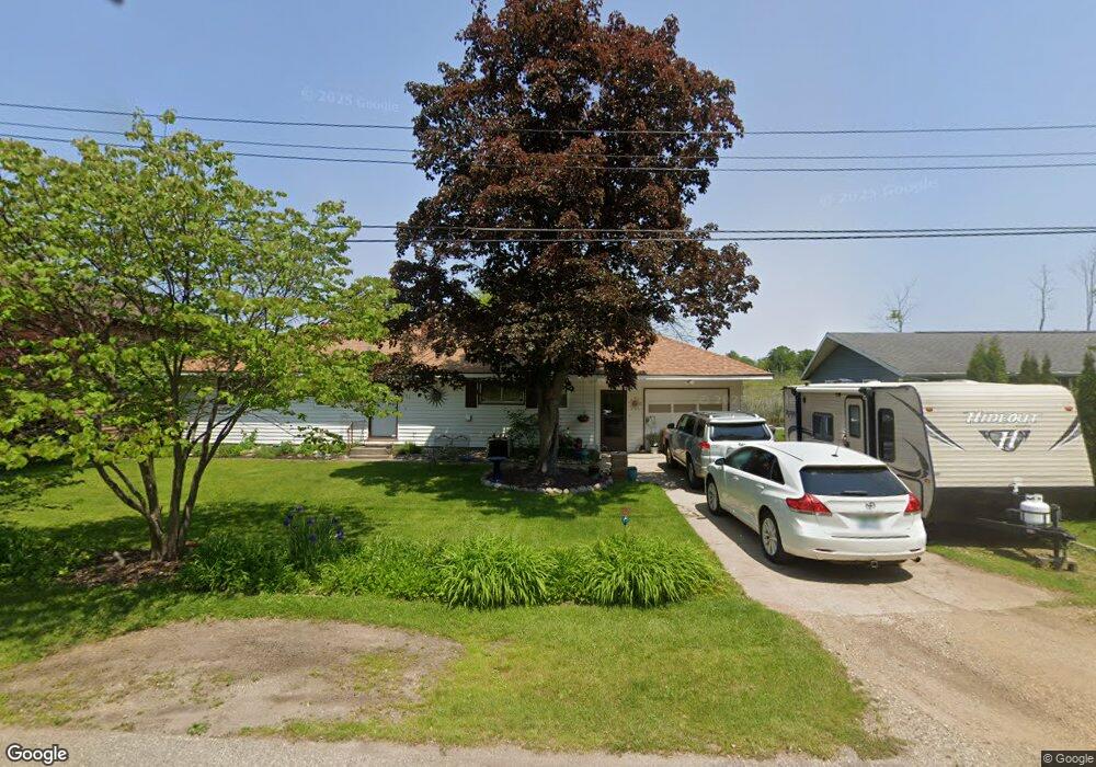
3126 Rolling Hill Ave Portage, MI 49024
Estimated Value: $254,039 - $389,000
3
Beds
2
Baths
1,450
Sq Ft
$205/Sq Ft
Est. Value
About This Home
This home is located at 3126 Rolling Hill Ave, Portage, MI 49024 and is currently estimated at $297,010, approximately $204 per square foot. 3126 Rolling Hill Ave is a home located in Kalamazoo County with nearby schools including Moorsbridge Elementary School, Portage Central Middle School, and Portage Central High School.
Ownership History
Date
Name
Owned For
Owner Type
Purchase Details
Closed on
Jul 11, 2006
Sold by
Mcninch Rick J and Mcninch Elizabeth E
Bought by
Mickley John R and Mickley Judy K
Current Estimated Value
Home Financials for this Owner
Home Financials are based on the most recent Mortgage that was taken out on this home.
Original Mortgage
$158,400
Outstanding Balance
$94,453
Interest Rate
6.73%
Mortgage Type
Purchase Money Mortgage
Estimated Equity
$202,557
Create a Home Valuation Report for This Property
The Home Valuation Report is an in-depth analysis detailing your home's value as well as a comparison with similar homes in the area
Home Values in the Area
Average Home Value in this Area
Purchase History
| Date | Buyer | Sale Price | Title Company |
|---|---|---|---|
| Mickley John R | $198,000 | Chicago Title |
Source: Public Records
Mortgage History
| Date | Status | Borrower | Loan Amount |
|---|---|---|---|
| Open | Mickley John R | $158,400 |
Source: Public Records
Tax History Compared to Growth
Tax History
| Year | Tax Paid | Tax Assessment Tax Assessment Total Assessment is a certain percentage of the fair market value that is determined by local assessors to be the total taxable value of land and additions on the property. | Land | Improvement |
|---|---|---|---|---|
| 2025 | $4,524 | $107,500 | $0 | $0 |
| 2024 | $3,983 | $112,400 | $0 | $0 |
| 2023 | $3,797 | $96,300 | $0 | $0 |
| 2022 | $4,102 | $92,600 | $0 | $0 |
| 2021 | $3,965 | $97,300 | $0 | $0 |
| 2020 | $3,879 | $91,600 | $0 | $0 |
| 2019 | $349 | $86,200 | $0 | $0 |
| 2018 | $0 | $87,200 | $0 | $0 |
| 2017 | $0 | $90,200 | $0 | $0 |
| 2016 | -- | $88,600 | $0 | $0 |
| 2015 | -- | $88,500 | $0 | $0 |
| 2014 | -- | $78,800 | $0 | $0 |
Source: Public Records
Map
Nearby Homes
- 2633 Rolling Hill Ave
- 10025 Shuman St
- 9898 Windflower Ln
- 1817 Alder Ave
- 9770 Windflower Ln
- 9820 Windflower Ln
- 2685 Ashford Trail
- 11025 Higley Cir W
- 2613 Ashford Trail
- 2586 Ashford Trail
- 9899 Windflower Ln
- 10381 Schrier Ln
- Integrity 1800 Plan at Pennridge Trail North
- Integrity 2085 Plan at Pennridge Trail North
- Integrity 1910 Plan at Pennridge Trail North
- 10197 Pennridge Dr
- 10382 Pennridge Dr
- 10187 Pennridge Dr
- 2612 Ashford Trail
- 2750 Ashford Trail
- 3118 Rolling Hill Ave
- 3210 Rolling Hill Ave
- 3112 Rolling Hill Ave
- 3204 Rolling Hill Ave
- 3127 Rolling Hill Ave
- 3127 Rolling Hill
- 3100 Rolling Hill Ave
- 3205 Rolling Hill Ave
- 3119 Rolling Hill Ave
- 3200 Rolling Hill Ave
- 3034 Rolling Hill Ave
- 3091 Rolling Hill Ave
- 3012 Rolling Hill Ave
- 3011 Rolling Hill Ave
- 3008 Rolling Hill Ave
- 3026 Witters Ct
- 3004 Rolling Hill Ave
- 3003 Rolling Hill Ave
- 2924 Rolling Hill Ave
- 2925 Rolling Hill Ave