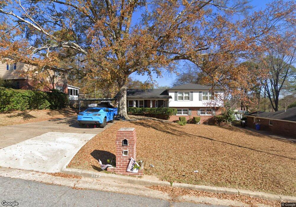
3127 Apache Dr Columbus, GA 31909
North Columbus NeighborhoodEstimated Value: $217,867 - $263,000
4
Beds
3
Baths
2,198
Sq Ft
$113/Sq Ft
Est. Value
About This Home
This home is located at 3127 Apache Dr, Columbus, GA 31909 and is currently estimated at $247,467, approximately $112 per square foot. 3127 Apache Dr is a home located in Muscogee County with nearby schools including Allen Elementary School, Arnold Middle School, and Jordan Vocational High School.
Ownership History
Date
Name
Owned For
Owner Type
Purchase Details
Closed on
May 28, 2025
Sold by
Barefield Selendra
Bought by
Barefield Kelvin
Current Estimated Value
Purchase Details
Closed on
May 28, 2019
Sold by
Lowe Benjamin
Bought by
Barefield Kelvin and Barefield Selendra D
Home Financials for this Owner
Home Financials are based on the most recent Mortgage that was taken out on this home.
Original Mortgage
$164,900
Interest Rate
4.1%
Create a Home Valuation Report for This Property
The Home Valuation Report is an in-depth analysis detailing your home's value as well as a comparison with similar homes in the area
Home Values in the Area
Average Home Value in this Area
Purchase History
| Date | Buyer | Sale Price | Title Company |
|---|---|---|---|
| Barefield Kelvin | -- | None Listed On Document | |
| Barefield Kelvin | -- | None Listed On Document | |
| Barefield Kelvin | $164,900 | -- |
Source: Public Records
Mortgage History
| Date | Status | Borrower | Loan Amount |
|---|---|---|---|
| Previous Owner | Barefield Kelvin | $164,900 |
Source: Public Records
Tax History Compared to Growth
Tax History
| Year | Tax Paid | Tax Assessment Tax Assessment Total Assessment is a certain percentage of the fair market value that is determined by local assessors to be the total taxable value of land and additions on the property. | Land | Improvement |
|---|---|---|---|---|
| 2025 | -- | $75,576 | $8,588 | $66,988 |
| 2024 | -- | $75,576 | $8,588 | $66,988 |
| 2023 | $0 | $75,576 | $8,588 | $66,988 |
| 2022 | $0 | $60,996 | $8,588 | $52,408 |
| 2021 | $0 | $58,704 | $8,588 | $50,116 |
| 2020 | $0 | $58,704 | $8,588 | $50,116 |
| 2019 | $1,972 | $48,140 | $8,588 | $39,552 |
| 2018 | $1,972 | $48,140 | $8,588 | $39,552 |
| 2017 | $1,979 | $48,140 | $8,588 | $39,552 |
| 2016 | $2,087 | $50,588 | $6,365 | $44,223 |
| 2015 | $836 | $50,588 | $6,365 | $44,223 |
| 2014 | $2,092 | $50,588 | $6,365 | $44,223 |
| 2013 | -- | $50,588 | $6,365 | $44,223 |
Source: Public Records
Map
Nearby Homes
- 3091 Mustang Dr
- 5552 Perry Ave
- 5531 Mariner Dr
- 5435 Wayne Dr
- 5836 Sherborne Dr
- 5921 Canterbury Dr
- 3618 Grier Ave
- 6002 Canterbury Dr
- 3710 Winkfield Place
- 3325 N North Quay Dr
- 2528 Lorraine St
- 2516 Lorraine St
- 6226 Westbrook Dr
- 6232 Westbrook Dr
- 6308 Adams Park Dr
- 6225 Westbrook Dr
- 6231 Westbrook Dr
- 6221 Charing Dr
- 3704 E Britt David Rd
- 2325 Coventry Dr
- 3119 Apache Dr
- 3135 Apache Dr
- 3111 Apache Dr
- 3123 Dehaviland Dr
- 3133 Dehaviland Dr
- 3115 Dehaviland Dr
- 3143 Apache Dr Unit 6
- 3143 Apache Dr
- 3126 Apache Dr
- 3134 Apache Dr
- 3137 Dehaviland Dr
- 3103 Apache Dr
- 3120 Apache Dr
- 3137 De Haviland Dr
- 3142 Apache Dr
- 3114 Apache Dr
- 3143 Dehaviland Dr
- 3108 Apache Dr
- 3148 Apache Dr
- 3202 Jottings Dr