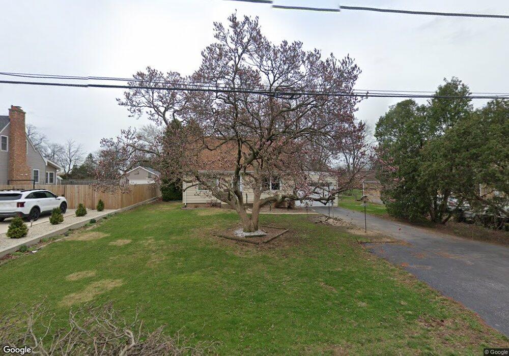
3127 Charles St Melrose Park, IL 60164
West Grand Ave NeighborhoodEstimated Value: $224,000 - $284,420
2
Beds
1
Bath
768
Sq Ft
$337/Sq Ft
Est. Value
About This Home
This home is located at 3127 Charles St, Melrose Park, IL 60164 and is currently estimated at $259,105, approximately $337 per square foot. 3127 Charles St is a home located in Cook County with nearby schools including Westdale Elementary School, Mannheim Middle School, and West Leyden High School.
Ownership History
Date
Name
Owned For
Owner Type
Purchase Details
Closed on
Mar 25, 2021
Sold by
Sims Kenneth L and Kenneth L Sims Trust
Bought by
Sims Kenneth L and The Kenneth L Sims Trust
Current Estimated Value
Purchase Details
Closed on
Feb 27, 2002
Sold by
Sims Kenneth L
Bought by
Sims Kenneth L and Kenneth L Sims Trust
Purchase Details
Closed on
Jan 16, 1998
Sold by
Schmidt Marell E
Bought by
Sims Kenneth L
Create a Home Valuation Report for This Property
The Home Valuation Report is an in-depth analysis detailing your home's value as well as a comparison with similar homes in the area
Home Values in the Area
Average Home Value in this Area
Purchase History
| Date | Buyer | Sale Price | Title Company |
|---|---|---|---|
| Sims Kenneth L | -- | None Available | |
| Sims Kenneth L | -- | -- | |
| Sims Kenneth L | $57,500 | -- |
Source: Public Records
Tax History Compared to Growth
Tax History
| Year | Tax Paid | Tax Assessment Tax Assessment Total Assessment is a certain percentage of the fair market value that is determined by local assessors to be the total taxable value of land and additions on the property. | Land | Improvement |
|---|---|---|---|---|
| 2024 | $4,510 | $21,000 | $10,024 | $10,976 |
| 2023 | $4,379 | $21,000 | $10,024 | $10,976 |
| 2022 | $4,379 | $21,000 | $10,024 | $10,976 |
| 2021 | $2,772 | $13,888 | $7,796 | $6,092 |
| 2020 | $2,872 | $13,888 | $7,796 | $6,092 |
| 2019 | $3,028 | $15,676 | $7,796 | $7,880 |
| 2018 | $4,477 | $18,829 | $6,682 | $12,147 |
| 2017 | $4,495 | $18,829 | $6,682 | $12,147 |
| 2016 | $6,239 | $18,829 | $6,682 | $12,147 |
| 2015 | $3,933 | $15,674 | $6,125 | $9,549 |
| 2014 | $3,897 | $15,674 | $6,125 | $9,549 |
| 2013 | $3,684 | $15,674 | $6,125 | $9,549 |
Source: Public Records
Map
Nearby Homes
- 10833 Wellington St
- 2817 N Roberta Ave
- 10729 W Grand Ave
- 2756 Landen Dr
- 10548 Crown Rd
- 10542 Crown Rd
- 11353 W Grand Ave
- 3037 Bright St
- 3112 Pearl Ave
- 2743 Bellwood Ave
- 64 Macarthur Dr
- 10459 Diversey Ave
- 3041 Lincoln St
- 2933 Lincoln St
- 44 King Arthur Ct Unit 7
- 10345 Mcnerney Dr
- 10330 Addison Ave
- 41 King Arthur Ct Unit 1
- 35 King Arthur Ct Unit 19
- 38 King Arthur Ct Unit 14
- 3123 Charles St
- 3133 Charles St
- 3111 Charles St
- 3141 Charles St
- 3118 Charles St
- 3138 Charles St
- 3114 Charles St
- 3101 Charles St
- 3140 Charles St
- 3110 Charles St
- 10938 Barry Ave
- 3153 Charles St
- 3146 Charles St
- 3104 Charles St
- 3148 Charles St
- 10919 Belmont Ave
- 3125 Haber Ave
- 3117 Haber Ave
- 3059 Charles St
- 3152 Charles St