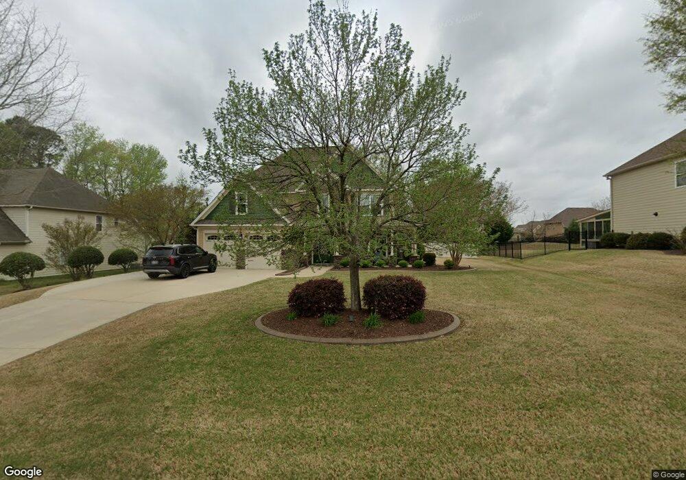
313 Adams Point Dr Garner, NC 27529
Estimated Value: $492,488 - $539,000
4
Beds
3
Baths
3,140
Sq Ft
$164/Sq Ft
Est. Value
About This Home
This home is located at 313 Adams Point Dr, Garner, NC 27529 and is currently estimated at $515,872, approximately $164 per square foot. 313 Adams Point Dr is a home located in Johnston County with nearby schools including West View Elementary School, Cleveland Middle School, and West Johnston High School.
Ownership History
Date
Name
Owned For
Owner Type
Purchase Details
Closed on
Feb 13, 2007
Sold by
Southpoint Homes Llc
Bought by
Adams Louie D and Adams Rochelle M
Current Estimated Value
Home Financials for this Owner
Home Financials are based on the most recent Mortgage that was taken out on this home.
Original Mortgage
$44,523
Interest Rate
6.3%
Mortgage Type
Stand Alone Second
Create a Home Valuation Report for This Property
The Home Valuation Report is an in-depth analysis detailing your home's value as well as a comparison with similar homes in the area
Home Values in the Area
Average Home Value in this Area
Purchase History
| Date | Buyer | Sale Price | Title Company |
|---|---|---|---|
| Adams Louie D | $297,000 | None Available |
Source: Public Records
Mortgage History
| Date | Status | Borrower | Loan Amount |
|---|---|---|---|
| Closed | Adams Louie D | $44,523 | |
| Open | Adams Louie D | $237,460 |
Source: Public Records
Tax History
| Year | Tax Paid | Tax Assessment Tax Assessment Total Assessment is a certain percentage of the fair market value that is determined by local assessors to be the total taxable value of land and additions on the property. | Land | Improvement |
|---|---|---|---|---|
| 2025 | $3,042 | $479,020 | $70,000 | $409,020 |
| 2024 | $2,451 | $302,540 | $48,000 | $254,540 |
| 2023 | $2,367 | $302,540 | $48,000 | $254,540 |
| 2022 | $2,488 | $302,540 | $48,000 | $254,540 |
| 2021 | $2,488 | $302,540 | $48,000 | $254,540 |
| 2020 | $2,519 | $302,540 | $48,000 | $254,540 |
| 2019 | $2,519 | $302,540 | $48,000 | $254,540 |
| 2018 | $2,403 | $281,830 | $44,000 | $237,830 |
| 2017 | $2,403 | $281,830 | $44,000 | $237,830 |
| 2016 | $2,403 | $281,830 | $44,000 | $237,830 |
| 2015 | $2,403 | $281,830 | $44,000 | $237,830 |
| 2014 | $2,403 | $281,830 | $44,000 | $237,830 |
Source: Public Records
Map
Nearby Homes
- 236 Fieldtrial Cir
- 356 Fieldtrial Cir
- 181 Fawn Hill Ct
- 58 Trailblazer Ln
- 232 Fawn Hill Ct
- 648 Fieldtrial Cir
- 403 Airedale Trail
- 866 Black Angus Dr
- 111 Artic Cir
- 131 Artic Cir
- 421 Danielle Dr
- 304 Artic Cir
- 368 Artic Cir
- 908 Olive Dr
- 36 Norman Ct
- 113 Hogan Dr
- 50 Linden Ct
- Lot 2a S Shiloh Rd
- 242 Thornwhistle Place
- 562 Pierce Rd
- 295 Adams Point Dr
- 331 Adams Point Dr
- 275 Adams Point Dr
- 351 Adams Point Dr
- 1372 Fieldtrial Cir
- 1332 Fieldtrial Cir Unit CAROL
- 1332 Fieldtrial Cir
- 1352 Fieldtrial Cir
- 310 Adams Point Dr
- 328 Adams Point Dr
- 1396 Fieldtrial Cir
- 1314 Fieldtrial Cir
- 290 Adams Point Dr
- 373 Adams Point Dr
- 255 Adams Point Dr
- 346 Adams Point Dr
- 270 Adams Point Dr
- 1416 Fieldtrial Cir Unit CAROL
- 368 Adams Point Dr
- 31 Meadowmist Dr
Your Personal Tour Guide
Ask me questions while you tour the home.