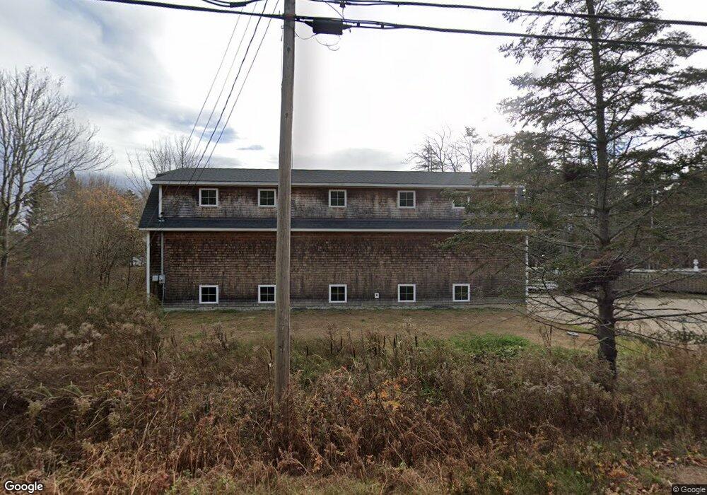
313 Basin Point Rd Harpswell, ME 04079
Harpswell Neck NeighborhoodEstimated Value: $597,000 - $646,868
1
Bed
1
Bath
980
Sq Ft
$642/Sq Ft
Est. Value
About This Home
This home is located at 313 Basin Point Rd, Harpswell, ME 04079 and is currently estimated at $628,967, approximately $641 per square foot. 313 Basin Point Rd is a home located in Cumberland County with nearby schools including Mt Ararat High School.
Ownership History
Date
Name
Owned For
Owner Type
Purchase Details
Closed on
Sep 24, 2015
Sold by
Saxton Christopher Q
Bought by
Basin Point Llc
Current Estimated Value
Purchase Details
Closed on
Nov 20, 2013
Sold by
Northey Peter and Northey Marlene L
Bought by
Saxton Christopher Q
Purchase Details
Closed on
Jun 8, 2007
Sold by
Connolly Ronald J
Bought by
Northey Peter and Northey Marlene L
Create a Home Valuation Report for This Property
The Home Valuation Report is an in-depth analysis detailing your home's value as well as a comparison with similar homes in the area
Home Values in the Area
Average Home Value in this Area
Purchase History
| Date | Buyer | Sale Price | Title Company |
|---|---|---|---|
| Basin Point Llc | -- | -- | |
| Saxton Christopher Q | -- | -- | |
| Northey Peter | -- | -- |
Source: Public Records
Tax History
| Year | Tax Paid | Tax Assessment Tax Assessment Total Assessment is a certain percentage of the fair market value that is determined by local assessors to be the total taxable value of land and additions on the property. | Land | Improvement |
|---|---|---|---|---|
| 2024 | $2,348 | $369,200 | $60,200 | $309,000 |
| 2023 | $2,252 | $369,200 | $60,200 | $309,000 |
| 2022 | $2,178 | $369,200 | $60,200 | $309,000 |
| 2021 | $1,376 | $203,600 | $56,800 | $146,800 |
| 2020 | $1,372 | $203,600 | $56,800 | $146,800 |
| 2019 | $1,364 | $203,600 | $56,800 | $146,800 |
| 2018 | $1,319 | $203,600 | $56,800 | $146,800 |
| 2017 | $7,172 | $203,600 | $56,800 | $146,800 |
| 2016 | $1,303 | $203,600 | $56,800 | $146,800 |
| 2015 | $354 | $56,800 | $56,800 | $0 |
| 2013 | $383 | $66,200 | $57,000 | $9,200 |
Source: Public Records
Map
Nearby Homes
- 31 Goose Ledge Rd
- 1450 Harpswell Neck Rd
- 1 Mallard Pond Rd
- 87 Lowells Cove Rd
- Lot 2B Allen Point Rd
- 0 Bayview Rd Unit 2 1632776
- 471 South Rd Unit A
- 471 South Rd Unit B
- 58 Maquoit Dr
- 70 Maquoit Dr
- 275 Littlejohn Rd
- 83 Central Ave
- lot C Long Point Rd
- 46 Blackstone Club Rd
- 30 Driftwood Tide Ln
- Map 80 Lot 18-0 White Island
- 7 Shearwater Way
- 6 Daybreak Ln Unit 18
- 41 Atlantic Ln
- 539 Harbor de Grace
- 15 Marquis Ln
- 20 Marquis Ln
- 0 Marquis Ln
- 313 Basin Point Rd
- 0 Basin Point Rd Unit 860739
- 0 Basin Point Rd Unit 237543
- 0 Basin Point Rd Unit 236866
- 0 Basin Point Rd Unit 276560
- 0 Basin Point Rd Unit 986195
- 0 Basin Point Rd Unit 1027756
- 0 Basin Point Rd Unit 1064542
- 0 Basin Point Rd Unit 1370468
- 10 Cardinal Way
- 27 Marquis Ln
- 317 Basin Point Rd
- 23 Marquis Ln
- 00 Basin Point Rd
- 29 Marquis Ln
- 36 Marquis Ln
- 33 Marquis Ln
Your Personal Tour Guide
Ask me questions while you tour the home.