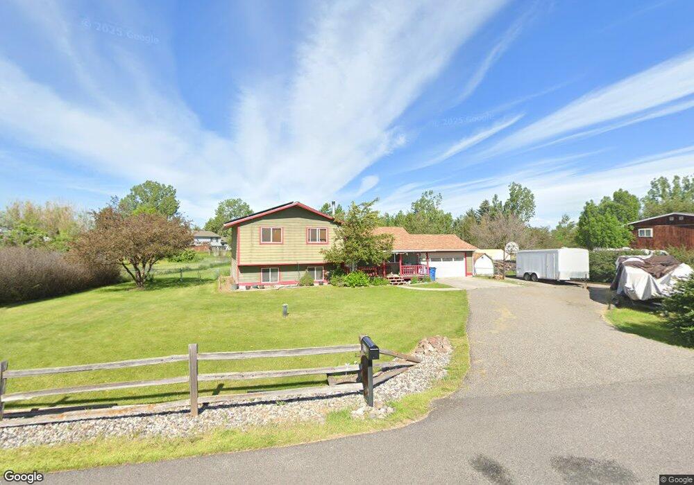
313 Crest Dr Bozeman, MT 59718
Estimated Value: $585,218 - $657,000
4
Beds
2
Baths
1,632
Sq Ft
$385/Sq Ft
Est. Value
About This Home
This home is located at 313 Crest Dr, Bozeman, MT 59718 and is currently estimated at $628,805, approximately $385 per square foot. 313 Crest Dr is a home located in Gallatin County with nearby schools including Saddle Peak Elementary School, Belgrade High School, and Great Beginnings Montessori School.
Ownership History
Date
Name
Owned For
Owner Type
Purchase Details
Closed on
Dec 19, 2012
Sold by
Gibson Stephanie and Leibenguth Stephanie
Bought by
Leibenguth Randy
Current Estimated Value
Purchase Details
Closed on
Aug 18, 2011
Sold by
Leibenguth Randy and Leibenguth Stephanie
Bought by
Leibenguth Randy and Leibenguth Stephanie
Home Financials for this Owner
Home Financials are based on the most recent Mortgage that was taken out on this home.
Original Mortgage
$205,000
Interest Rate
4.53%
Mortgage Type
New Conventional
Purchase Details
Closed on
Jan 23, 2007
Sold by
Leibenguth Randy
Bought by
Leibenguth Randy and Gibson Stephanie
Home Financials for this Owner
Home Financials are based on the most recent Mortgage that was taken out on this home.
Original Mortgage
$228,000
Interest Rate
6.1%
Mortgage Type
New Conventional
Create a Home Valuation Report for This Property
The Home Valuation Report is an in-depth analysis detailing your home's value as well as a comparison with similar homes in the area
Purchase History
| Date | Buyer | Sale Price | Title Company |
|---|---|---|---|
| Leibenguth Randy | -- | None Available | |
| Leibenguth Randy | -- | Montana Title & Escrow | |
| Leibenguth Randy | -- | Montana Title & Escrow Inc |
Source: Public Records
Mortgage History
| Date | Status | Borrower | Loan Amount |
|---|---|---|---|
| Closed | Leibenguth Randy | $205,000 | |
| Closed | Leibenguth Randy | $228,000 |
Source: Public Records
Tax History
| Year | Tax Paid | Tax Assessment Tax Assessment Total Assessment is a certain percentage of the fair market value that is determined by local assessors to be the total taxable value of land and additions on the property. | Land | Improvement |
|---|---|---|---|---|
| 2025 | $2,347 | $606,900 | $0 | $0 |
| 2024 | $3,393 | $560,700 | $0 | $0 |
| 2023 | $3,613 | $560,700 | $0 | $0 |
| 2022 | $2,641 | $352,400 | $0 | $0 |
| 2021 | $2,797 | $352,400 | $0 | $0 |
| 2020 | $2,640 | $301,400 | $0 | $0 |
| 2019 | $2,720 | $301,400 | $0 | $0 |
| 2018 | $2,610 | $274,200 | $0 | $0 |
| 2017 | $2,448 | $274,200 | $0 | $0 |
| 2016 | $2,369 | $240,400 | $0 | $0 |
| 2015 | $2,204 | $240,400 | $0 | $0 |
| 2014 | $2,143 | $143,100 | $0 | $0 |
Source: Public Records
Map
Nearby Homes
- TBD Harper Puckett
- TBD Nelson
- TBD Nelson Unit Lot 22
- TBD Nelson Unit Lot 21
- TBD E Cameron Bridge Rd
- 456 Bison Trail
- 2950 Nelson Rd
- Lot 2A Bison Trail
- 174 Valley Grove Dr
- 3589 Royal Wolf Way Unit A
- 3589 Royal Wolf Way Unit B
- 3589 Royal Wolf Way Unit C
- 3555 Royal Wolf Way Unit Lot 18
- 4040 Nelson Rd
- 3485 Royal Wolf Way Unit B
- 3485 Royal Wolf Way Unit A
- 3481 Royal Wolf Way Unit B
- 3481 Royal Wolf Way Unit A
- TBD Riparian Way
- 263 Nelson Rd
Your Personal Tour Guide
Ask me questions while you tour the home.