Estimated Value: $225,000 - $367,000
3
Beds
3
Baths
1,393
Sq Ft
$218/Sq Ft
Est. Value
About This Home
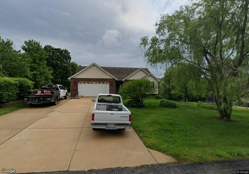
This home is located at 313 Daniels Estates Dr, Union, MO 63084 and is currently estimated at $304,172, approximately $218 per square foot. 313 Daniels Estates Dr is a home located in Franklin County with nearby schools including Washington High School, Immaculate Conception School, and St. Gertrude Catholic School.
Ownership History
Date
Name
Owned For
Owner Type
Purchase Details
Closed on
Apr 2, 2024
Sold by
Lawson Lauren
Bought by
Lawson Austin and Lawson Lauren
Current Estimated Value
Purchase Details
Closed on
Jul 25, 2013
Sold by
Giurca Alin and Giurca Didina
Bought by
Peirick Lauren
Home Financials for this Owner
Home Financials are based on the most recent Mortgage that was taken out on this home.
Original Mortgage
$173,469
Interest Rate
3.93%
Mortgage Type
New Conventional
Create a Home Valuation Report for This Property
The Home Valuation Report is an in-depth analysis detailing your home's value as well as a comparison with similar homes in the area
Purchase History
| Date | Buyer | Sale Price | Title Company |
|---|---|---|---|
| Lawson Austin | -- | None Listed On Document | |
| Lawson Austin | -- | None Listed On Document | |
| Peirick Lauren | $170,000 | -- |
Source: Public Records
Mortgage History
| Date | Status | Borrower | Loan Amount |
|---|---|---|---|
| Previous Owner | Peirick Lauren | $173,469 |
Source: Public Records
Tax History
| Year | Tax Paid | Tax Assessment Tax Assessment Total Assessment is a certain percentage of the fair market value that is determined by local assessors to be the total taxable value of land and additions on the property. | Land | Improvement |
|---|---|---|---|---|
| 2025 | $1,981 | $36,530 | $0 | $0 |
| 2024 | $1,981 | $32,070 | $0 | $0 |
| 2023 | $1,777 | $32,070 | $0 | $0 |
| 2022 | $1,825 | $32,861 | $0 | $0 |
| 2021 | $1,825 | $32,861 | $0 | $0 |
| 2020 | $1,705 | $29,538 | $0 | $0 |
| 2019 | $1,699 | $29,538 | $0 | $0 |
| 2018 | $1,560 | $28,559 | $0 | $0 |
| 2017 | $1,563 | $28,559 | $0 | $0 |
| 2016 | $1,452 | $26,389 | $0 | $0 |
| 2015 | $1,452 | $26,389 | $0 | $0 |
| 2014 | $1,345 | $24,449 | $0 | $0 |
Source: Public Records
Map
Nearby Homes
- 1552 Clearview Rd
- 3732 Highway A
- 143 Willow Creek Rd
- 406 Emma Ln
- 5950 Highway V
- 14 Oak Ridge Dr
- 5728 Country Club Rd
- 695 Clearview Heights Dr
- 541 Rock Creek Dr
- 323 Park Hill Dr
- 1227 N Washington Ave
- 227 Cedar Berry Dr
- 000 Mo-V
- 6414 Country Club Rd
- 0 Highway V
- 435 Water Tower Dr
- 1016 Westmoreland Blvd
- 1008 N Washington Ave
- 371 Peaceful Hollow Dr
- 23 Forest Ln
- 317 Daniels Estates Dr
- 306 Daniels Estates Dr
- 306 Daniels Estates Dr
- 311 Daniels Estates Dr
- 323 Daniels Estates Dr
- 345 Daniels Estates Dr
- 332 Daniels Estates Dr
- 346 Daniels Estates Dr
- 355 Daniels Estates Dr
- 307 Daniels Estates Dr
- 308 Daniels Estates Dr
- 375 Daniels Estates Dr
- 331 Daniels Estates Dr
- 356 Daniels Estates Dr
- 322 Daniels Estates Dr
- 370 Daniels Estates Dr
- 376 Daniels Estates Dr
- 340 Daniels Estates Dr
- 1459 Clearview Rd
- 391 Daniels Estates Dr
Your Personal Tour Guide
Ask me questions while you tour the home.