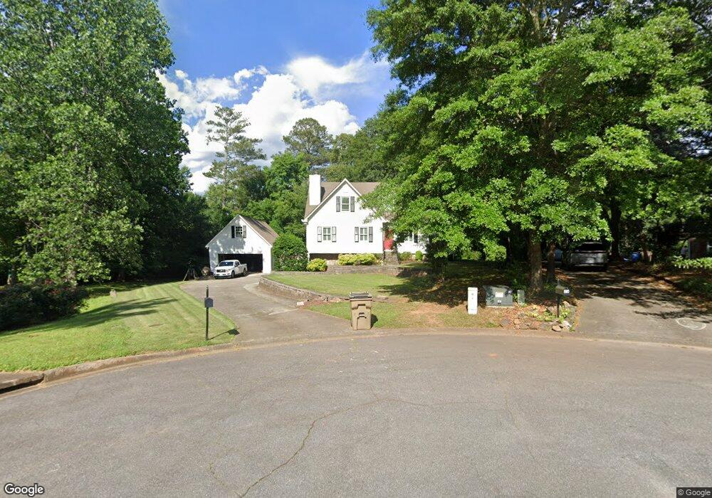
313 Devon Ct Woodstock, GA 30188
Union Hill NeighborhoodEstimated Value: $405,000 - $433,691
4
Beds
3
Baths
2,668
Sq Ft
$157/Sq Ft
Est. Value
About This Home
This home is located at 313 Devon Ct, Woodstock, GA 30188 and is currently estimated at $419,346, approximately $157 per square foot. 313 Devon Ct is a home located in Cherokee County with nearby schools including Arnold Mill Elementary School, Mill Creek Middle School, and River Ridge High School.
Ownership History
Date
Name
Owned For
Owner Type
Purchase Details
Closed on
Jun 30, 2003
Sold by
Foster David A
Bought by
Lester Robert T
Current Estimated Value
Home Financials for this Owner
Home Financials are based on the most recent Mortgage that was taken out on this home.
Original Mortgage
$120,000
Interest Rate
4.79%
Purchase Details
Closed on
May 12, 1998
Sold by
Staples Jeffrey W and Staples Kathy A
Bought by
Foster David A
Purchase Details
Closed on
May 30, 1995
Sold by
Bryan Scott A Judy L
Bought by
Staples Jeffrey W Kathy A
Create a Home Valuation Report for This Property
The Home Valuation Report is an in-depth analysis detailing your home's value as well as a comparison with similar homes in the area
Home Values in the Area
Average Home Value in this Area
Purchase History
| Date | Buyer | Sale Price | Title Company |
|---|---|---|---|
| Lester Robert T | $169,000 | -- | |
| Foster David A | $129,900 | -- | |
| Staples Jeffrey W Kathy A | $115,000 | -- |
Source: Public Records
Mortgage History
| Date | Status | Borrower | Loan Amount |
|---|---|---|---|
| Closed | Lester Robert T | $120,000 | |
| Closed | Foster David A | -- |
Source: Public Records
Tax History Compared to Growth
Tax History
| Year | Tax Paid | Tax Assessment Tax Assessment Total Assessment is a certain percentage of the fair market value that is determined by local assessors to be the total taxable value of land and additions on the property. | Land | Improvement |
|---|---|---|---|---|
| 2024 | $775 | $147,496 | $32,000 | $115,496 |
| 2023 | $670 | $158,416 | $30,000 | $128,416 |
| 2022 | $788 | $139,536 | $28,400 | $111,136 |
| 2021 | $748 | $110,336 | $18,000 | $92,336 |
| 2020 | $708 | $99,016 | $15,200 | $83,816 |
| 2019 | $679 | $91,240 | $15,200 | $76,040 |
| 2018 | $662 | $83,520 | $15,200 | $68,320 |
| 2017 | $672 | $204,700 | $15,200 | $66,680 |
| 2016 | $655 | $181,000 | $12,000 | $60,400 |
| 2015 | $1,979 | $174,000 | $12,000 | $57,600 |
| 2014 | $1,889 | $166,100 | $13,200 | $53,240 |
Source: Public Records
Map
Nearby Homes
- 806 Westover Ct
- 2209 River Woods Way
- 711 Woodbridge Dr
- 112 Sunnybrook Ln
- 104 River Creek Dr
- 499 Bishop Ln
- 414 Spring View Dr
- 436 Silver Brook Dr
- 454 Silver Brook Dr
- 217 Sweetbriar Club Dr
- 624 Arnold Mill Rd
- 0 O Hara Dr Unit 8443973
- 0 O Hara Dr Unit 6064833
- 632 Arnold Mill Rd
- 321 Burdock Trace
- 636 Arnold Mill Rd
- 236 Persimmon Dr
- 120 Sweetbriar Farm Rd
- 123 Old Reece Ln
- 311 Devon Ct
- 220 Lexington Dr
- 314 Devon Ct
- 218 Lexington Dr
- 312 Devon Ct Unit IV
- 216 Lexington Dr
- 309 Devon Ct Unit IV
- 224 Lexington Dr
- 0 Lexington Dr Unit 7551091
- 0 Lexington Dr Unit 7550956
- 00 Lexington Dr
- 0 Lexington Dr Unit 5612515
- 0 Lexington Dr Unit 7604611
- 0 Lexington Dr Unit 8846462
- 0 Lexington Dr Unit 8033574
- 0 Lexington Dr Unit 7510336
- 0 Lexington Dr Unit 8957812
- 0 Lexington Dr Unit 8981358
- 0 Lexington Dr Unit 7117276
- 0 Lexington Dr Unit 7139268